


The Ouachita National Forest turned 110 years old yesterday. For the uninitiated, Ouachita is pronounced Wash-it-aw.

Forest Service Management

Over these years, the 1.8 million acres Ouachita National Forest has managed the forest for a number of multiple uses, including timber, wilderness, recreation, minerals, water and wildlife in Arkansas and Oklahoma.
A proclamation by President Roosevelt on December 18, 1907, created the Arkansas National Forest on reserved public domain lands south of the Arkansas River. The first supervisor’s office for the forest was established in January 1908 in Fort Smith, Ark. Seven months later it moved to Mena, Ark.
Then in 1910, the headquarters moved to Womble, Ark., then to its present home in Hot Springs, Ark.
On April 29, 1926, President Calvin Coolidge renamed the forest Ouachita for the mountains which it embraces and for the principal river which drains it. President Hoover extended the Ouachita National Forest into Oklahoma in 1930 with the purchase of 50,000 acres of cutover and burned land.
Today, the Ouachita National Forest continues supporting the local communities with 1,550 jobs annually and approximately $64.5 million dollars of annual labor income for wage earners and business sole proprietors. More information about the economics of US Forest Service land can be found here.
(from US Forest Service – Ouachita NF)
Geology of the Ouachitas
The Ouachita Mountains are folded ridges and valleys composed of Paleozoic rocks. They are one of the six natural divisions of Arkansas. Where the Rocky Mountains and Appalachian Mountains run north to south, the Ouachitas are unusual as they run east to west. The dominant rocks underlying the mountains are alternating layers of sandstone and shale.
Three of the most distinctive regions of the Ouachita Mountains include the Fourche Mountains which run across the Northern part of the range from the Oklahoma border near Waldron, through Conway and Little Rock to Searcy in White County. Yes, those big hills through Cammack Village, the Heights and Fort Roots are part of the Ouachita Range. Just to the south are the Central Ouachita Mountains That run east to west from the Oklahoma border to Hot Springs and beyond. The Athens Plateau is the southernmost part of the Ouachitas and is often considered the foothills of the Ouachitas.
(from Encyclopedia of Arkansas)
The Playground
The Ouachitas have long filled the needs of human populations. The name, Ouachita, comes from the French spelling of the Caddo word wishita, meaning “good hunting grounds.” Recreational opportunities have also been a staple of the Ouachitas. Native Americans came to Hot Springs for the healing powers of the waters. In 1832 Congress passed an act to reserve the hot springs and their environs (2,529.1 acres), guaranteeing that “four sections of land including said [hot] springs, reserved for the future disposal of the United States, shall not be entered, located, or appropriated, for any other purpose whatsoever.” On April 20, 1832, President Andrew Jackson signed the act, exempting the area from settlement.¹ This was known as Hot Springs Preserve and predated the first National Park, Yosemite, by 40 years making it the oldest, but not first National Park.
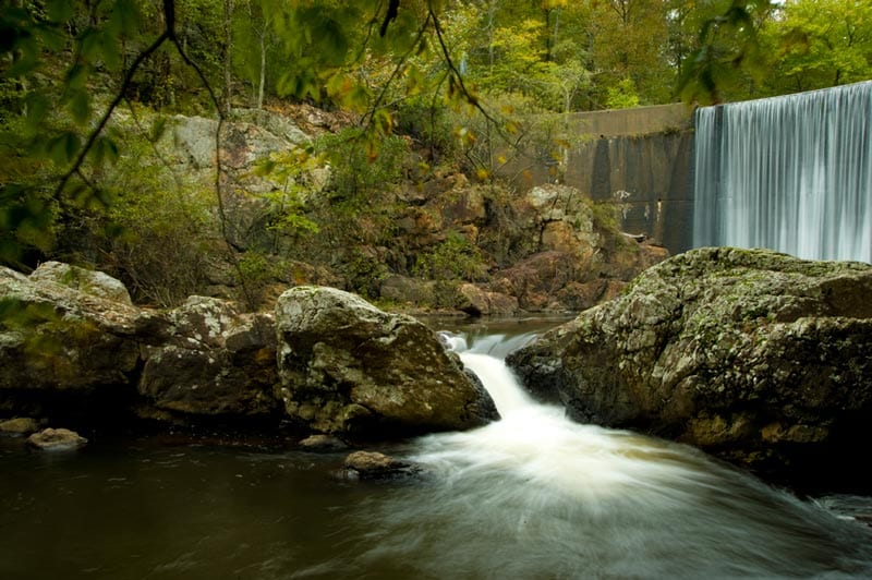
The Ouachita Mountains are now home to eight Arkansas State Parks numerous lakes and wild, scenic rivers. Fishing and hunting continue to be enjoyed in the area. The lakes are some of the cleanest in the country providing opportunities to waterski and boat. The rivers provide everything from easy downstream floats to Class V rapids for the adventurous. Visitors can travel through the area via the 223-mile long Ouachita National Recreation Trail from Oklahoma to Little Rock or hundreds of miles of other hiking trails. Mountain biking has been a part of the mountains for more than 30 years and the area hosts three International Mountain Bicycling Association Epic Trails. Camping is available throughout the region on mountain tops and lakeside or riverside.
¹(from Encyclopedia of Arkansas)
Visit the Ouachitas
Do yourself a favor, visit the Ouachita Mountains. Thanks to a visionary President for setting aside this fantastic mixed-use area for Arkansans and our visitors. Feel free to join our Facebook group page to get some insider ideas on where and when to go.
