

New mapping technology makes it easier to plan hikes, backpacking trips, and backcountry adventures
As cooler temperatures and changing leaves will soon invite hikers and backpackers back to Arkansas’s trails, the U.S. Geological Survey (USGS) is offering a new tool for exploring the Natural State and beyond. The agency recently released a series of innovative 25K Recreational Topo maps designed specifically for outdoor recreation.
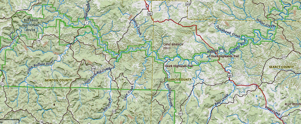
For anyone heading out on fall adventures—whether it’s a day hike at Mount Nebo, a weekend backpacking trip in the Ouachita Mountains, or a paddling expedition along the Buffalo National River—these new topographic maps are a powerful planning resource. Created with outdoor users in mind, these maps include intuitive features such as clearly marked trailheads, campsites, picnic areas, and points of interest. Their detailed terrain visuals allow explorers to select routes that match their skill level, time constraints, and hiking goals.
“Whether you are a seasoned explorer or a casual hiker, the new USGS maps are a game-changer for recreational activities. If you’re looking for the shortest path to a summit or a leisurely trail along a river, these maps have you covered,” said Ariel Doumbouya, a USGS geographer and product lead.
The maps use a 1:25,000 scale—meaning one inch on the map represents just under half a mile on the ground—providing a more precise view than traditional USGS quads. This scale matches maps used in Alaska, Canada, and by the U.S. military, creating consistency across agencies and improving the user experience for those who travel or adventure internationally.
Designed using modern mapping technology, these maps offer precise coordinates and topographic detail that can be integrated with GPS devices and mobile navigation apps. They are available through the free USGS topoBuilder tool, which allows users to customize and download OnDemand digital maps featuring the most up-to-date data from The National Map. This makes it easier than ever to explore the country’s protected landscapes, from national forests to wild and scenic rivers.
In Arkansas, this means you can confidently map out your hike through the Ozark Highlands Trail, scout campsites in the Ouachita National Forest, or locate access points to the state’s scenic waterways.
“The 25K Recreational Topos mark a milestone in supporting recreation and reflect USGS’s commitment to innovative cartography that serves and supports the American public,” said Doumbouya. “They empower adventurers to explore the outdoors with greater confidence, insights, and awareness of their surroundings.”
So whether you’re chasing waterfalls, bagging peaks, or planning a weekend backpacking loop through the backcountry, the new 25K Recreational Topo maps are a valuable companion. Download your custom map, pack your gear, and head for the trail.

To explore the new USGS 25K Recreational Topos and start building your own adventure map, visit the USGS topoBuilder application.
This article was originally published on ArkansasOutside.com, your trusted source for outdoor news and updates in The Natural State. Unless otherwise credited, all photos included in this piece are the property of Arkansas Outside, LLC. We take pride in sharing the beauty and adventures of Arkansas through our lens—thank you for supporting our work!