

Estimated reading time: 7 minutes
Pulaski County has released a new countywide vision for trails and active transportation, outlining how existing paths, projects under construction, and future connections could eventually become a more complete network across Central Arkansas.
The new Pulaski County Trails Master Plan builds on nearly two decades of trail development since the county adopted its previous pedestrian and bicycle trails plan in 2006. The updated plan brings together projects from Pulaski County, municipalities, regional planning agencies, and other partners into a larger framework designed to improve connections between communities.
An interactive version of the plan is now available online, allowing residents to explore existing and proposed routes throughout the county.
Building on Two Decades of Trail Development
Central Arkansas’ trail network looks considerably different than it did when Pulaski County completed its original plan in 2006.
Since then, major projects including the Big Dam Bridge and Two Rivers Bridge have opened, while the Arkansas River Trail has developed into the backbone of the region’s bicycle and pedestrian network. Work has also expanded beyond the Arkansas River corridor through projects including the Southwest Trail and Southeast Trail.
The updated master plan looks at how those major routes can work together instead of functioning as individual projects.
Crafton Tull, which is developing the plan for Pulaski County, previously identified the need for several regional trail “spines” connecting communities with the Arkansas River Trail, Southwest Trail, Southeast Trail, and neighboring counties.
The planning work has also examined potential connections northeast toward Sherwood and Jacksonville, northwest toward Faulkner County, and west between Pinnacle Mountain State Park and the Southwest Trail.
Connecting the Big Regional Trails
One of the most important elements of the new plan is connectivity.
Central Arkansas already has several significant trail projects either completed, underway, or planned. The challenge is connecting them into a system that allows people to travel between neighborhoods, parks, communities, employment centers, and recreation destinations without encountering major gaps.
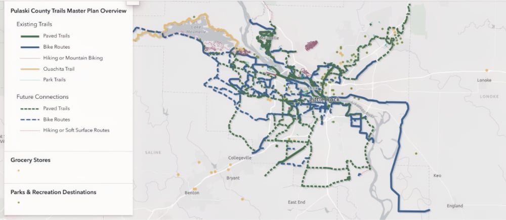
The Arkansas River Trail provides the core of that network through Little Rock and North Little Rock. (The unfinished portions are the responsibility of the cities to complete and/or improve.)
From there, the Southwest Trail is being developed toward Saline County and eventually Hot Springs. The Southeast Trail is planned to extend from the Arkansas River Trail toward eastern and southeastern Pulaski County, including connections toward the Little Rock airport and ultimately the Jefferson County direction.
To the north and northeast, regional plans envision connections from North Little Rock toward Sherwood and Jacksonville. Northwest connections could eventually extend through Maumelle and toward Faulkner County.
Together, these routes could create a network extending well beyond the urban core of Little Rock and North Little Rock.
Filling the Gaps Between Existing Plans
The Pulaski County Trails Master Plan does not exist in isolation.
Metroplan’s Central Arkansas Regional Greenways Plan, adopted in 2023, established a framework for a regional system extending throughout Central Arkansas. That plan identified several major corridors, including routes toward Saline, Lonoke and Faulkner counties.
The Pulaski County plan provides another layer by identifying connections within the county that can tie those regional corridors to communities and existing local trail systems.
The plan also overlaps with the Maumelle Pinnacles Recreation Master Plan, which focuses on the large recreation and conservation corridor extending west from the Big Dam Bridge and Two Rivers Park past Pinnacle Mountain State Park, Rattlesnake Ridge, Blue Mountain, and Lake Maumelle.
The result is a network that could connect some of Central Arkansas’ most important outdoor recreation destinations while also providing transportation connections for people traveling by bicycle or on foot.
More Than Recreation
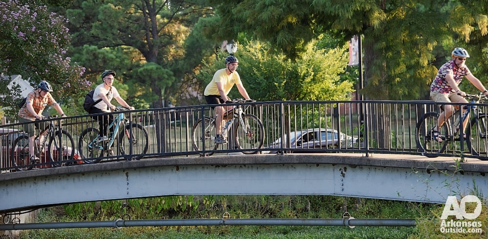
Although trails are frequently associated with recreation, the Pulaski County plan also treats them as part of the transportation system.
Separated multi-use paths, bicycle facilities, sidewalks, and other connections can provide routes between homes, schools, parks, businesses, transit stops, and employment centers.
That distinction becomes increasingly important as individual trail projects begin connecting with one another.
A trail used for a Saturday morning bike ride can also serve someone riding to work on Monday. A neighborhood path can provide access to a park while also connecting residents with a larger regional greenway.
The county’s earlier planning work examined walking distances around public and private schools and looked at how existing and proposed facilities could improve access. That analysis reinforced the need for regional routes that serve as the backbone of a larger network.
A Plan, Not a Construction Schedule
The routes shown in the master plan should not be confused with funded construction projects.
A master plan establishes a long-term vision and helps governments identify priorities. Individual projects still require additional planning, engineering, right-of-way, environmental review, funding, and, in many cases, coordination among multiple jurisdictions.
Some routes could take years to develop, while others may change as engineering and planning work moves forward.
Having those routes identified, however, can be important when transportation projects are designed, roads are rebuilt, development occurs, or state and federal grant opportunities become available.
The plan can also help Pulaski County and its municipalities avoid creating isolated pieces of infrastructure by showing how individual projects fit into a larger system.

Public Review Continues
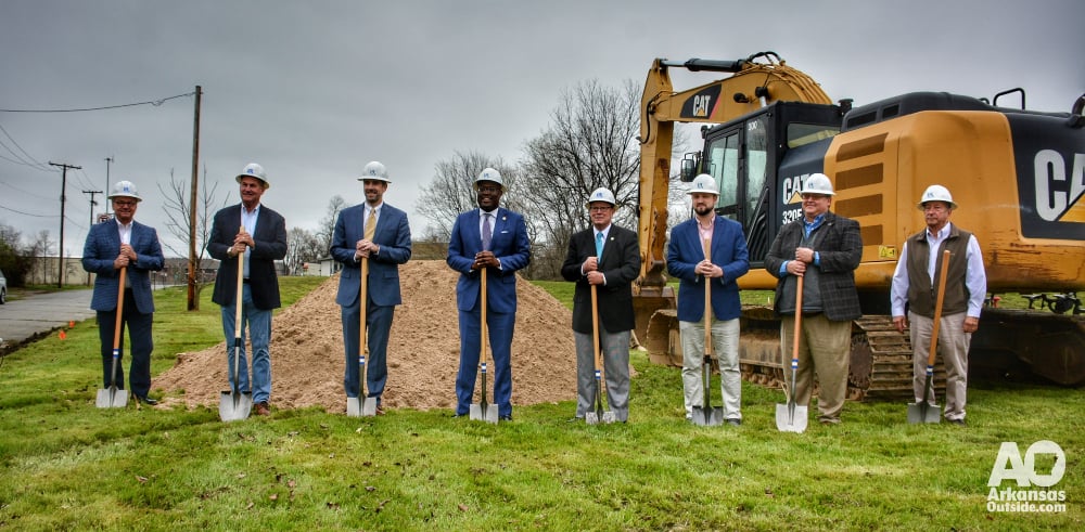
Pulaski County and Crafton Tull unveiled the updated trail network during a public event at Two Rivers Park on September 12. Residents were able to review maps, talk with members of the project team, and provide comments about proposed connections.
The release of the interactive online plan expands that process beyond the event.
Residents can now explore the proposed network, compare it with existing trails, and consider where additional connections may be needed.
The project team is also scheduled to share information about the plan during the Big Dam Bridge 100 on September 26, providing another opportunity for trail users and cyclists to learn about the network.
From Individual Trails to a Regional Network
Central Arkansas has spent decades building individual pieces of bicycle and pedestrian infrastructure.
The Big Dam Bridge connected the two sides of the Arkansas River. Two Rivers Bridge extended the network west. The Arkansas River Trail connected parks, neighborhoods, downtown areas, and recreation destinations. New projects such as the Southwest and Southeast trails are beginning to push that network farther into the region.
The Pulaski County Trails Master Plan looks at what comes next: connecting those pieces.
If implemented over time, the network shown in the plan could make it possible for more residents to reach parks, communities, schools, workplaces, and regional trails by bicycle or on foot while expanding the outdoor recreation network available throughout Central Arkansas.
The plan is still a vision, and many of its proposed routes remain years away from construction. But putting those connections on a map establishes a framework for the next generation of trail development in Pulaski County.
This article was originally published on ArkansasOutside.com, your trusted source for outdoor news and updates in The Natural State. Unless otherwise credited, all photos included in this piece are the property of Arkansas Outside, LLC. We take pride in sharing the beauty and adventures of Arkansas through our lens, thank you for supporting our work!