

Below are updates from the National Park Service at Buffalo National River
River Closure Lifted as Damage Assessment Continues (December 30, 2015, 11:22)
The Buffalo River has receded sufficiently for canoe and kayak use to resume today. Although a comprehensive damage assessment is still ongoing, all campgrounds with the exception of Tyler Bend and parts of Buffalo Point are open. However, all are still soaked and most have varying amounts of mud, sand, or silt covering former grass surfaces. Roads throughout the park are open and grading operations under way, but visitors will find conditions variable, especially at water crossings and low-lying areas, and should exercise caution. Most toilet facilities are closed until vaults can be pumped and walls and floors cleaned.
The trail at Lost Valley is open although some surfaces remain uneven. The river crossings in the Erbie area, in very bad condition prior to the flood, are impassible.
This flood event ranks among the top five in recorded flood history of the Buffalo River. Damage in the upper district (roughly Boxley to Mt. Hersey) was light with little deposit of debris. Moving downriver impacts were greater as the accompanying photo showing picnic tables in trees at the Tyler Bend Campground. Furloughed park maintenance staff will be brought back to work on the clean up beginning January 10th.
The good news is that the many waterfalls throughout the park are in full force while the runoff continues!


Latest Update: Buffalo River Closure Remains in Effect (December 29, 2015, 9:40 am)
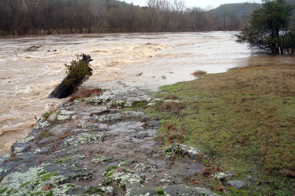
River traffic on the Buffalo River remains closed due to unsafe flood conditions. River gauges are still showing readings at flood stage for most of the upper river and all points downstream.
An initial assessment of the popular Lost Valley Trail showed minor damage to the access road along Clark Creek and some localized wash-outs on the trail itself. The trail is open but visitors can expect wet feet at the creek crossing which was ankle-deep this morning. Care should be taken on all trails as slippery conditions are likely to be encountered, including morning ice and wet leaves.


River Closure Due to Flooding Announced (December 28, 2015, 9:34 am)
Shortly after 7 am this morning the Superintendent closed Buffalo National River to river traffic due to flooding caused by the extended heavy rains over the weekend. At the time of this release river levels were continuing to rise in much of the park. The river crested in the Ponca area between 1 and 2 am Monday which translates to an anticipated crest in the Tyler Bend area at about noon today. Predicted crest height may be as much as 47-50 feet.
First light found the entire Ponca put-in underwater. At Tyler Bend the entire campground was underwater which is currently reaching the base of the hill below the visitor center. Park staff are in the process of documenting impacts. Initial assessments show that flood water has inundated many of the campgrounds throughout the park.
As of 9 am the Buffalo River was receding as far down at Carver. USGS gauging stations at Hwy 14 and Hwy 65 show the rise is slowing. By way of comparison USGS gauging stations showed approximately half the flow rate for the Buffalo at Hwy 14 as the Arkansas River has at Fort Smith, and the Arkansas river has risen about 15 feet and is in its floodplain.
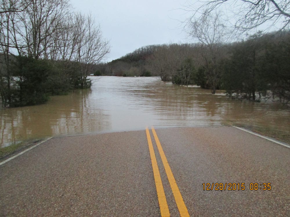
Lost Valley Road is open but Clark Creek is blocking access to the hiking trail. Visitors should be aware that while the closure does not pertain to roads and trails there are obvious safety concerns and visitation at this time is not advised. All creek crossings should be treated with caution.


One Response
Hi, was wnderng if you have info on the a April 1979 flood on the Buffalo Rver.
I was there on the opposite side of the river from the scout camp, high and dry
in a small barn. Had to leave the next day and found out the river was closed by
a rental guy who was allowed to be there due to lost canoe from a client. He found
it a half mile or so down and so each of us (4 guys with 2 canoes) got to solo his empty
canoe and one of our very loaded canoe. It was all good since 3 of us were quite
experienced. When We landed at (????) there was a Ranger there. He was not that
happy, but the rental guy, who He knew, told him We did fine and had helped him.
Lucky for us or We would have been fined. Not sure HoW We could have known the river was clsed, way
before Skullular phones………It was a FUN ride I’ll tell you.
The poor people across the river must have been miserable. The rain had stopp3d the afternoon before so We hiked up the cliff behind the barn…..A 4 wheel drive drove down to the Scout camp and there were 4 to 6 people running for it, falling down, running again…..WE WERE THE LUCKIEST….Dry, had hot food, PLENTY of beer(gooid ballast the next day), and plenty of laughter.
Anyway, i am curious if you can give Me any info on this flood—–Thanks—-Texas Bob