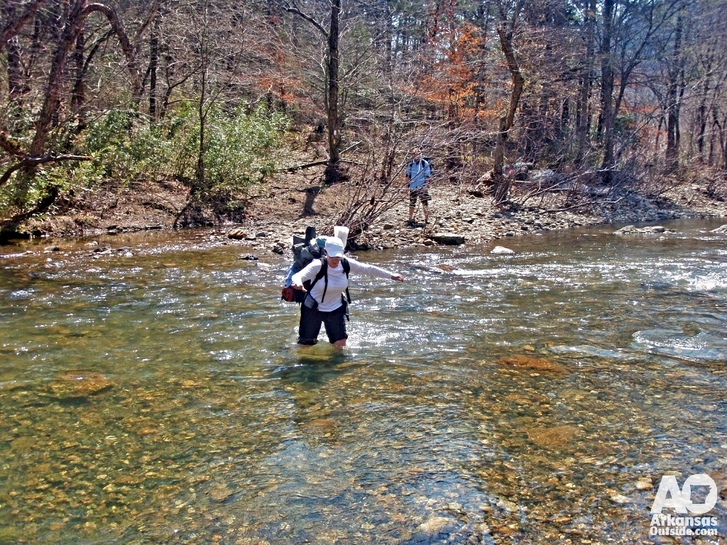
We lost count of stream crossings somewhere around 15 to 20 before noon on the first day. The sandals got a lot of use. It was a great three-day, two-night trip, and one I had wanted to take for years.
(This article is from March of 2010. In June of 2010, a devastating flood occurred in the area destroying the camping area and killing 20 people)
Why the Eagle Rock Loop Belongs on Your Backpacking List
The Eagle Rock Loop in the Ouachita Mountains is one of the few true overnight loop trails in Arkansas. At roughly 27 miles, it makes for a satisfying long weekend without requiring a car shuttle. The loop is built from three connecting trails: the Little Missouri Trail, which follows the Little Missouri River through some genuinely wild canyon country; the Viles Branch Trail, a wider equestrian route along a creek of the same name; and the Athens-Big Fork Trail, which carries you north over six forested ridges.
The trailhead sits just north of the Albert Pike Recreation Area, a U.S. Forest Service site west of Glenwood in western Arkansas. Despite the remoteness you feel out there, the area is only about two hours from Little Rock. That combination — accessible but wild — is exactly what makes the Eagle Rock Loop worth planning a trip around.
Planning the Trip: Watching the Weather
My wife Lisa, our son David, and I had been talking about a family backpacking trip for a while. The Eagle Rock Loop gave us a good reason to commit to a date. We originally planned to start on a Sunday, but as the weekend approached the forecast looked rough. Snow and rain were in the picture for Saturday, with lingering showers on Sunday. I pushed our start date back one day, and this time that was the right call.
The weather for our three days on trail landed in the 60s during the day and the 40s at night. For backpacking, that is about as good as it gets. Cool enough that you are never overheating under a loaded pack, warm enough that evenings at camp are enjoyable rather than something to survive.
Practical note: Spring is prime time for the Eagle Rock Loop, but spring weather in the Ouachita’s can shift quickly. Build flexibility into your schedule and watch the forecast closely in the days before you go.
Day One: Trailhead to Camp at Saline Creek
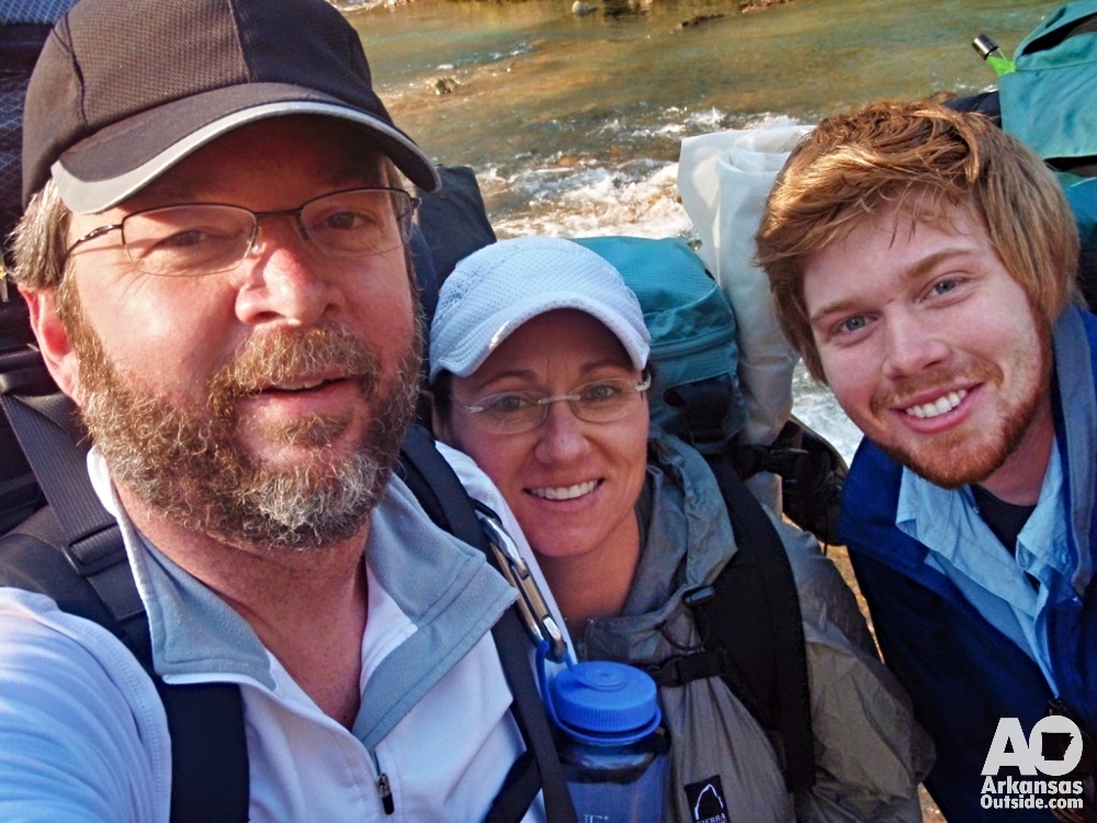
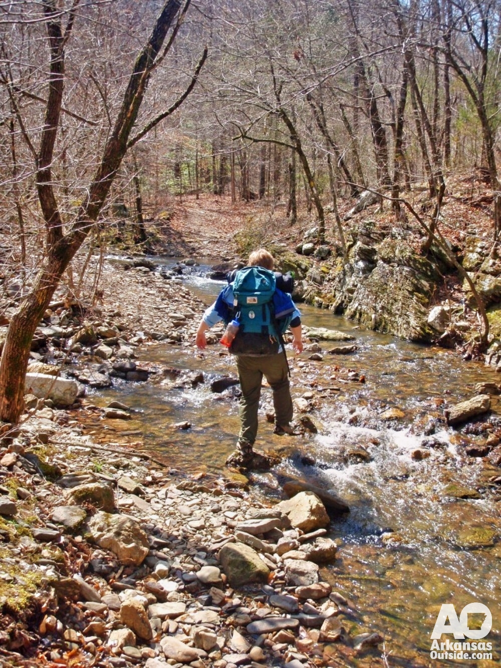
We arrived at the trailhead ready to hike, and within about 30 seconds we were taking our boots off. The trail begins with a low-water bridge crossing on the Little Missouri River, known locally as the Little Mo. The water was about eight inches deep. We were not going to start a three-day trip with wet feet, so the sandals came out before we had even shouldered our packs all the way up.
Before we got moving I had a moment of genuine frustration with myself. I had brought the good camera but left a fully charged battery sitting on the charger at home. Bonehead move. Fortunately we also had a waterproof point-and-shoot along, so the trip got documented. The image quality was not what I had hoped, but the photos exist, which is what matters. I stashed the dead-battery camera under the car seat and we headed out.
The Route: Albert Pike to Winding Stairs
Most trip reports and trail descriptions run the loop clockwise, so we did the same. From the trailhead, the Little Missouri Trail follows the river for about half a mile through the Albert Pike camping area, where a fair amount of new construction was underway when we visited. New RV sites were going in along the river. Once through the campground the trail climbs hard, and after more than 30 minutes of hiking we could still look back and see the car in the parking area. That was motivation enough to pick up the pace.
The trail settles into a ridge-and-creek rhythm after that, following the high ground for stretches before dropping down to cross small drainages. We came across a group of hikers from Illinois who seemed to be figuring things out as they went. They stayed close to us through a few crossings, but when they watched us wade through one of the deeper fords they decided to look for a drier option. That was the last we saw of them.
Winding Stairs: The Defining Stop of Day One
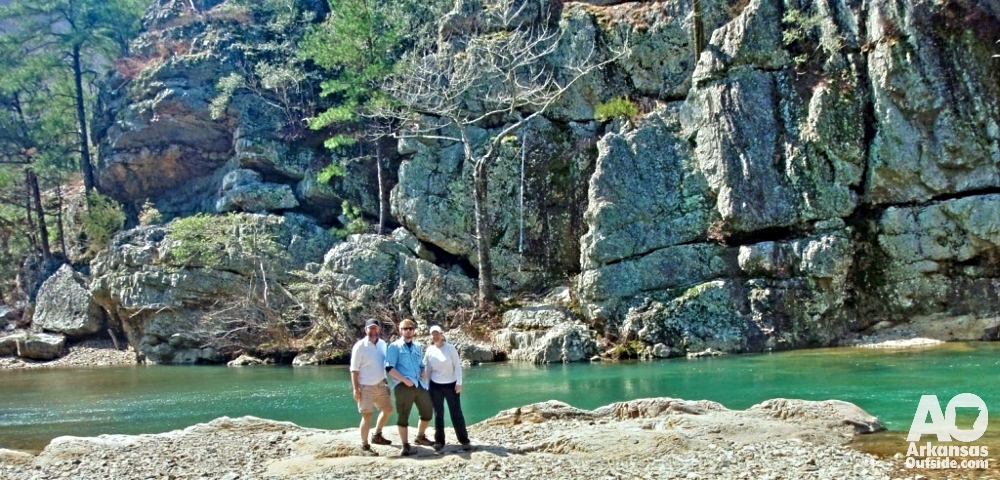
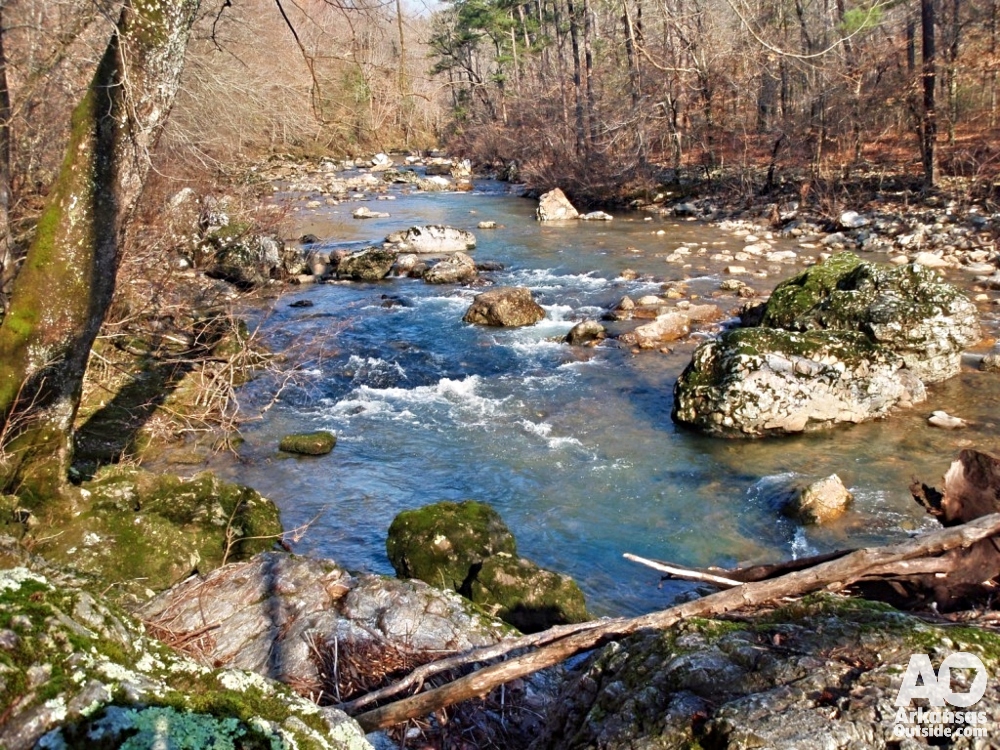
After just under five miles and a handful more stream crossings, we reached the Winding Stairs section. If you hike the Eagle Rock Loop and skip Winding Stairs, you have made a significant error in judgment. The Little Missouri has carved through and around a series of unusual rock formations here, and the result is one of the more striking places I have encountered on a trail in Arkansas.
We stopped for lunch on a flat rock beside the river. Peanut butter and honey on flatbread. Simple and exactly right. We wandered around for a good while looking at the rock shapes, the way the water moved through the channels, the scale of the stone faces along the bank. Winding Stairs is a place that earns the word spectacular without any exaggeration, and it is reason enough on its own to hike this trail.
Into the Athens-Big Fork Trail: Climbing to Eagle Rock Vista
After lunch we had one final crossing of the Little Mo for the day before turning onto the Viles Branch Equestrian Trail. This section runs noticeably wider than the Little Missouri Trail, as a horse trail should. We followed it along Viles Branch Creek for about 3.5 miles, crossing the creek several times, before reaching the junction with the Athens-Big Fork Trail.
The Athens-Big Fork heads north across six ridges. With afternoon coming on, we decided to cross the first one and camp at Saline Creek on the other side. The climb to the top is 700 to 800 feet. We dropped our packs at the ridge for a few minutes and walked out to Eagle Rock Vista, the namesake of the loop. The views are long and the Ouachita ridgeline opens up in a way that puts the whole landscape in context. Hunger may have kept us from lingering as long as we should have. We were ready to get down to camp.
We also had a brief, only-in-Arkansas moment on the Viles Branch section. We met three young women from Ouachita Baptist University who were out for a day hike. David was more than willing to help them across a river crossing and offered his towel for drying their feet. While we sorted out the logistics of the ford, we figured out that a couple of them knew a guy he had gone to high school with, and one of them knew the daughter of one of Lisa’s coworkers. Two degrees of separation. It is a real phenomenon here.
Camp at Saline Creek: Mac and Cheese and a Good Fire
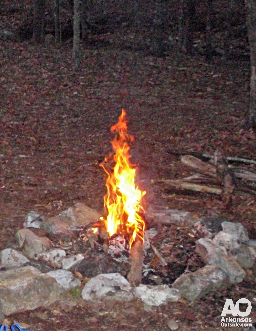
We found a campsite near Saline Creek in about 15 to 20 minutes after dropping off the ridge. Two sites sat close to the water and we took the one farthest from the trail. There was room for both tents without any crowding.
I pumped water from the creek with the filter, we got a fire started, and Lisa made dinner. Mac and cheese with summer sausage. Some traditions are non-negotiable on backpacking trips, and that combination is one of them. Rice Krispy Treats for dessert. We played cards for an hour, watched the fire for a while longer, and were in our sleeping bags by 9:30.

Five more ridge crossings, more stream fords, some equipment problems, and more friendly people were waiting for us in the morning. Read Part 2 as we come across wildlife, catch some great views, more water crossings, and a wardrobe malfunction.
Eagle Rock Loop Trail Basics
| Total distance | Approximately 27 miles (loop) |
| Duration | 3 days / 2 nights is the standard plan; strong hikers can do it in 2 |
| Location | Ouachita National Forest, west of Glenwood, Arkansas |
| Nearest town | Glenwood, AR — roughly 2 hours southwest of Little Rock |
| Trailhead | Just north of Albert Pike Recreation Area off Forest Road 73 |
| Stream crossings | Numerous — count on 15 or more, especially in spring. Sandals or water shoes are strongly recommended. |
| Water sources | The Little Missouri River and its tributaries provide reliable water. Filter all sources. |
| Camping | Dispersed camping is permitted throughout the Ouachita National Forest within Leave No Trace guidelines. |
| Best seasons | Spring and fall. Summer heat and ticks are both significant. Winter trips are possible but stream crossings become more serious. |
| Maps | Ozark Outdoor Supply in Little Rock has excellent printed maps for this and other Ouachita trails. |
This article was originally published on ArkansasOutside.com, your trusted source for outdoor news and updates in The Natural State. Unless otherwise credited, all photos included in this piece are the property of Arkansas Outside, LLC. We take pride in sharing the beauty and adventures of Arkansas through our lens—thank you for supporting our work!