

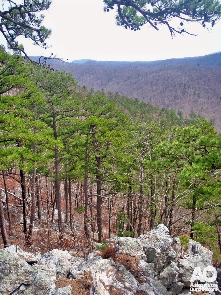
We slept well our first night on Saline Creek, which meant getting moving in the morning took a little longer than planned. It is actually easier to break camp fast when you did not sleep well. We had a good breakfast of oatmeal, shouldered our packs, and headed out around 10 a.m., about an hour behind our goal. We had five ridge crossings ahead of us before we would make camp again. It was time to get after them.
If you missed the first day on the trail, start with Part 1 of the Eagle Rock Loop trip report.
Day Two: Five Ridges, a Snake, and a Boot Crisis
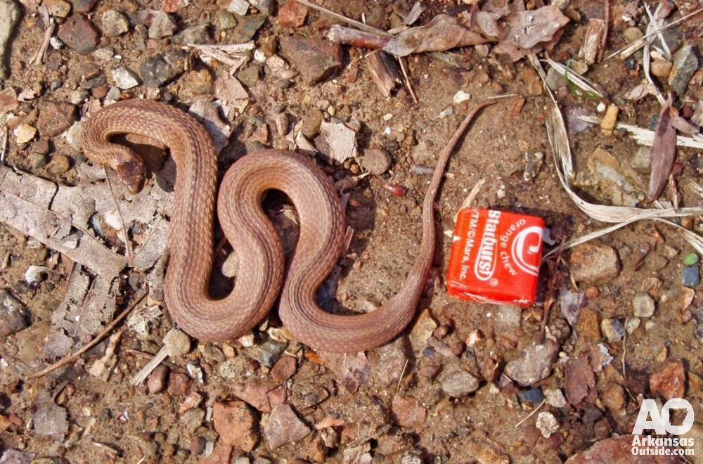
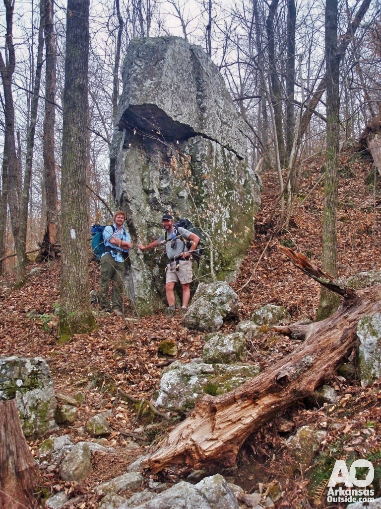
The first climb of the day went up to a saddleback next to Brush Heap Mountain. The approach followed a beautiful creek for about three-quarters of a mile before the trail turned uphill. I was leading and stepped right over a snake without noticing. Lisa and David both saw it and managed to get a photo. We took a quick breather at the top, then found the downhill a bit punishing on feet that were already starting to feel the miles. We were moving well, though, and pushed on.
We had realized the night before that we had not packed a lunch for the following day, which meant we wanted to cover as much ground as possible today and plan to hike out after breakfast on the third morning.

Navigation Note: The Turn at Brier Creek
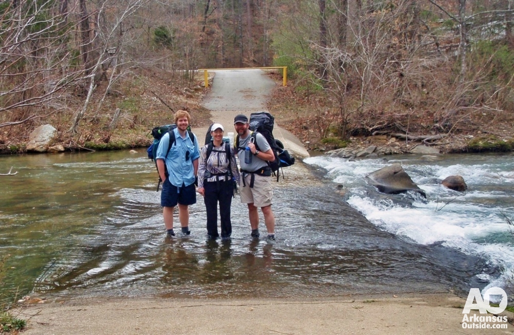
We passed the West Blaylock Trailhead at Forest Road 106, which put us 4.9 miles from the junction where we would turn east back onto the Little Missouri Trail. Almost immediately after the trailhead we had another boots-off stream crossing. By this point we had done enough of them that the routine felt natural.
The next ridge took us over the Leader Mountains and down a fast, steep descent to Brier Creek. One note worth passing along for anyone hiking north on the Athens-Big Fork Trail: at Brier Creek, the trail turns left, heading west. The blazes going right appear to follow an ATV trail. It is an easy place to go wrong if you are not paying attention to your map.
The Boot Repair: Duct Tape at Mile Farthest from the Car
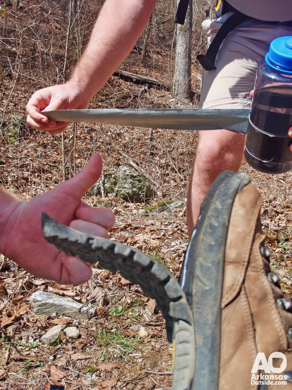
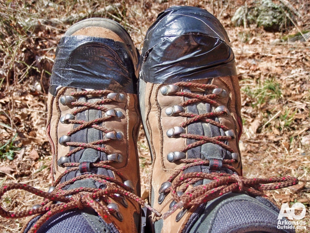
While we were hiking west along Brier Creek I heard an “uh-oh” behind me. I turned around to find that the sole had separated from the bottom of one of Lisa’s hiking boots. The other sole was clearly on its way off as well. Seven years is a fair life for a good pair of boots, but the timing was not ideal. By my calculation we were at the farthest point from the car on the entire loop.
The good news was the duct tape I had wrapped around my water bottle for years, just in case. We wrapped both of Lisa’s boots tight, crossed our fingers, and kept moving. The repair held better than either of us expected.
McKinley Mountain and the Long Creek Campground
We crossed the Brier Creek Mountains for our third ridge of the day, still making reasonable time despite the boot situation. The downhill off that ridge dropped us into a camping area near Long Creek that was clearly popular with ATV and four-wheel-drive vehicles. We stopped to eat a quick lunch and refill water bottles.
The trash in that area was hard to ignore. Cases of beer and soda, empty bottles everywhere. This is not a conservation lecture, just a straightforward observation: if you can carry full cans and bottles in, you can carry empty ones out. The vast majority of the Eagle Rock Loop is clean and well-maintained. Spots like that one stand out because everything else on this trail is beautiful, and the contrast is frustrating.
After crossing Long Creek we climbed straight up McKinley Mountain, which may have been the toughest single climb of the whole trip. Very exposed, with a lot of loose rock. David compared it to hiking in sand, which is about right. It was a slow, grinding pull on a full stomach. A fast descent brought us down to Straight Creek, and then one final climb near Hurricane Knob, which was genuinely windy. Then down for the last section of the ridge roller coaster.
Back on the Little Missouri River: Camp Near the Falls
Late in the afternoon we reached the Little Missouri River and turned east. We figured we would push on toward Little Missouri Falls, about 4.1 miles ahead, and camp somewhere near there. Lisa’s boots were still holding. The plan was to keep them intact as long as possible before she would need to switch to her Keens for the last stretch.
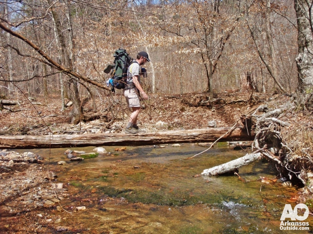
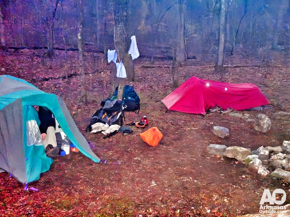
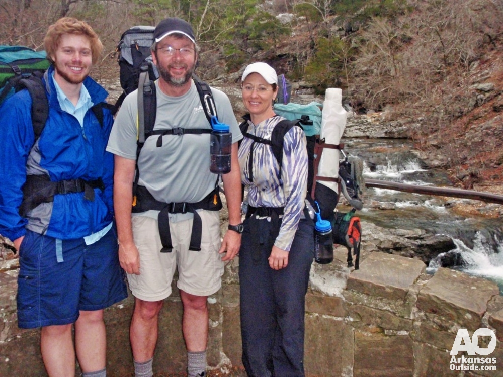
This section of the trail along the Little Mo is beautiful. We had plenty of daylight and just kept moving through several more river crossings. Eventually we came to a concrete bridge with a campground nearby. It was not as scenic as the Saline Creek site from the night before, but it was solid ground near water with room for both tents, and that was enough. We got camp set up, gathered firewood, and Lisa made dinner. Jambalaya with summer sausage. Russell Stover samplers for dessert. We turned in early with plans to get a faster start in the morning.
Morning at Camp: Listening to the Woods Wake Up
I woke before the others, bundled up, and went outside to sit in the dark. There was a campfire burning downstream and a headlamp moving around in the trees. I sat against a log and listened to the birds start up over the sound of the river on the rocks. It is one of my favorite things about backpacking: that window early in the morning before camp is moving when you can just sit and listen to the place. Eventually I heard David and Lisa stirring, got the food down from where I had hung it off the bridge, and started getting us organized for the last day.
Day Three: Little Missouri Falls and the Finish
A quick breakfast and we were on the trail. Within minutes we walked into the Little Missouri Falls Recreation Area. It is a genuinely beautiful spot and we were glad to have it almost entirely to ourselves that morning. The campfire I had watched from the dark belonged to another couple who had camped there on their very first backpacking trip. They had hiked out from the same parking area we used, gone the opposite direction, made it to the falls, and spent the night. In the morning they decided to hike back to the car without packs and drive around to retrieve their gear. They were good-natured about the whole thing and said they planned to try it again starting with shorter trips. A solid attitude.
We had about six miles back to the car. We moved quickly, enjoying the river views. Several more crossings brought us to what looked like the most difficult ford of the entire trip, well downstream where the Little Mo had spread out and deepened. We got across and kept moving.
The sun came back out in the final miles. With about a mile left to the car we collectively decided we were done taking off our boots. Lisa’s duct-taped soles were still attached, just barely, and we walked straight through every remaining crossing. It felt like exactly the right way to finish. We drove as far as Benton before stopping for a late lunch at Brown’s Buffet. A great trip that had been a long time coming.
Final Thoughts on the Eagle Rock Loop
This is a wonderful loop hike and one that every serious hiker in Arkansas should put on the list. A few things worth knowing before you go:
Come prepared for water crossings. There are a lot of them, and in spring the Little Missouri and its tributaries run high. Sandals or lightweight water shoes make the crossings much more manageable than repeatedly pulling off hiking boots. We lost count somewhere past 20 total fords over three days.
The ridge climbs on the Athens-Big Fork Trail are real climbs. McKinley Mountain in particular is steep and loose. Trekking poles are worth the weight on this trail. Take them if you have them.
There are good campsites throughout the loop, most of them near water. Leave No Trace principles apply, and the trail system as a whole is clean and well cared for. Use established sites rather than creating new ones.
And check your boots before you leave home.

Eagle Rock Loop Quick Reference
| Total distance | Approximately 27 miles (loop) |
| Duration | 3 days / 2 nights standard; strong hikers can complete in 2 |
| Location | Ouachita National Forest, west of Glenwood, Arkansas |
| Nearest town | Glenwood, AR — roughly 2 hours southwest of Little Rock |
| Trailhead | Just north of Albert Pike Recreation Area off Forest Road 73 |
| Stream crossings | 20 or more over the full loop, especially in spring. Sandals or water shoes are strongly recommended. |
| Key navigation note | At Brier Creek on the Athens-Big Fork Trail, turn left (west). Right-hand blazes follow an ATV route. |
| Water sources | The Little Missouri River and its tributaries throughout. Filter all sources. |
| Camping | Dispersed camping permitted in Ouachita National Forest. Use established sites near water. |
| Gear tip | Trekking poles help significantly on McKinley Mountain and the other steep descents. Carry duct tape. |
| Best seasons | Spring and fall. Summer heat and ticks are significant factors. Winter crossings become more serious. |
| Maps | Ozark Outdoor Supply in Little Rock has excellent printed maps for this and other Ouachita trails. |
| Completion patch | Email the Ouachita National Forest Ranger District after your hike and they will send you a trail completion patch. |
Read about day one of this trip in Part 1: Trailhead to Camp at Saline Creek.
This article was originally published on ArkansasOutside.com, your trusted source for outdoor news and updates in The Natural State. Unless otherwise credited, all photos included in this piece are the property of Arkansas Outside, LLC. We take pride in sharing the beauty and adventures of Arkansas through our lens—thank you for supporting our work!