

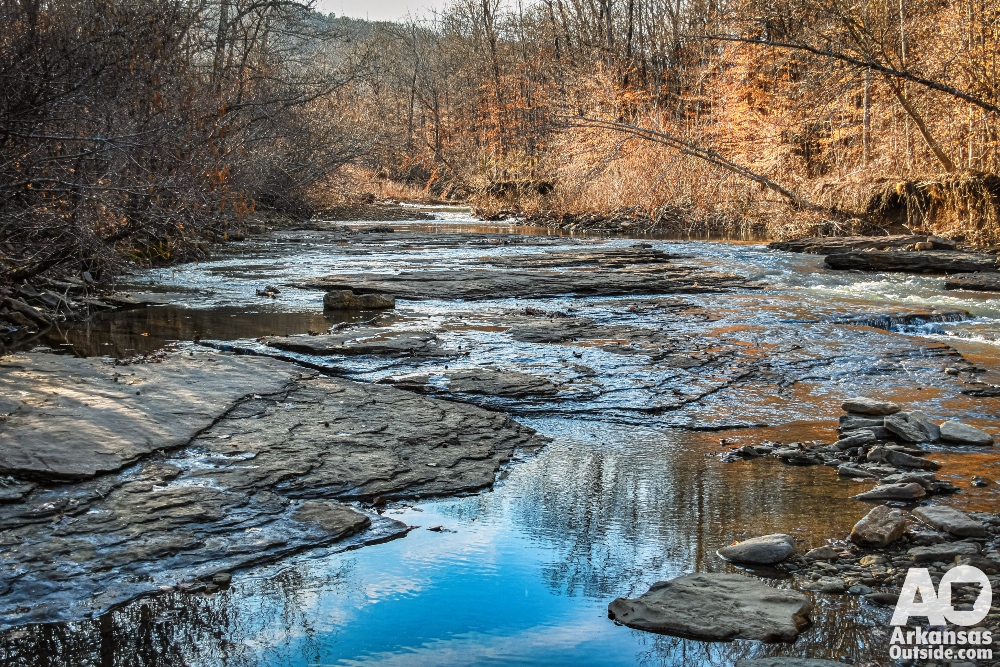
When an old friend visits Arkansas, the kind of friend you have known since childhood and shared trails with across Montana, Wyoming, Idaho, and the Appalachians, including the Smoky Mountains and Joyce Kilmer National Forest, the pressure is on to show off The Natural State. My plan started with a night of overlanding and camping along the Upper Buffalo River. The next morning, we crossed the creek at first light and pointed the trucks up a high-clearance, four-wheel-drive road toward Whitaker Point.
The Hard Way In: Overlanding to the Whitaker Point Trailhead
That approach was a deliberate choice. Most visitors reach the Whitaker Point trailhead by way of a well-graded gravel road that is accessible to virtually any passenger vehicle. It is a perfectly fine route, and there is no shame in taking it. But when you have a friend who has wheeled through mountain terrain from the Selway-Bitterroot to the Nantahala, you look for the harder line. The river crossing and the rough track climbing out of the Buffalo River bottom fit that description. Ruts, loose rock and steep grades kept us focused, and my friend, a veteran of countless backcountry approaches, remarked that the drive alone told him we were in for something worth seeing.
Whitaker Point Trailhead: What to Expect When You Arrive
The trailhead for Whitaker Point, sometimes called Hawksbill Crag, sits inside the Boxley Valley corridor of the Ozark National Forest in Newton County, at roughly 2,300 feet in elevation. A new parking area at the trailhead now accommodates visitors comfortably, a welcome improvement given how popular the site has become. From the trailhead, the hike to the point is just under 3 miles round trip, which means the trail does not wear you out before the payoff.
What the Whitaker Point Trail Looks and Feels Like
The path winds through a mixed hardwood and pine forest typical of the Arkansas Ozarks. In early morning, shafts of light cut through the canopy and the air carries the smell of damp leaves and creek stone. Neither of us said much on the way in. That is the kind of trail it is.
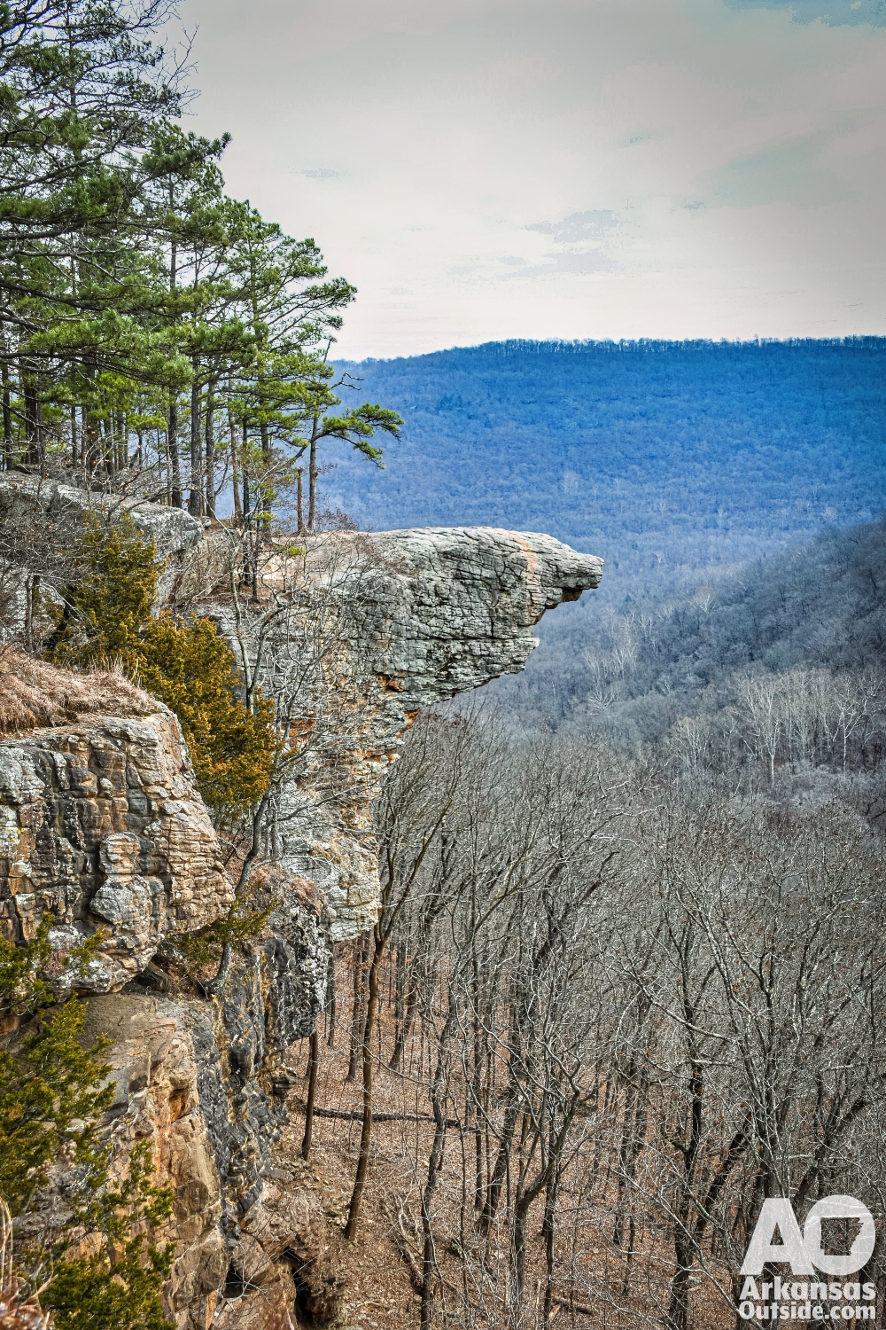
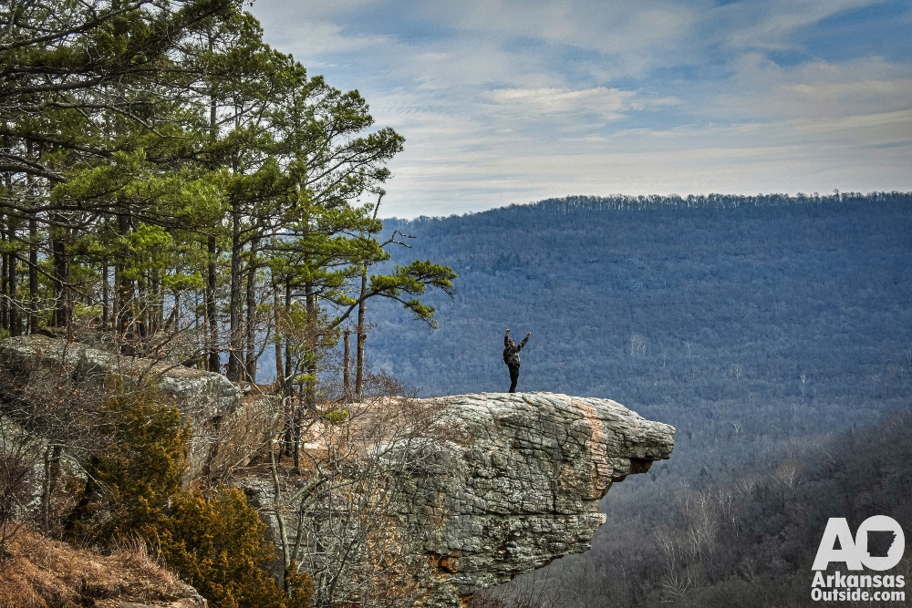
The View from Hawksbill Crag: Why Whitaker Point Stops You Cold
Whitaker Point itself is a narrow sandstone promontory that juts out roughly 200 feet above the valley below. When you step out onto that ledge and look across the folded ridges of the Upper Buffalo River Wilderness, the scene stops conversation entirely. The Buffalo River valley stretched out below us in a patchwork of deep green and early morning shadow. To the west, a line of bluffs caught the first hard light of the day. My friend stood at the edge for a long moment, then turned and said simply, “OK. I get it.”
That is the reaction Whitaker Point tends to produce in people who have seen a great deal of wild country. It is not the tallest overlook. It is not the most remote. What it is, though, is perfectly composed. The sandstone ledge, the drop below, the river valley beyond and the unbroken Ozark ridgeline running to the horizon form a view that feels deliberate, as though the landscape arranged itself for exactly this purpose.
Here is what happens when you walk out on Hawksbill Crag with a 360 Degree camera.
View this post on Instagram
The Buffalo National River and Upper Buffalo Wilderness: The Landscape Below
The Buffalo National River, which flows through the valley below, was designated as the nation’s first national river by Congress in 1972. The Upper Buffalo Wilderness, which surrounds much of the land near Whitaker Point, encompasses more than 12,000 acres of roadless terrain in the Boston Mountains sub-range of the Ozarks. Elevations in the area top out near 2,500 feet, modest by Rocky Mountain standards but sufficient to produce genuine backcountry character and dramatic topography.
Whitaker Point Hiking Tips: Best Time to Visit and How to Get There
For visitors planning the trip, a few practical notes apply. The standard gravel road to the trailhead is suitable for most vehicles and well-marked from Arkansas Highway 43 in the Boxley Valley. The new parking area at the trailhead is a genuine convenience, but it fills quickly on weekends between April and October, when Whitaker Point draws significant crowds. A weekday visit is strongly recommended. The difference in solitude between a Tuesday morning and a Saturday afternoon at the overlook is not a minor one. Arriving on a weekday means having the sandstone ledge largely to yourself, which is the proper way to experience a view that deserves unhurried attention.
The trail itself is well-worn but not heavily improved. Footing is generally good, though tree roots and exposed rock require attention in places. The last quarter mile to the point includes some rocky scrambling that most hikers handle without difficulty. Dogs are welcome on leash. No permit is required to hike Whitaker Point, though visitors should pack out all trash and observe Leave No Trace principles. The Ozark National Forest asks that hikers stay on established trails to protect the fragile sandstone formations.

Why Whitaker Point Makes a Believer Out of Anyone Who Has Hiked Everywhere Else
We lingered at the point longer than planned, which is what tends to happen. Eventually we made our way back down to the trucks, drove back out to the pavement and experienced the windy roads that parallel the Buffalo National River to Jasper where we used the welcome cell phone service to make contact with home before heading off on our next adventure which I posted about herehere.
This article was originally published on ArkansasOutside.com, your trusted source for outdoor news and updates in The Natural State. Unless otherwise credited, all photos included in this piece are the property of Arkansas Outside, LLC. We take pride in sharing the beauty and adventures of Arkansas through our lens—thank you for supporting our work!