


Lace up your boots and explore the natural beauty of Northwest Arkansas. The region, renowned for its rugged Ozark Mountain terrain, offers a wealth of hiking trails perfect for a challenging day trip. This guide highlights some of the best short-to-moderate hikes, ranging from 5 to 10 miles, across Benton, Washington, Carroll, and Madison counties.
These trails showcase diverse landscapes, from serene lakeside paths and forested hollows to rocky bluffs with rewarding vistas. Remember to always carry water, wear appropriate footwear, check weather conditions and trail status before you go, and practice Leave No Trace principles.

Benton County: Hobbs State Park-Conservation Area
Pigeon Roost Trail
- Location: Rogers, Hobbs State Park-Conservation Area
- Length: Approximately 8.2 miles (outer loop option) or 8.5 miles (full double-stacked loop). Shorter 4-mile and 4.8-mile loops are also available.
- Difficulty: Moderate to Strenuous. The trail features several climbs and descents, gaining around 1,400 feet in elevation over the longer loops.
- Highlights: This well-maintained trail winds through diverse Ozark forest, featuring stands of native pines and hardwoods. Hikers will traverse narrow hollows and rugged ridges, with seasonal views of Beaver Lake’s Van Hollow branch, especially during leaf-off. The longer loop offers primitive campsites (reservations required).
- Access: The primary trailhead with restroom facilities is located on the north side of Arkansas Highway 12, about 0.7 miles east of War Eagle Road.
Washington County: Devil’s Den State Park
Vista Point Trail
- Location: West Fork, Devil’s Den State Park
- Length: 9 miles
- Difficulty: Moderate to Strenuous. The trail involves significant elevation changes as it ascends Holt Ridge and traverses the plateau.
- Highlights: Offering some of the most expansive views in the park, this trail takes hikers through mature Ozark forest, past intriguing rock formations, a historic Civilian Conservation Corps quarry, and a 19th-century homestead site. The Vista Point Overlook above Blackburn Creek provides a stunning panorama. Sections of this trail coincide with the Gorley King Trail and the Butterfield Hiking Trail.
- Access: The trail can be accessed from the horse camp area within Devil’s Den State Park. Check park maps for specific trailhead locations.
Carroll County: Lake Leatherwood City Park
Leatherwood Lake and Ridge Loop (Combined Trails)
- Location: Eureka Springs, Lake Leatherwood City Park
- Length: Approximately 7-8 miles (custom loop)
- Difficulty: Moderate. This combination involves some flat lakeside walking with more strenuous climbs and descents on the ridge trails.
- Highlights: Create your own adventure by combining several of Lake Leatherwood’s scenic trails. A potential route could start with the relatively flat Beacham Trail (approx. 3.2 miles) circling the historic Lake Leatherwood. Connect to the Hyde Hollow Trail (1.5 miles) and then challenge yourself on the Twin Knobs Trail (3 miles) for rewarding ridgetop views and interesting geological formations. The park boasts nearly 25 miles of trails through diverse forest, past rock shelters, and alongside the 85-acre spring-fed lake.
- Access: Main park entrance is off Arkansas Highway 62, west of Eureka Springs. Trailheads for individual trails are well-marked within the park. Pick up a trail map at the park.
Madison County: Ozark National Forest
Ozark Highlands Trail: Lick Branch Trailhead Out-and-Back
- Location: Near Cass (closest small community, trailhead is remote), Ozark National Forest. The Lick Branch trailhead is in Johnson County, but the trail heading east quickly enters Madison County. A hike eastward will be predominantly in Madison County.
- Length: 5 to 10 miles (customizable out-and-back). For example, a 3-mile hike east and back would total 6 miles.
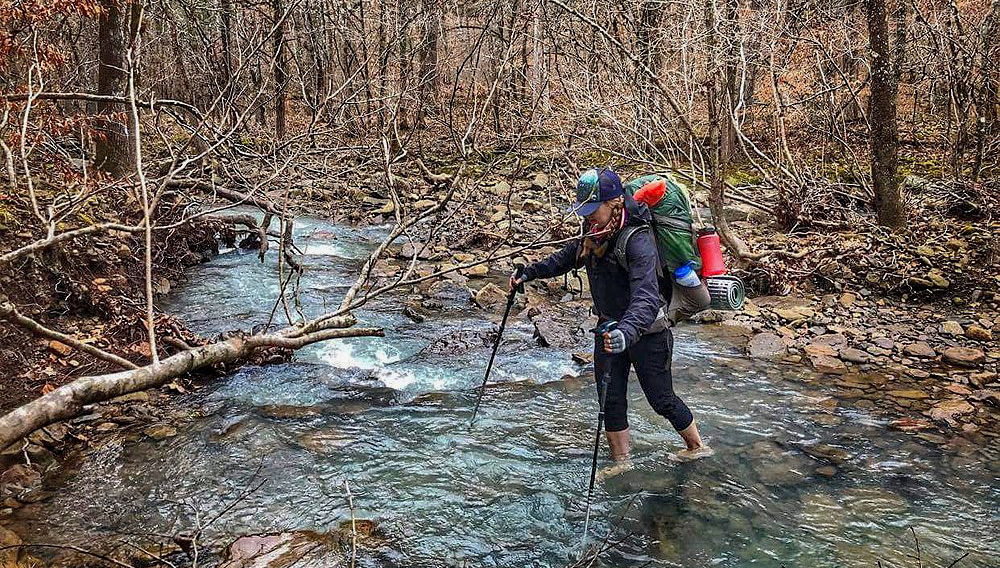
- Difficulty: Moderate to Strenuous. The OHT is known for its rugged terrain, with climbs, descents and creek crossings.
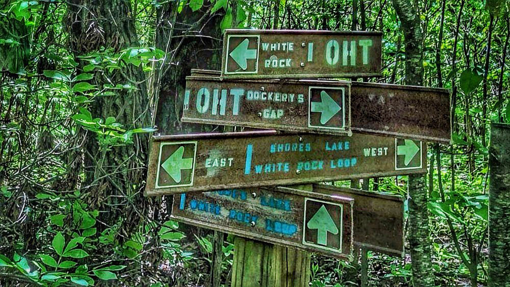
- Highlights: Experience a wilder section of the Ozark National Forest on this renowned long-distance trail. Hiking east from the Lick Branch trailhead (OHT mile marker 55.1) takes you into Madison County through dense hardwood forests, across seasonal creeks, and past impressive rock bluffs and outcrops. Expect solitude and a true backcountry feel. This section offers quintessential Ozark scenery.
- Access: The Lick Branch trailhead (GPS: 35.71000, -93.66157) is located off unpaved Forest Service roads. A high-clearance vehicle may be advisable depending on recent weather. Ensure you have a map of the Ozark Highlands Trail.
These hikes offer just a glimpse of the outdoor adventures awaiting in Northwest Arkansas. With careful planning, hikers of various skill levels can find a rewarding experience in the heart of the Ozarks.
This article was originally published on ArkansasOutside.com, your trusted source for outdoor news and updates in The Natural State. Unless otherwise credited, all photos included in this piece are the property of Arkansas Outside, LLC. We take pride in sharing the beauty and adventures of Arkansas through our lens—thank you for supporting our work!
