


Why go hunting for waterfalls when it has barely rained? That question was stuck in my head. We have had a dry winter, yet I had a brand new Arkansas waterfall guidebook waiting to be used since Christmas. Now it was late February, and friends kept warning me that many of the waterfall hot spots in the Ozarks were still not worth the drive.
A Return Visit and a New Ozarks Adventure
That was a problem. A friend was coming to visit and he wanted some remote camping. It was only his second time in Arkansas. On his first trip we camped in the Ouachitas for a couple of nights, so I wanted to give him a taste of the Ozarks this time.
I mapped out an overnight in the Buffalo Headwaters area with some overlanding mixed in. That part of the adventure is a whole different story. After that I planned to spend a couple of nights at the Carver sandbar on the Buffalo National River. We rolled into Carver early in the afternoon. When we saw the low water, the winter bare trees, and the steady wind ripping through the valley, we agreed to move on. I decided to take a chance on the tumbling waters around the Richland Creek Recreation Area.
A Quiet Winter Camp at Richland Creek
We wound through the gravel roads of eastern Newton County, crossed into Searcy County, and pulled into the US Forest Service campground. It was empty on this cold weekday. Site 8 gave us easy access down to Falling Water Creek and its confluence with Richland Creek. We set up camp and planned our next day exploring a couple of waterfalls up Falling Waters Road. A glance down into the creek gave us hope. There was at least a little water moving.
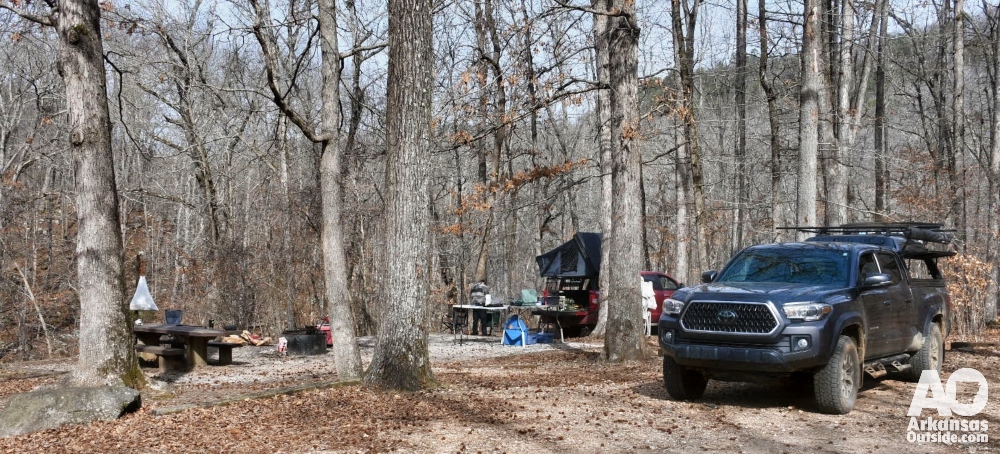
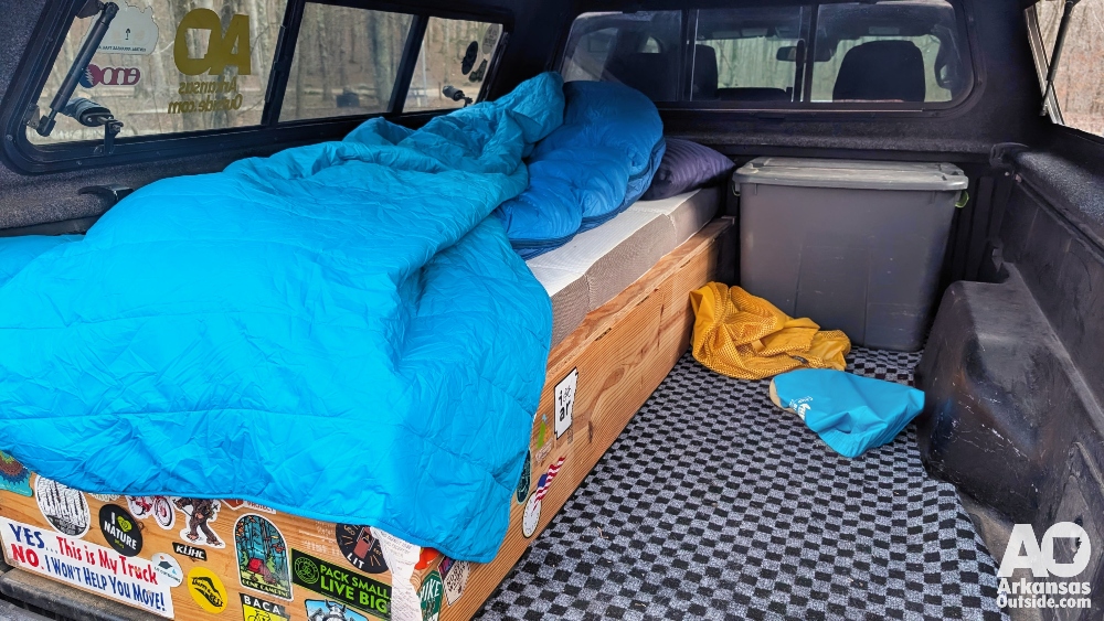
Truck Camping Comfort in the Ozarks
We camp out of our trucks these days. My friend has a rooftop tent and I have a bed set up under a camper shell. It is a comfortable way to travel and we save the backpacking tents for when the hike in demands it. The campground’s level parking spots made the entire process quick and easy.
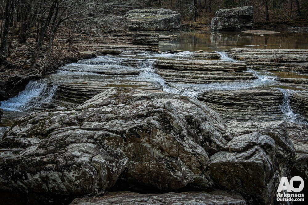
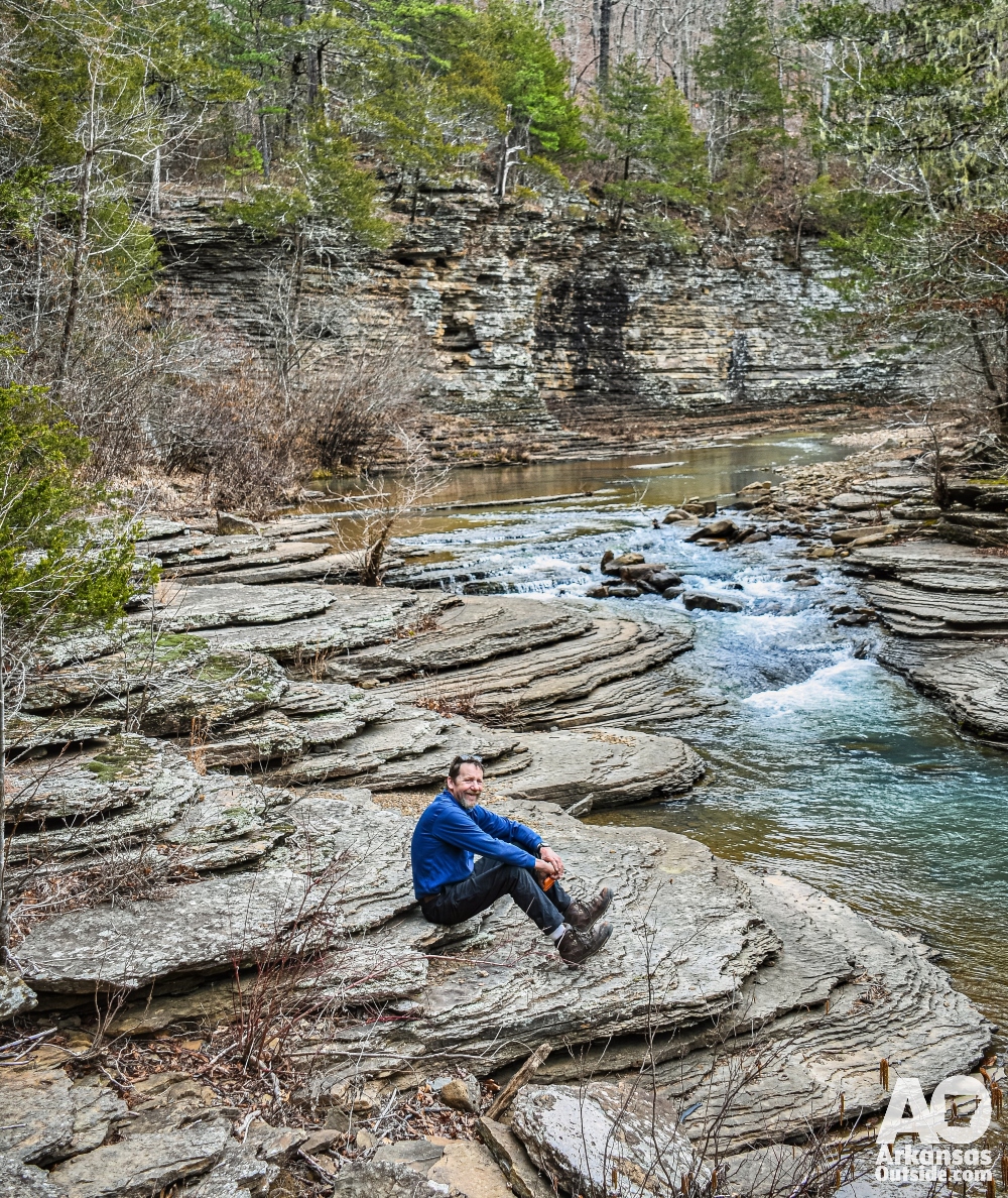
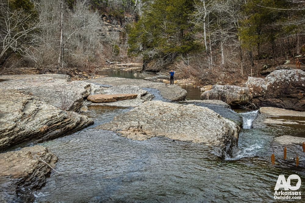
Exploring Six Fingers Falls at Low Water
The next morning we headed up Falling Waters Road, a gravel route through one of the best waterfall corridors in Arkansas. This is part of the Ozark Grinder Trail, a tough gravel cycling route through the area. Our first stop was Six Fingers Falls. Instead of the usual broad ledge of water you see after a storm, the creek was threading itself between narrow rock channels. The low flow let us see the area’s unique geology up close.
Six Fingers Falls exists because of differential erosion. The creek flows over layers of rock with different hardness. Over time, water carved deep parallel grooves in the softer stone, leaving behind the harder ridges that form the fingers. When the water is low, the falls are more like several side by side chutes instead of one wide curtain. The result is a waterfall about six to ten feet tall and nearly forty feet wide that is constantly being reshaped, especially during high water. It is the kind of waterfall that invites you to explore from every angle.
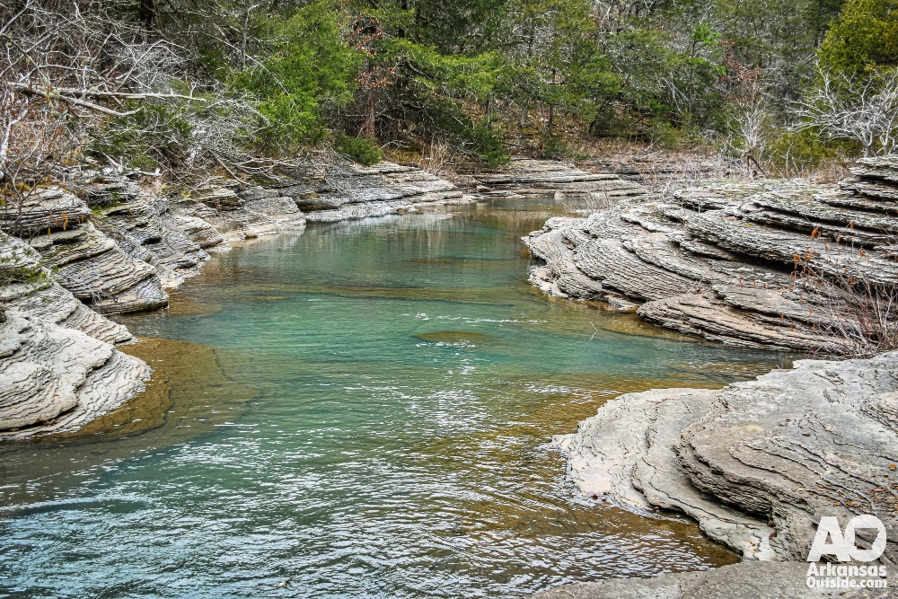
Discovering Intersection Falls in Its Winter Quiet
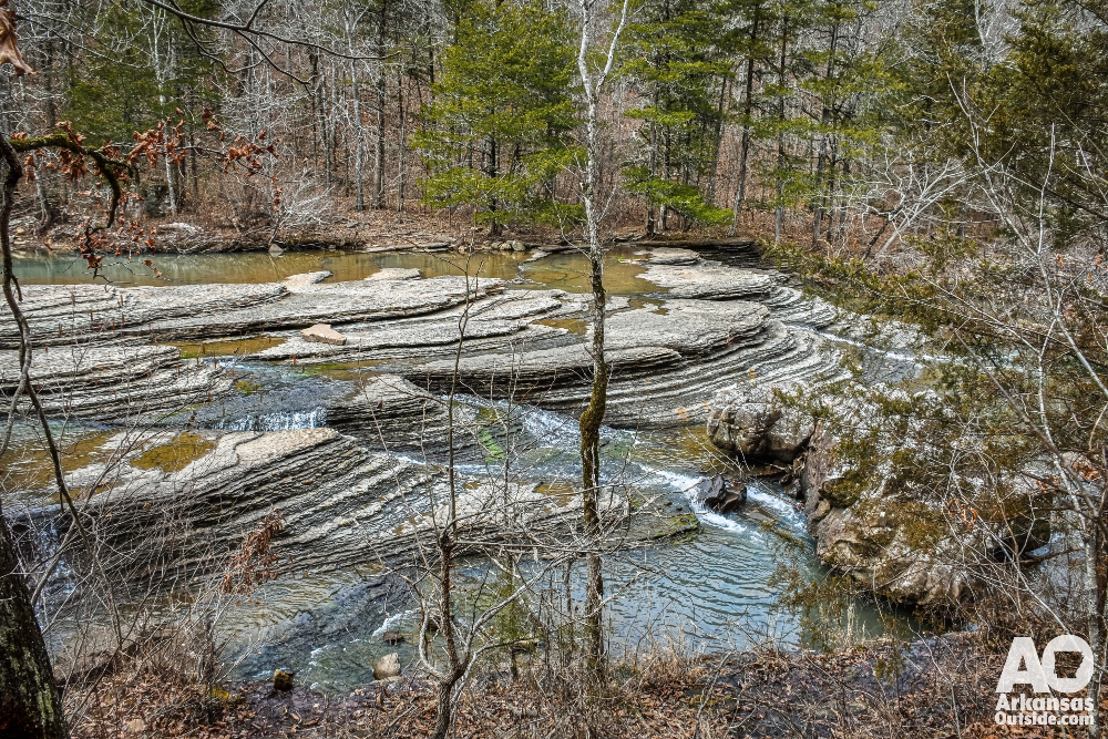
After wandering across the falls and into places that would be unreachable during normal flow, we moved on to Intersection Falls.
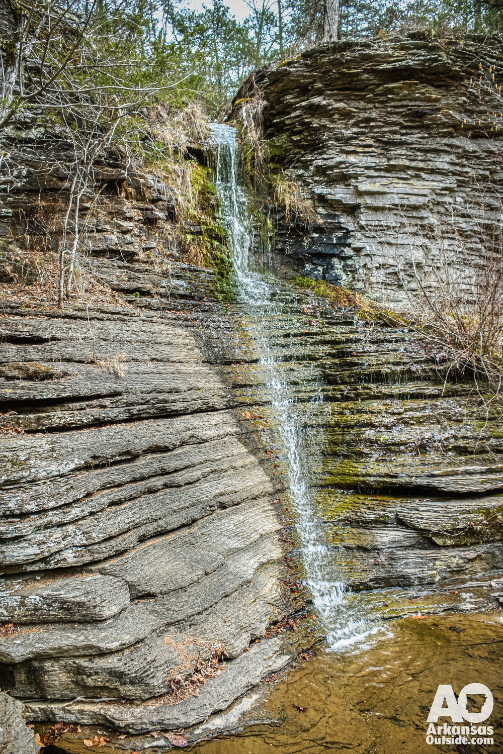
In low water, Intersection Falls looks like it has been stripped down to its bones. The big tropical style sheet of water disappears and the bluff becomes an open display of Pennsylvanian sandstone and shale. Thin ribbons of water slide across dark ledges and mossy shelves. The pool at the bottom turns still and green. The whole place feels quiet, ancient, and more like a stone cathedral than a waterfall. It is a side of the Ozarks that most people never see.
Why Low Flow Waterfall Trips Are Worth It
Seeing these falls in low water turned out to be a gift. I will now tell anyone who visits Richland Creek to make two trips. Go once during normal flow to see the classic waterfall experience. Go again when the flow is low to understand how water shapes this landscape.
A New Appreciation for The Natural State
And my friend from out of state. Like most visitors, he arrived with a picture in his mind of what Arkansas might look like. He left with a new appreciation for how beautiful and surprising The Natural State can be.
Here are a few other photos:

To see these falls and others with more water in them go to this article from a winter trip in 2023.
This article was originally published on ArkansasOutside.com, your trusted source for outdoor news and updates in The Natural State. Unless otherwise credited, all photos included in this piece are the property of Arkansas Outside, LLC. We take pride in sharing the beauty and adventures of Arkansas through our lens—thank you for supporting our work!

One Response
Cossatot falls is another unique area to explore at low water