


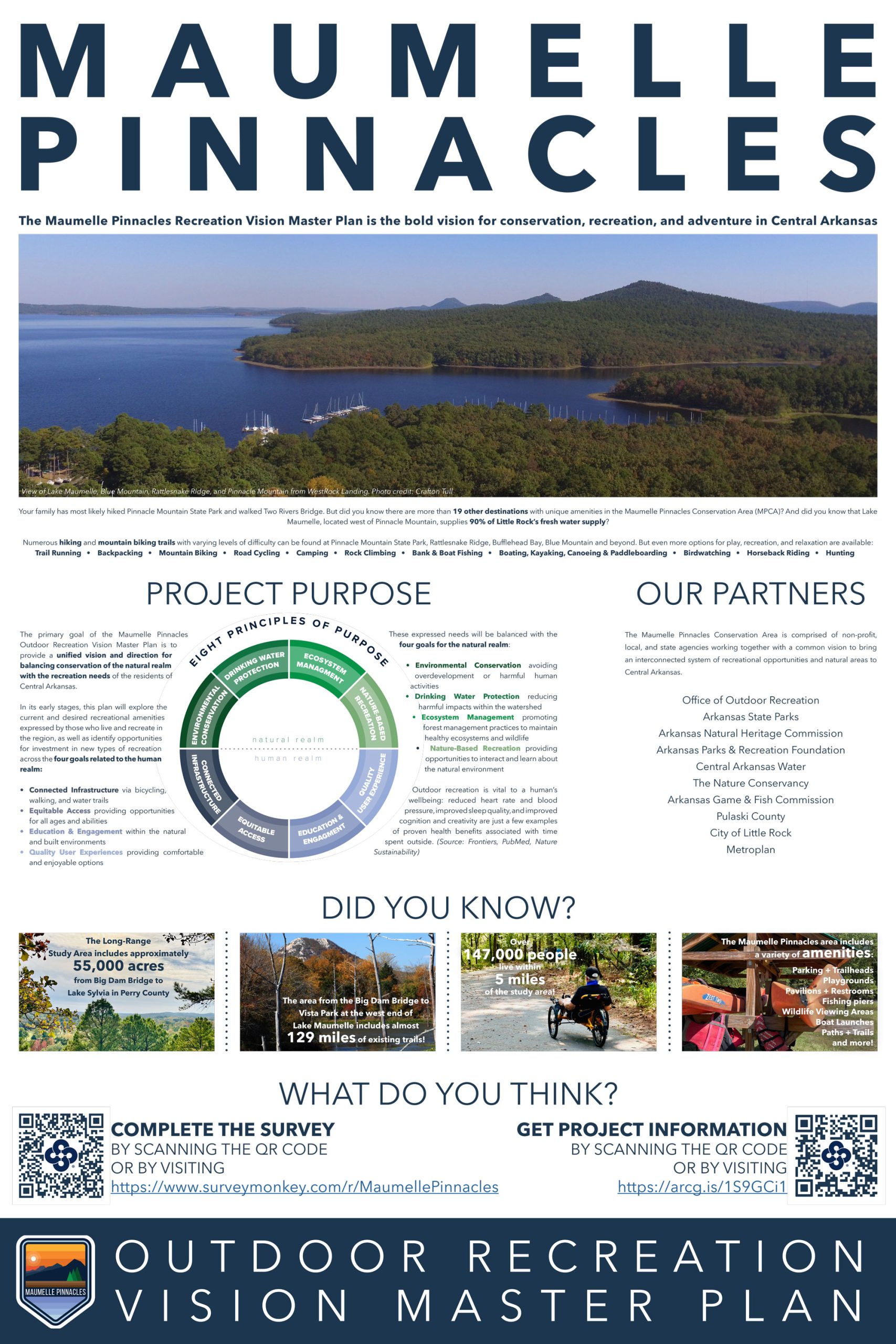
Read over the information below, and then make sure you go to the Crafton Tull website and take the survey.
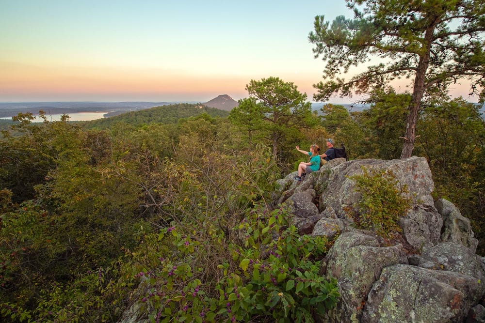
For me, if there were ever a gateway to the Ouachita Mountains, it would be Pinnacle Mountain State Park. I credit the park for why I live in Little Rock. After spending most of my life following my family and my career around the county, never living anywhere for more than 5 years, I found myself in Little Rock in the late 1990s. My family remained in the Dallas, TX area as we waited to sell our house. I was living in a suite at the Marriott Courtyard in West Little Rock. As I was getting my new position settled I would spend my off time at Pinnacle Mountain. Up, over, and around was my daily mantra. I had come to Arkansas with some extra weight but for the first time in decades, I was ready to get myself back into good physical shape. The mountain was the perfect mix of physical challenge and escape from long retail hours.
It wasn’t long before I started exploring the Ouachita National Recreation Trail, heading west I discovered the wonders of the Lake Sylvia area. Friends began taking me to the Ouachita Mountains to ride mountain bikes on the gravel roads and the old Wildcat Mountain Trails. I began competing in Adventure Racing and found the perfect workout area at Pinnacle, around Lake Maumelle, and at Lake Sylvia.
A Trail Around the Lake
Central Arkansas Trail Alliance was formed 10 years ago with the major goal of creating a mountain bike trail that circled Lake Maumelle. The idea included starting with using the Ouachita National Recreational Trail (ONRT) to make it possible to ride to Lake Sylvia to camp and enjoy what they hoped would be a rebuilt Wildcat Mountain Trail System. The trail advocacy group came close but could not convince Central Arkansas Water, the land manager of much of the Lake Maumelle watershed to allow the use of this section of ONRT for mountain bike use. Some may remember an erosion study area upstream from the lake on the Maumelle River. Due to access issues to the area and the relatively short amount of trail available, the study did not draw enough participants to move forward.

In July of 2021, Representative French Hill was successful at getting the Lake Sylvia/Camp Ouachita Area included in the Arkansas State Park system as a satellite recreation area of Pinnacle Mountain State Park. The connection of the two areas made more and more sense.
About 5 years ago, Mitchell Allen and Leah Beck, who both worked at the time for The Nature Conservancy in Arkansas, floated the idea of creating a planned, focused recreation area between Pinnacle Mountain State Park and the area around Lake Maumelle. Working with Raven Lawson, the Watershed Protection Manager with Central Arkansas Water, on a hiking trail that would link the location of the planned new visitor center and the Rattlesnake Ridge trails on the south side of the lake.
“I wrote a recreation plan when I was with The Nature Conservancy based on recognizing the low-hanging fruit, what our partners at Arkansas State Parks, the Department of Natural Heritage, and Central Arkansas Water already have that we can work with,” said Allen. “There wasn’t a lot of interest at that time.”
A Shake-Up in Outdoor Recreation
In 2021, under Secretary Stacy Hurst, the Arkansas Office of Outdoor Recreation was formed as a division of the Arkansas Department of Parks, Heritage and Tourism (ADPHT). Shortly after taking office in 2023, Governor Sarah Huckabee Sanders created the Natural State Initiative, chaired by her husband, Bryan Sanders, an avid mountain biker and outdoor enthusiast. Suzanne Grobmeyer left the leadership role at the Arkansas Parks and Recreation Foundation (APRF) to work as the chief of staff for then ADPHT Secretary, Mike Mills, and Mitchell Allen became the Interim Executive Director of the APRF.
This adjustment made it possible for several plans to move forward such as Arkansas joining the Confluence of States, a national outdoor recreation industry group, in 2022 and a new look at the recreation plan developed by Allen. A synergy was created and at the grand opening of the new Pinnacle Mountain State Park Visitor Center, Katherine Andrews, Director of the Arkansas Office of Outdoor Recreation (AOOR), announced the Maumelle Pinnacles Recreation Master Plan.

The Plan Moves Forward
Mitchell Allen explained the original plan, “At The Nature Conservancy we were working on getting people from a city park to something more wild like Rattlesnake Ridge and eventually out to the Flatside Wilderness giving people the kind of experience with wilderness and conservation that would eventually create some kind of love and connection to the conservation work we were doing. It was really a simple, simple thing, if we have all this conservation land and people can’t use it or can’t get on it, then people have absolutely no reason to help conserve it. We made that case with the Maumelle Pinnacles partners.”
Raven Lawson of Central Arkansas Water added, “What we really want out of this is for people to come out here and get an appreciation for the resource and understand that this is where their drinking water comes from, why else would they come out here to learn that other than if they are coming out here to recreate? We decided at that point it was just three entities, Central Arkansas Water, the Natural Heritage Commission, and The Nature Conservancy that all have conservation as a major mission so let’s see what we can do to drive this project.”
On a website managed by Crafton-Tull dated October 20, 2023, the Maumelle Pinnacles Master Plan is laid out. According to the site, “The Maumelle Pinnacles Recreation Master Plan is the bold vision for conservation, recreation, and adventure in Central Arkansas.” This mirrors the three words displayed prominently in front of the Pinnacle Mountain State Park Visitor Center, “Protect, Enjoy, Explore.”

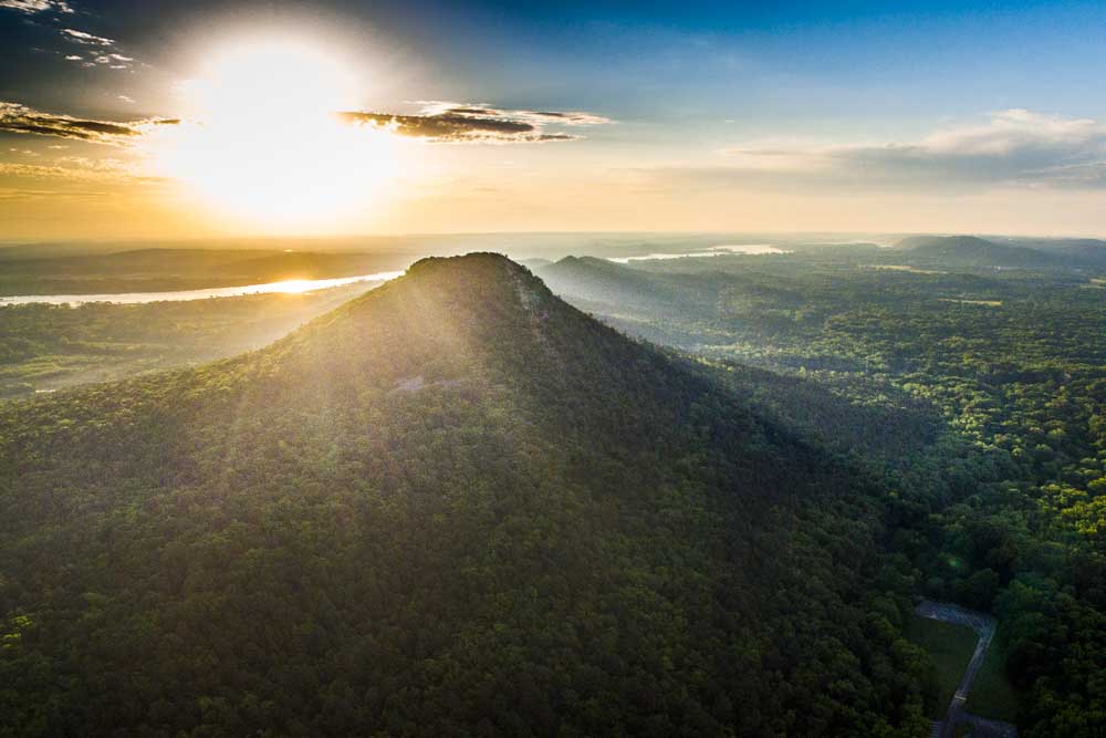
The area of interest covers over 55,000 acres from the Big Dam Bridge in the east to Lake Sylvia Recreation Area in the west. In between are Two Rivers Park, the Arkansas River, the Little and Big Maumelle, Pinnacle Mountain State Park, Lake Maumelle, Rattlesnake Ridge, Blue Mountain, the Ouachita National Recreational Trail, the Ouachita Mountains, and more.
Crafton-Tull has created a questionnaire to involve the public in the plan. The questionnaire covers trail running, backpacking, mountain biking, road cycling, camping, rock climbing, bank & boat fishing, boating, kayaking, canoeing, and paddleboarding, birdwatching, horseback riding, hunting, and more. Don’t let the 90+ questions deter you. You will only have to answer in the areas that interest you.
The partnership has also grown to include the following:
- Office of Outdoor Recreation
- Arkansas State Parks
- Arkansas Natural Heritage Commission
- Arkansas Parks & Recreation Foundation
- Central Arkansas Water
- The Nature Conservancy
- Arkansas Game & Fish Commission
- Pulaski County
- City of Little Rock

Katherine Andrews said, “The partners looked to the Arkansas Office of Outdoor Recreation as the conduit for a master plan so I organized the RFQ (Request For Qualifications) process and Crafton-Tull was selected to manage the creation of the master plan. There was already a lot of work being done. But Crafton-Tull and their work on this has really heightened it to a new level that couldn’t have been done by the initial group or it would have taken a really long time. It’s nice to have a third party totally dedicated to working on this project.”
The area could easily be connected to other projects in central Arkansas including MetroPlan’s Regional Greenway Initiative and Pulaski County’s work on the Southwest and Southeast Trail systems. In 2020 Tab Townsell, previous executive director of MetroPlan met with Mitchell Allen to discuss how the Greenways could connect the cities of the region to both Pinnacle Mountain State Park and all the recreational opportunities in the area. “We brought Casey Covington, current director of MetroPlan, in and he has been awesome. He’s a very avid hiker out in that area and it’s been nice to have him be a part of the project,” said Andrews.
Andrews also emphasized, “I think what I’d like people to understand is it’s not just going to be a trail, Crafton-Tull is going to look at different opportunities in that corridor meaning, are there potential spots where we need to add new kayak access or climbing access, or whatever is needed.”
According to Andrews, in late January or early February, they are planning to have the first of many public meetings for people to give their input in person.
Last night the Central Arkansas Trail Alliance held an informative membership meeting with Jeff Fore, Director of Conservation Programs for The Nature Conservancy, and Julie Kelso, Vice President of Planning for Crafton-Tull speaking on the Maumelle Pinnacles project.
Jeff Fore opened with data he had received that day at the Arkansas Outdoor Economy Summit in Little Rock. “Every year the number of children cycling drops by 250,000, in the last 10 years there has been a drop of 50% in the number of kids using bikes as transportation and a 35% drop in kids riding bikes for fun, and this year, only one in four kids will ride a bike. It’s mind-blowing. The Nature Conservancy bought properties at Rattlesnake Ridge and Blue Mountain to provide access to natural spaces.” Fore also said that a Memorandum of Understanding was developed between the key partners to, “develop sustainably-based and conservation-based recreation across this area.”
Julie Kelso mentioned that in 2013, Crafton-Tull was hired to create a new state bicycle/pedestrian plan by the Arkansas Department of Transportation. This plan was one of the remedies a state government task force created when Arkansas was ranked 50th in the country in bicycle friendliness by the League of American Bicyclists in 2012. Recently, Crafton-Tull worked on MetroPlan’s Regional Greenway Initiative.
Kelso said an early part of the study would be looking at, “What does this transition look like from the urban environment out to the rural environment when you think about getting out to the Ouachita Trail, Flatside Pinnacle, and beyond where you’re really having more of a wilderness experience with limited resources and primitive camping all the way back to being in Two Rivers Park, and the Big Dam Bridge where you have a very urban environment and a different type of recreation.”
This transition is explained in the section of one of the informational posters.


Opinion: An attendee at the Central Arkansas Trail Alliance meeting mentioned that she had been to three different presentations on current planning initiatives in central Arkansas in the past few weeks. Besides this presentation, Casey Covington of MetroPlan presented information on the Regional Greenways Plan at last month’s Bicycle Advocacy of Central Arkansas meeting and the Little Rock Downtown Partnership held the second public input meeting on revitalizing downtown. Much of the Downtown Partnership meeting had to do with alternative transportation and greenspaces. It shouldn’t be forgotten that other major projects like the Southwest and Southeast Trails are currently being shepherded by Pulaski County Judge, Barry Hyde. Plus, the cities of Conway and Hot Springs are earning funding for alternative transportation plans that will connect to all of these other plans. It’s a dynamic time to be in central Arkansas. It would behoove local leaders to also look at creating a similar project to make the 108,800-acre Fourche Creek Watershed an outdoor recreation destination in the same way that the plan for Maumelle Pinnacles is being pursued.
Also, remember that right in the middle of all of this planned growth in outdoor recreation and alternative transportation is a hole in the Arkansas River Trail. The city needs to CLOSE THE LOOP through the Highway 10/Dillards/Episcopal School corridor or none of these projects will be completely or safely connected. This will take leadership that we have yet to see.
Below are the 3 informational posters shown at the Pinnacle Mountain State Park Visitor Center opening (Go to their website for more information):


2 Responses
Awesome, there should be a trail connecting all of the peaks/pinnacles, I believe there are 6 or 7 peaks you can see from the top of Pinnacle. Would love to do all of them in one day!!!
Having managed the 66 acre Nationally Historic Camp Ouachita for several years, we always promoted it as the Gateway to the Ouachita National Forest (all 1.8 Million acres). It would be amazing to bring all of that (Flatside, Lake Sylvia, Camp Ouachita facilities with Pinnacle) together into a contiguous experience, rather than remain in subparts of opportunities.