The Ouachita National Forest (ONF) will issue a Special Use Permit (SUP) to allow Arkansas State Parks (ASP) to develop trails and recreational facilities on about 8,196 acres of National Forest System (NFS) land within an 8,832-acre project area that includes ASP and City of Mena properties. The permit allows ASP year-round operations on NFS lands, while ONF retains access and can authorize additional compatible uses. Upon the permit’s termination, ASP must restore the site per an agreed plan.
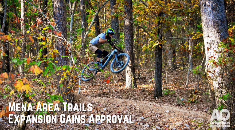
ASP will create specialized biking and hiking trails with features like jumps and rock obstacles, allowing greater design flexibility outside standard Forest Service specifications. The state parks will maintain the trails to prevent environmental damage and ensure access for varied user abilities. E-bike access is also permitted on these non-NFS trails as per state park rules (class 1 e-bikes only) not the current rules for e-bikes recently approved for two of the IMBA epic trails in the Ouachita and Ozark-St. Francis National Forests. The permit allows up to 100 miles of natural surface trails, catering to hikers, gravity-oriented mountain bikers, and backcountry users. Existing trails, like the Ouachita National Recreational Trail, will remain under Forest Service management, with minimal alterations to preserve their character. Motorized vehicle use is limited to maintenance and emergency operations, with no public access for motorized vehicles beyond e-bikes. Equestrian use is excluded.
Four alternatives were considered, ranging from no development (Alternative 1) to full development with lifts (Alternative 2). Alternative 3, the selected plan, reduces development to address environmental and scenic concerns. Alternative 4 proposed development without lift access. The Alternative 2 proposal included a total of 5 lifts in the area, Alternative 3 drops that down to 3 lifts. You can see the Alternative 2 proposal in our article from March 2023.
Mitchell Allen of the Arkansas Parks and Recreation Foundation said, “I think it’s a good outcome. I think the reality of 5 lifts is a bit much and this alternative should allow the plans to move forward.” He also mentioned that the Arkansas Office of Outdoor Recreation is currently accepting Requests for Information (RFI) to begin the process of hiring a concessionaire to manage the lifts, shuttles, and other amenities associated with the trail system.
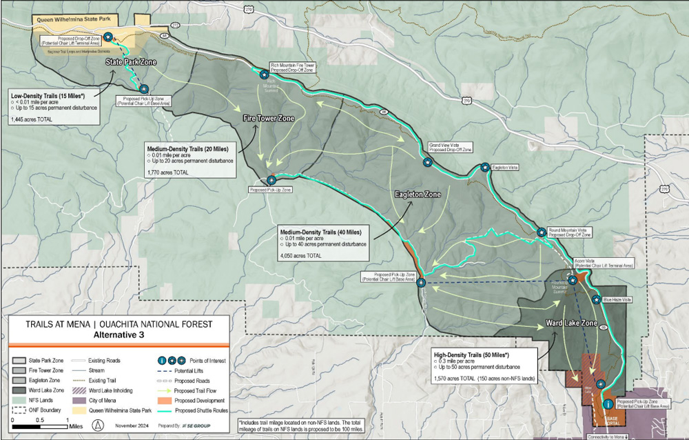
Below is a summary of the decision made by the forest service by zone. An updated map is included at the end of this article.
Ward Lake Zone
The national forest approved up to 50 miles of trails in Ward Lake Zone, some on non-NFS lands, to accommodate various skill levels. Most trails are bike-optimized and directional to reduce user conflicts, featuring elements like jumps, berms, and bridges. A chairlift will be built from the Base Portal to near Round Mountain’s summit, designed to manage trail access and avoid congestion. Guest staging areas will offer paved surfaces, shelters, and Forest Service-compliant restrooms. This zone will connect to the recently opened trails at Ward Lake.
Eagleton Zone
Officials approved up to 40 miles of dispersed mountain biking trails, allowing up to 40 acres of permanent and 90 acres of temporary disturbance. This includes shuttle services, access roads, and possibly a chairlift. A new shuttle pick-up point will be created near Polk County Road 720, with upgrades for staging, shelter, and remote restrooms. Shuttle drop-offs are planned along Highway 88, with improvements for staging, shelter, and restroom facilities.
Fire Tower Zone
To preserve scenic integrity, the Ouachita National Forest will not allow the construction of a chairlift here but will allow the development up to 20 miles of trails. A shuttle pick-up area along an existing Forest Service Road will support staging and amenities. The drop-off point near the Rich Mountain Fire Tower will allow optimal vertical relief and include paved surfaces, shelter, and restrooms.

State Park Zone
ONF approved up to 15 miles of cross-country trails connecting users from Queen Wilhelmina State Park to the Fire Tower Zone and supporting extended rides. Although no additional features are planned, structures may be added to protect sensitive areas. The zone will allow for shuttles and a lift, with a shuttle pick-up point requiring upgrades and a drop-off near Queen Wilhelmina Lodge. An access road from the bottom lift terminal to an existing Forest Road will be closed to the public, and additional improvements will accommodate shuttle traffic.

The plan includes the development of around 100 miles of trails and up to three lift systems, along with enhanced parking and pick-up/drop-off areas along the Talimena Scenic Byway (Highway 88) and Polk County Road 720. The SUP will be official once the final objection period is over on November 25, 2024.


