


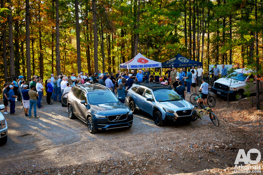
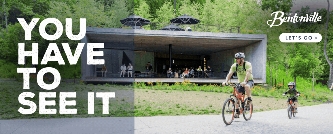
On Thursday, the City of Mena hosted a ribbon-cutting ceremony to officially open the new trail system at Ward Lake. This exciting development marks a significant milestone in the city’s efforts to expand outdoor recreation opportunities and attract visitors to the area. The Trails, built by professional trail builders, Progressive Trail Design (PTD) surround an abandoned lake north of Mena on city property.
The new trail system offers a variety of experiences for outdoor enthusiasts of all skill levels, including mountain biking, hiking, and trail running. The trails wind through scenic forests, providing access to the stunning landscape. The project was made possible through a partnership between the City of Mena, the Mena Advertising and Promotion Commission, the Western Arkansas Planning and Development District, the Economic Development Administration, and the Arkansas Parks and Recreation Foundation.
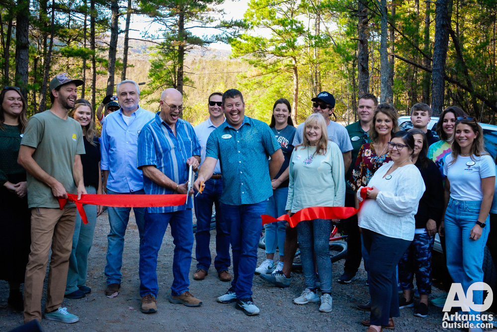
“Today, we are not just opening a new trail system, we’re opening up new opportunities for adventure, fitness, and outdoor enjoyment for locals and visitors alike,” said Seth Smith, Mayor of Mena. “The Ward Lake Trail System is more than a collection of trails, it’s a symbol of what we can accomplish when we work together. It’s a place where families, friends, and visitors can connect with nature, challenge themselves, and experience the best that our beautiful part of the world has to offer.”
The ribbon-cutting ceremony was attended by several city leaders, including State Representative John Maddox, Secretary of the Arkansas Department of Parks, Heritage and Tourism, Shea Lewis, and representatives from the offices of Senator Tom Cotton, Senator John Boozman, and Representative Bruce Westerman. Following the ceremony, attendees were invited to explore the new trails and enjoy a variety of activities, including guided bike rides and trail runs.
First Gentleman, Bryan Sanders spoke at the ceremony saying, “Our plan is to build the best year-round lift access downhill mountain bike park anywhere in the country right here.” he continued, “This is going to be a game-changer not just for Mena but for the whole state of Arkansas.”
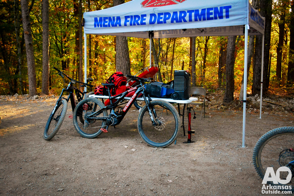
The Mena Fire Department was well represented at the event where they had the opportunity to show off some of their new rescue equipment, without actually putting it to the test.
Kenny Davis and others from the Mena Open Trail Alliance (MOTA) were in attendance. Kenny and I used to rub tires back in the day, he is credited with making the first presentation to the city that instigated this project.
My Take on the Trails
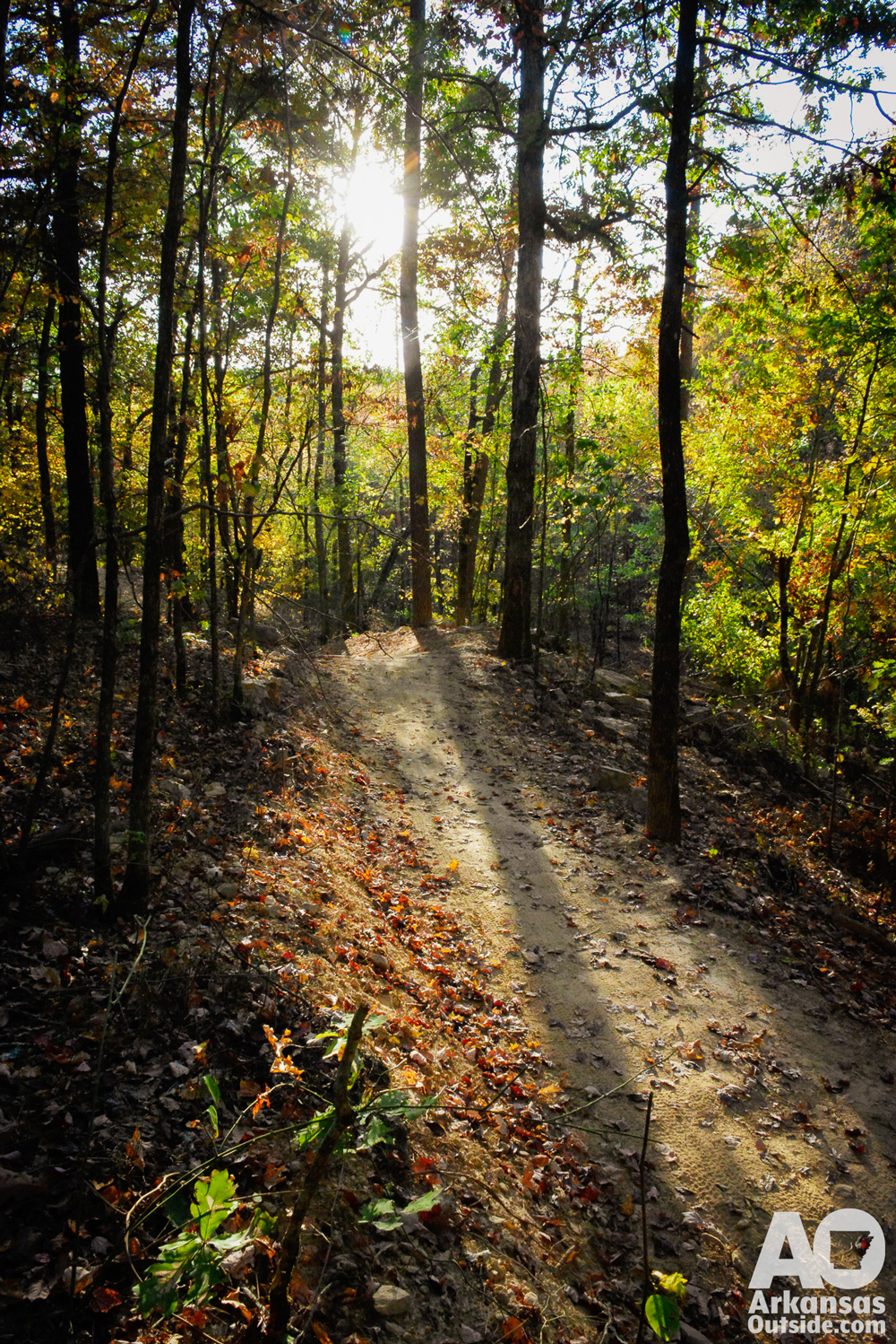
Ward Lake is an abandoned water source that is currently dry. The dam is intact and has been incorporated into the trail system. The trails for the most part stay out of the old lake bed and incorporate the surrounding hills. The trailhead is just off the Talimena Scenic Highway (Hwy 88) to the left as you head up the mountain just a few feet beyond the US Forest Service Information Center.
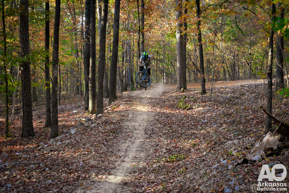
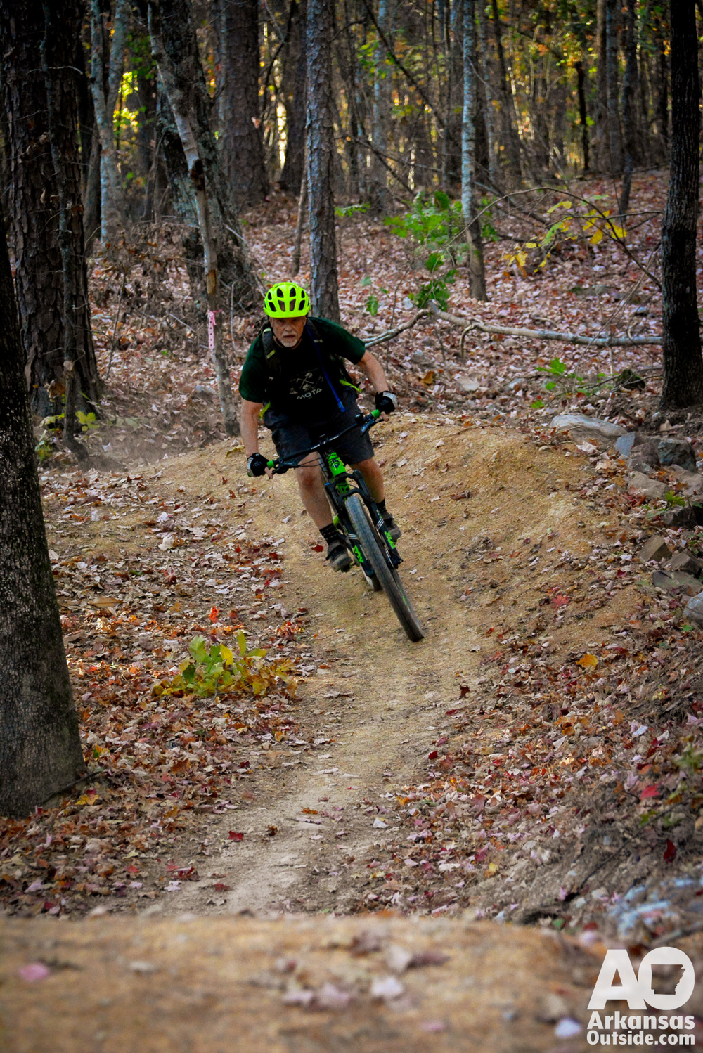
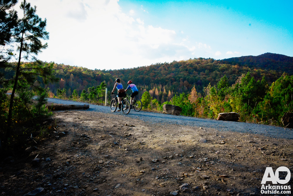
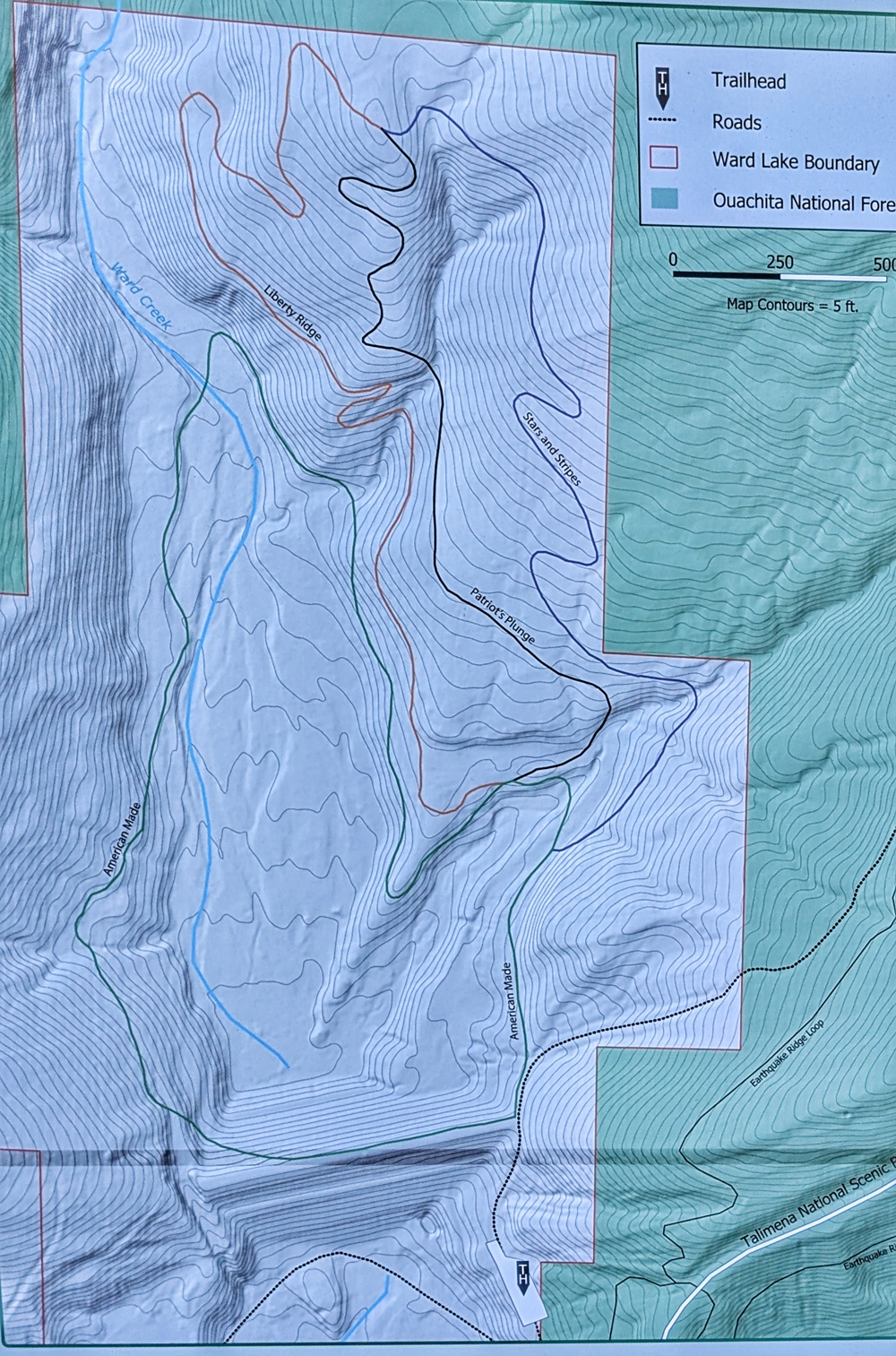
In my experience with Progressive Trail Design (PTD) projects, I found these trails to be exceptional. The system is relatively small and features a gravel path called “American Made,” a nod to the Tom Cruise movie of the same name that highlighted the City of Mena. This trail is 1.1 miles long and connects users to the dirt surface trails while also providing a comfortable walking path around the old lake bed and over the old dam.
The dirt surface trails consist of a climbing trail, designated blue, named “Liberty Ridge” which takes riders 0.7 miles to an upper hub. At this point, the rider has a choice of two downhill trails, “Stars and Stripes,” a blue 0.5-mile trail is a lot of fun with smaller jumps and minimal rock features. The other choice is the half-mile-long “Patriot’s Plunge,” rated a black diamond trail, this downhill features larger berms and jumps with several rocky jump exits. Both trails can be ridden using secondary lines to ease the degree of technicality.
The total amount of trail is about 3 miles but to ride everything once took me to almost 4 miles. While these trails are not yet extensive enough to draw out-of-town crowds they do represent what could be if the full project connecting up to the top of Rich Mountain and Queen Wilhelmina State Park is completed.
The Rest of the Project
While there is still no lift access, several groups are working toward making the full project happen. Most of the property between the City of Mena and Queen Wilhelmina State Park is owned and managed by the US Forest Service. According to Mr. Sanders, the project is waiting on final NEPA approval. They expect that by the end of the year. Shea Lewis, Secretary of ADPHT, said the department has a Request for Information (RFI) out seeking information on managing the lift system through a concessionaire. So things are moving forward.
The map below shows the vision for the entire project. You can also find more information from our July 1, 2024 article.


The City of Mena continues to invest in its outdoor recreation infrastructure, with plans for future trail expansions and improvements. By providing world-class outdoor experiences, Mena aims to position itself as a premier destination for outdoor enthusiasts. Although the system is still small, there are plenty of other mountain biking opportunities in the area including Earthquake Ridge right across Highway 88 and the Ouachita National Recreation Trail, and IMBA Epic, just a few miles farther up Highway 88. You’re also only about 25 minutes from The Womble Trail, another IMBA Epic to the east on Highway 270.
For a great video showing a ride down the trails, check out Anneke Beerten’s video.
One Response
Several years ago, a government bulldozer went through our posted land, at the foot of Blackfork Mt., and built a big bar ditch and put up signs “foot travel only”, across an old road that had been there for over 100 years. At the top of the mountain is the Little Cemetery, in which I have several relatives buried. Blocking the old road cut off our only way to get to the cemetery, since most of us are too old to walk that far uphill! Also, since the road has quit being used, it has eroded badly! The road is now a disaster……huge piles of rocks, washed away soil, etc… I find it hard to get excited about our new biking trails…..120 miles of forest mauled by bulldozers…but, yet our access (it’s about 1 1/2 miles to the cemetery) is blocked!! Of course, the cemetery is in the Wilderness Area, but the old road was blocked a good ways from where the Wilderness begins. Not much I can do about it, though. As I watched the lady ride her bicycle down the trail, I thought, “If many people ride like that it is going to drum up a lot of business for Mena Hospitals ER!!