


Arkansas State Parks is preparing for a potential prescribed burn at Pinnacle Mountain State Park in mid-November. Weather will determine the exact timing, but the effort represents an ongoing commitment to reducing hazardous fuels, improving wildlife habitat, and strengthening the long-term health of one of central Arkansas’s most popular outdoor destinations.
The planned burn area covers about 315 acres on and around Pinnacle Mountain. According to the announcement, the project is part of a broader strategy to maintain a healthy forest ecosystem while also improving visitor safety on the mountain.
When the Burn Could Happen
Arkansas State Parks has set a burn window of Monday through Thursday, November 17 to 20, 2025.
In the words of the release, “Planned daily ignition time: Approximately 9:30 a.m. each active burn day, weather permitting.” Actual ignition will only occur when temperature, humidity, and wind conditions meet strict safety and smoke management requirements.
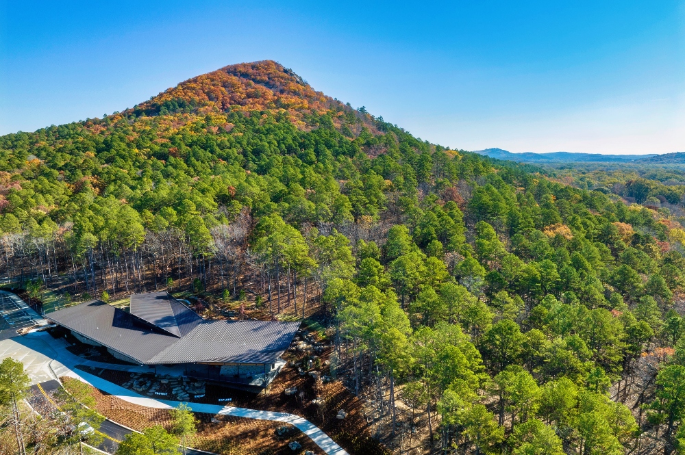
Where the Burn Will Occur

The burn will take place within Pinnacle Mountain State Park at 9600 Highway 300, Roland, AR, focusing mainly on slopes and forest surrounding the mountain itself. These areas include rugged terrain that naturally accumulates dead vegetation, making it an ideal target for prescribed fire work.
What Visitors Need to Know About Closures
To keep the public safe, some of the most popular trails around Pinnacle Mountain are expected to close on active burn days. According to the announcement, the following will be closed:
- West Summit Trail
- East Summit Trail
- Base Trail
- Lichen Link Trail
- Owl Pass Trail
- General area surrounding the mountain
A few areas are expected to remain open if conditions allow:
- Visitor Information Center
- West Summit parking area
- Playground
- Kingfisher Trail
- Monument Trails (Mountain Bike Trails)
- The Arkansas Arboretum
Visitors planning to hike or explore the mountain during the burn window should check park social media or call 501 869 5806 before heading out. Arkansas State Parks notes that closures will depend on day of weather conditions and fire behavior.
Smoke and Travel Impacts
Because Pinnacle Mountain sits within view of many central Arkansas communities, smoke may be noticeable at various points during the burn. The release notes that smoke may be visible from:
- Pinnacle Mountain State Park and surrounding communities
- Highway 300 and nearby roadways
- Portions of the Little Rock metro area
Drivers are encouraged to slow down, use headlights when needed, and watch for Arkansas State Parks personnel and equipment along roadways.
Why Prescribed Fire Matters

Prescribed burns are one of the most important tools in forest and habitat management. Arkansas State Parks outlined four core reasons for using fire on the landscape:
- Reduce the buildup of dead vegetation that can fuel more severe wildfires
- Maintain and restore native plant communities
- Improve wildlife habitat
- Enhance overall forest health and resilience
Trained fire crews will conduct the operation using a site specific burn plan and established safety standards to ensure the work meets ecological goals while minimizing impacts to visitors.
Pinnacle Mountain is one of the most visited outdoor recreation sites in the state. This planned burn is part of the ongoing work required to keep the park safe, healthy, and resilient for the millions of hikers, trail runners, paddlers, and families who visit each year.

ArkansasOutside.com will continue to share updates as conditions and schedules develop.
This article was originally published on ArkansasOutside.com, your trusted source for outdoor news and updates in The Natural State. Unless otherwise credited, all photos included in this piece are the property of Arkansas Outside, LLC. We take pride in sharing the beauty and adventures of Arkansas through our lens—thank you for supporting our work!
