


New four-mile stretch of regional trail marks beginning of 65-mile corridor connecting Little Rock to Hot Springs
LITTLE ROCK, Ark. (April 15, 2025) – Pulaski County officials, trail advocates, and community members gathered Tuesday morning near Iron Horse Church on Chicot Road to celebrate the ribbon cutting for Phase One of the Southwest Trail—a long-anticipated multi-use path that will eventually connect Little Rock to Hot Springs.
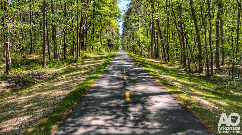
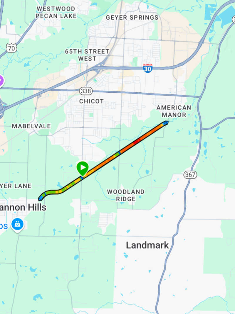
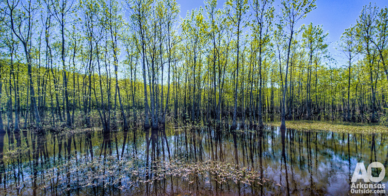
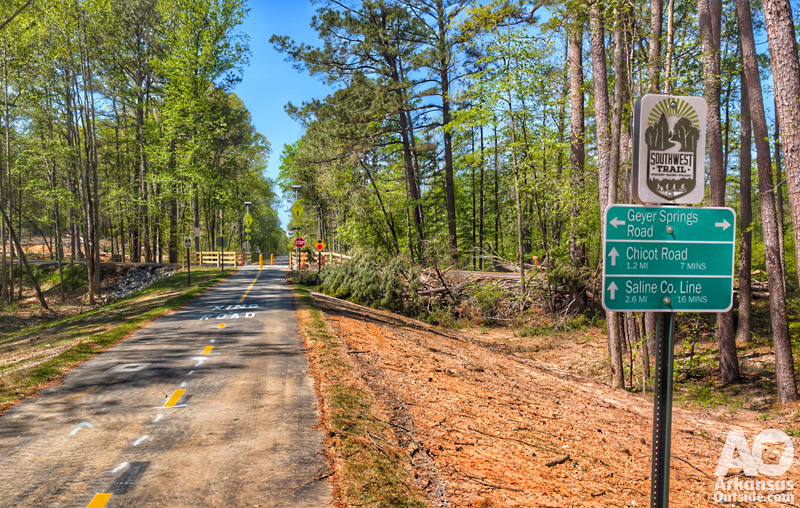
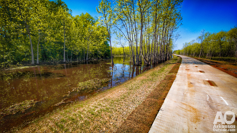
The newly opened segment spans approximately four miles, running from the Saline County line, crossing Chicot Road and Geyer Springs Road, and ending at Hilaro Springs Road. Built along an abandoned railroad bed, the trail is mostly flat and straight, weaving through wooded areas and wetlands.
A Vision Decades in the Making
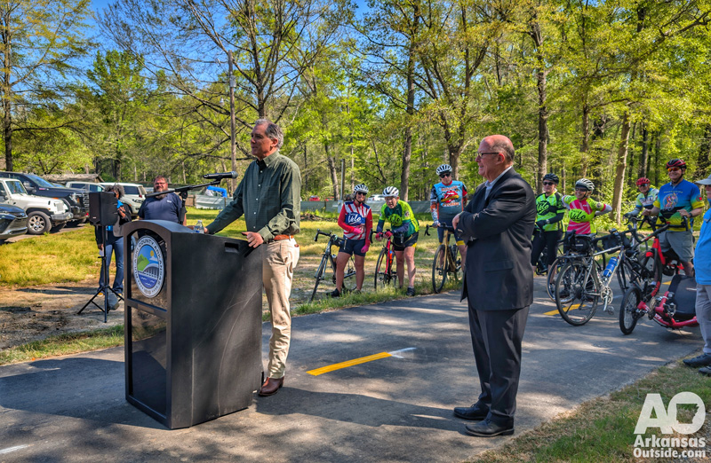
Pulaski County Judge Barry Hyde led the ceremony, recognizing the milestone as the result of years of planning, collaboration, and vision.
“This is not just a recreational project,” said Hyde. “It’s about connecting communities, promoting health, and creating new opportunities for economic development.”
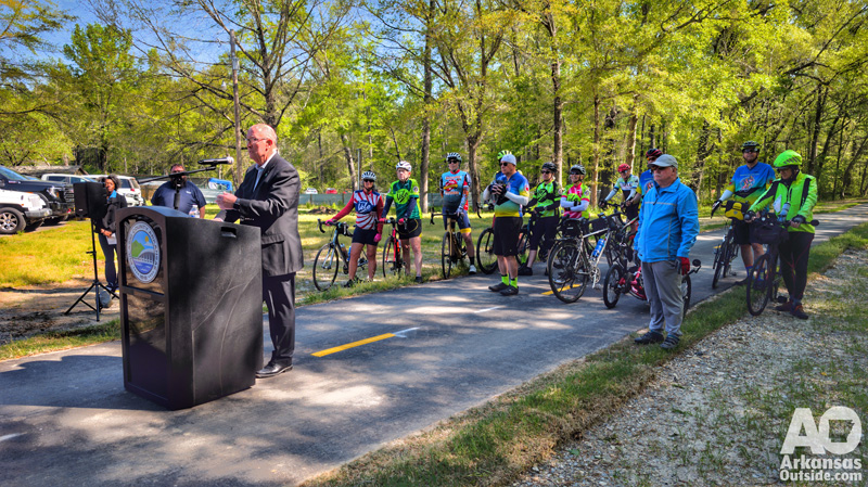
Judge Hyde was joined by U.S. Congressman French Hill and Bicycle Advocacy of Central Arkansas Vice-President Joe Jacobs, both of whom emphasized the Southwest Trail’s potential to transform regional transportation and recreation.
“It’s infrastructure that serves people,” said Jacobs. “Whether you’re commuting by bike, going for a jog, or exploring nature with your family—this trail gives us all a new way to experience Arkansas.”
The video below features all of the speeches:
Trail Features and Future Phases
The first phase offers a paved, multi-use route accessible to walkers, runners, and cyclists. Though mostly straight, the trail’s setting through wetlands and tree-lined corridors gives users a scenic and immersive outdoor experience, even within city limits.
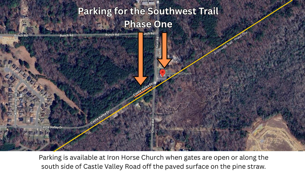
Update: Parking is available at the Iron Horse Church, 12611 Chicot Rd, Little Rock, AR when the gates are open, otherwise, park along the south side of Castle Valley Road off the paved surface on the pine straw. DO NOT attempt to park on Chicot Road or block the church gate.
Ultimately, the Southwest Trail will stretch 65 miles across Pulaski, Saline, and Garland counties, linking Little Rock and Hot Springs with a safe, continuous trail system. The completed route is expected to become a major recreational and transportation asset, much like the Arkansas River Trail, but with even broader regional impact.
Economic and Community Impact
The Southwest Trail has long been championed as a catalyst for economic development, tourism, and public health. Officials expect it to increase nearby property values, draw outdoor enthusiasts from across the region, and provide underserved communities with new access to outdoor infrastructure.
Planning for the trail began more than a decade ago, sparked by local interest in repurposing the historic Rock Island rail line. Since then, the project has evolved through public input, environmental review, and multi-jurisdictional cooperation. Funding has come from a mix of federal grants, local investment, and private partners.
More to Come
Tuesday’s ribbon cutting marks the first completed segment of a much larger project. With several phases still to come, supporters see this moment as a key milestone in building the full trail—and building momentum. Judge Hyde said that the next phase will be from Hilaro Springs Road to Baseline to be followed by another phase between Baseline Road and 65th Street. Eventually, the Pulaski portion would go to Central High School. The original Federal planning grant was awarded for alternative transportation routes between National Parks. This trail will eventually connect Central High School Historic Site and Hot Springs National Park. Each county, Pulaski, Saline, and Garland, are responsible for trail construction within their own jurisdictions. Saline County is currently working on their first section of the trail.

Judge Hyde also mentioned that this is the first Greenway facility of this type south of I-630.
“This is just the beginning,” said Hyde. “The Southwest Trail will be one of the defining features of our region—and it starts right here.”
Read more about the Southwest Trail on the Rails-to-Trails website and our previous article.
15 Responses
when is the projected completion date for the completion of the trail?
Saline County is currently constructing the next section south and Pulaski County hopes to be bidding the next section north later this year. As far as being completed from Central High School to Hot Springs, that will be years, I expect the Pulaski County section to be done in the next year or two and Saline County shortly behind that. Garland County is way behind on getting any trail completed outside of Hot Springs.
Is the open section uploaded to any map apps like Strava or Trailforks?
I just created a Trailforks map of the open section. https://www.trailforks.com/trails/southwest-trail-pulaski-county-phase-1/
I just went to ride the trail but church parking is closed with bar and stop sign. Do you know of any other parking access?
I’ve contacted Pulaski County about alternatives. I’ll update when I hear something. Thanks.
Who in Garland County is responsible for getting their part started?
Contact the Garland County Judge, Darryl Mahoney. 501-622-3600
Thank You ! I will
Not trying to blast anyone, I respect all land owners and their choice. However, the Iron Horse Church does not appear to be sharing their parking lot as reported. I just drove there in hopes of riding the new trail and they have a locked gate.
church parking was closed off by gate and stop sign.
Check the article for an update on the parking situation.
There needs to be parking in the Chicot/Heinke Rd trail. Who wants to park on Castle Rd just to have your vehicle vandalized:(( There’s NO parking on Heinke Rd.
there are several trees down on the trail
Let the county (counties) know.