


Pulaski County leaders say construction momentum is strong on two major active transportation corridors, the Southwest Trail and the Southeast Trail. In a meeting this week, Pulaski County Judge Barry Hyde provided updates on funding, design, and construction schedules for both projects, which aim to expand regional connectivity and improve safe walking and biking options across central Arkansas.
Southwest Trail
The Southwest Trail originated with a federal planning grant from the Federal Lands Access Program. The program supports transportation routes that improve access to national parks and historic sites. Pulaski, Saline, and Garland counties secured the grant in 2017 to design a multiuse trail connecting the Central High School National Historic Site in Little Rock with Hot Springs National Park. The project met the federal requirement that the route link two federally significant sites.
The grant funded comprehensive planning and engineering valued at an estimated $3.26 million. Local partners shared costs after the federal contribution. The long term goal is a continuous corridor for bicycling and walking that fosters recreation, tourism, and alternative transportation between two of Arkansas’s most visited destinations.
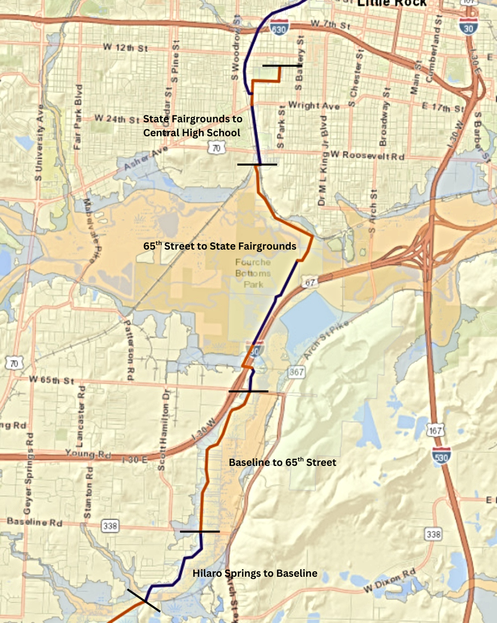
Judge Hyde said the construction of Pulaski County’s portion of the Southwest Trail is fully funded from the Saline County line to Central High School. Funding sources include federal grants administered through the Arkansas Department of Transportation and MetroPlan. This includes some of the funding mentioned in this article.
The first completed segment, from the Saline County line to Hilaro Springs Road, opened in April 2025. The next segment, running from Hilaro Springs Road to Baseline Road, has been engineered and approved. It is expected to go out for bid in March 2026 with construction beginning in April or May. Hyde said he hopes to see this section finished by the end of 2026. A major bridge on this stretch has already been built using a separate grant and will be set in place during construction.
The segment from Baseline Road to 65th Street is expected to begin construction this summer. Around the same time, work is also expected to begin on a northern section from Central High School to the Arkansas State Fairgrounds.
The remaining section between 65th Street and the State Fairgrounds is in design with construction targeted for early 2027. It is possible that the Pulaski County portion of the Southwest Trail to be complete by 2028.
Southeast Trail
The Southeast Trail is an emerging active transportation corridor that will eventually link the Arkansas River Trail in downtown Little Rock with communities in the southeastern part of the county, including College Station, Sweet Home, Wrightsville, and nearby rural areas. The project supports a countywide vision to expand safe biking and walking options in communities that have lacked connected infrastructure for decades.
Early planning focused on using existing rights of way to connect schools, neighborhoods, parks, job centers, and other destinations. When complete, the Southeast Trail will provide a protected route into Little Rock, support community health, and strengthen mobility choices across central Arkansas.
The existing Southeast Trail begins at the Arkansas River Trail near the William J. Clinton Presidential Center. It follows the river levee east to a point just past East End Park at Sixth Street. Design is complete for a continuous route to the Bill and Hillary Clinton National Airport terminal.
Judge Hyde said the next construction phase is expected to begin this summer. This segment will extend the trail east along the levee to Temple Road, then turn north along the north side of Temple Road as it curves around the airport runway and reaches the wastewater treatment plant. (see map below)
The following section will continue along Temple Road and cross the road before the airport taxiway underpass. The trail will pass through the underpass on the west side after the removal of existing sidewalks and a planned eastward shift of Airport Road. A protected trail will be added on the west side of the roadway. After exiting the underpass, the trail will continue to the airport terminal.
Additional phases will extend the Southeast Trail from the airport area along the terminal exit drive to East Roosevelt Road. From there, future segments will continue southeast, mostly along levees, to Terry Lock and Dam Park and eventually to the Jefferson County line.

Watch for upcoming articles on the Saline and Garland County sections of the Southwest Trail.

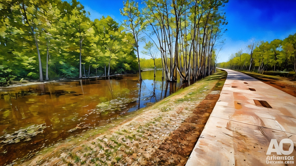
Lead photo is from an open section of the Southwest Trail west of Hilaro Springs Road.
This article was originally published on ArkansasOutside.com, your trusted source for outdoor news and updates in The Natural State. Unless otherwise credited, all photos included in this piece are the property of Arkansas Outside, LLC. We take pride in sharing the beauty and adventures of Arkansas through our lens—thank you for supporting our work!
