
Okay, where did I leave off? Oh yes, waking up on a glorious day in the Ouachitas. We slept pretty well the previous night and got a slow start breaking camp. I think it’s actually easier to get moving when you don’t sleep well. We had a good breakfast of oatmeal to fill us for the climbs we were in for today. Remember from Part 1 we did one climb the night before and we had 5 more to go today before we made camp again.
After checking our campsite for anything we might have left behind, we headed out at about 10 am, an hour behind our goal. Our first challenge of the day would be the climb up to a saddleback next to Brush Heap Mountain. The hike along the way followed a beautiful creek for about 3/4 of a mile and then we started up. I was leading and stepped over snake without noticing. Lisa and David saw it and were able to get a photo of the little bugger. We took a quick break at the top and then found the hike down a bit more punishing. Our feet were becoming a bit bruised but we were moving fast. We realized that we did not bring a lunch for the next day so we wanted to get as far as possible today and hike out after breakfast in the morning.

We soon passed the West Blaylock Trailhead at Forest Road 106. This made it 4.9 miles until we turn east on the Little Missouri Trail. Almost immediately we had another boots-off stream crossing. We were getting pretty good at these by now. It was time again for another ridge crossing, this one over the Leader Mountains and another fast steep downhill hike down to Brier Creek. Quick note, when heading North on the Athens-Big Fork Trail the trail turns left (west) at Brier Creek. Blazes going to the right look to be from an ATV trail.
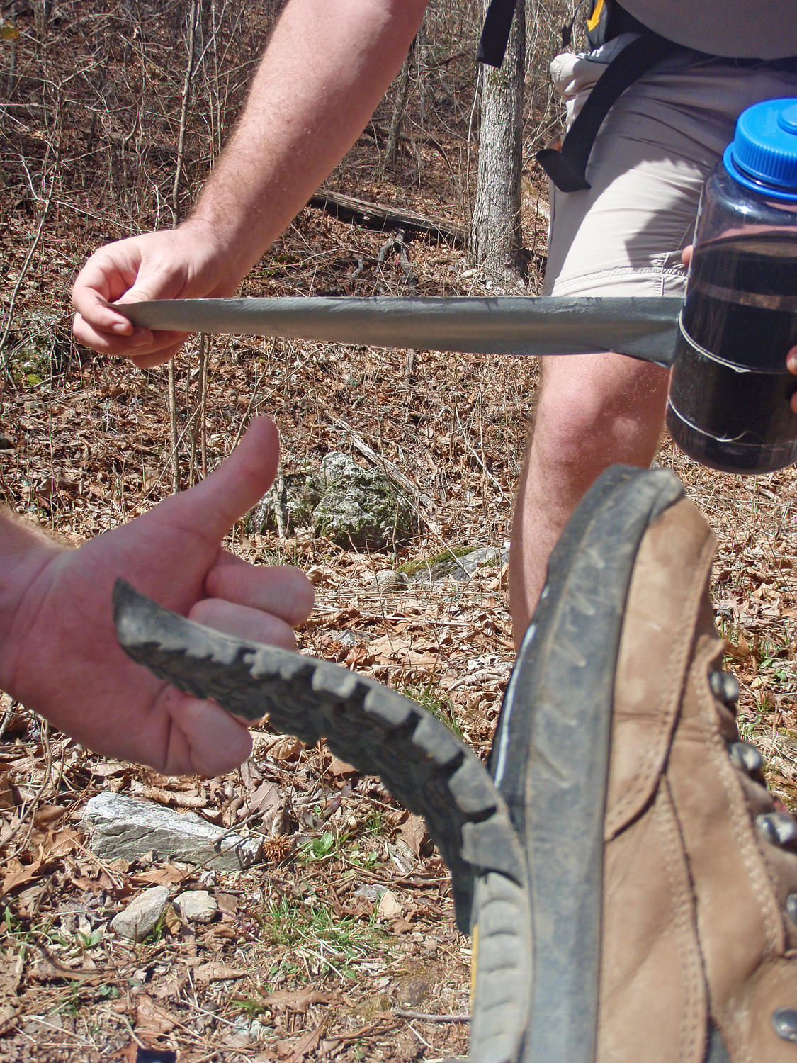
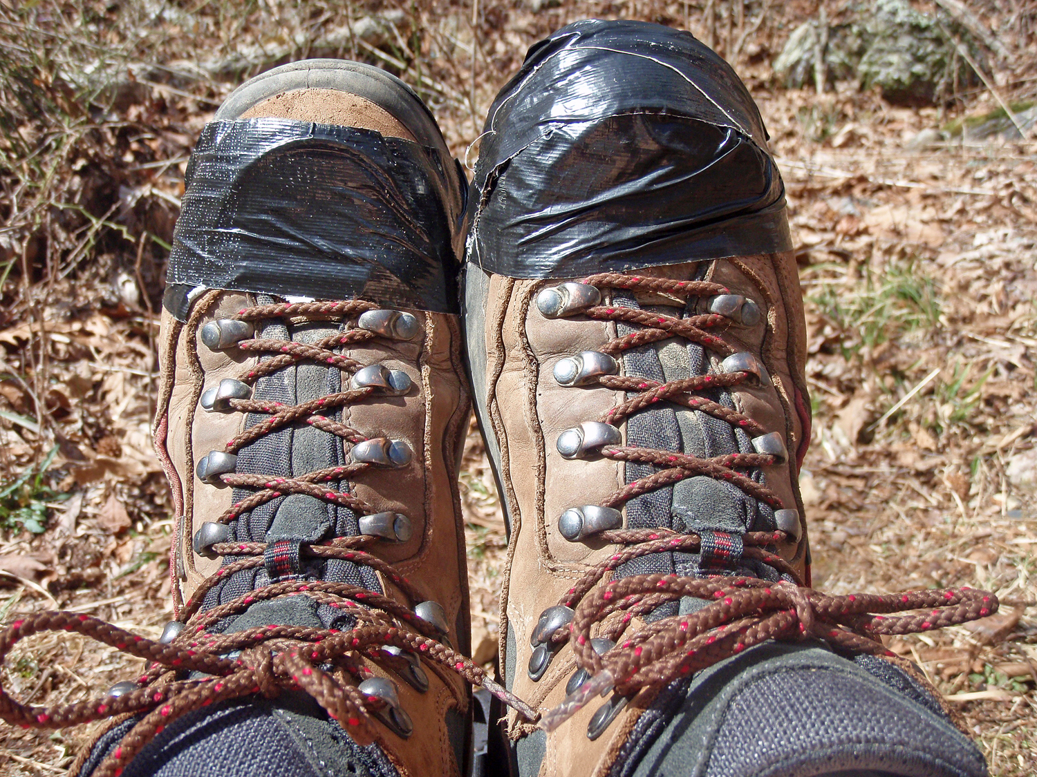
After traveling west along Brier Creek for a little while, I heard an uh-oh behind me. I turned to see that one of Lisa’s soles had come off the bottom of her boat. It was obvious the other was going. Seven years is a reasonable life for a good pair of hiking boots. The timing was a bit off for us as by my calculation we were at our farthest point from the car. The good news? Duct Tape! I had some black duct tape wrapped around my water bottle that had been there for years. We wrapped her boats to hold the soles on, crossed our fingers and moved on.

We soon crossed over the Brier Creek Mountains, our third ridge of the day. Despite Lisa’s boot issues we were still making good time. The next downhill took us into a camping area on long creek. The area was obviously popular with ATV and four-wheel drive vehicles. We stopped to eat a quick lunch and refill water bottles. We were dismayed by the amount of trash in the area. I don’t think this was backpacker trash since most backpackers don’t carry cases of beer and soda into the wilderness. I don’t understand why if you can bring full bottles of beer, sodas and water, you can’t carry them out empty. Most of the trail system seems to be very clean, but areas like this really bother me. This is not a conservationist, Sierra Club message just a wish that people could have a little more respect for the places they obviously like visiting. Wouldn’t hurt to have a little respect for those of us that may visit after you. Enough of the soapbox, Really, this area stood out because the rest of the hike was beautiful.

After crossing Long Creek, we went straight up McKinley Mountain. This may have been one of the toughest climbs of the day. It was very exposed with a lot of loose rock. David compared it to hiking in sand. It was a long slow pull on a full stomach. Another quick downhill to Straight Creek and then one final uphill near Hurricane Knob. Funny, it was really windy up there. Then down for the last bit of the roller coaster.

Late afternoon and we had made it to the Little Missouri River. Time to turn to the east. We figured we would camp somewhere near Little Missouri Falls, 4.1 miles ahead. We were really glad that Lisa’s boots had made it through all the climbs. The plan was to make them last as long as possible before she would have to shed them and hike the remainder in her Keens. We hiked on with several more river crossings on the Little Mo. We had plenty of daylight and just kept hiking. This section of the trail is beautiful and we kept pushing on. Finally, we came to a concrete bridge with a campground next to it. It wasn’t as nice as the campsite from the night before but it would certainly do. We got the campsite set up, collected some firewood and settled in for a dinner of Jambalaya with summer sausage followed up by Russell Stover samplers for dessert. We decided to go to bed early so we could get an earlier start the next morning.
I woke up pretty early, got bundled up and sat outside in the dark to enjoy daybreak in the woods. I noticed a campfire burning down river a little ways and saw a headlamp moving around. I love listening to the woods wake up in the morning so I just sat next to a log, listening to birds trying to make themselves heard over the water rushing over the rocks. Eventually I heard David and Lisa stirring so I got up and started to collect our gear, get our food from where I had hung it off the bridge over the river and basically get ready for our last day of hiking.
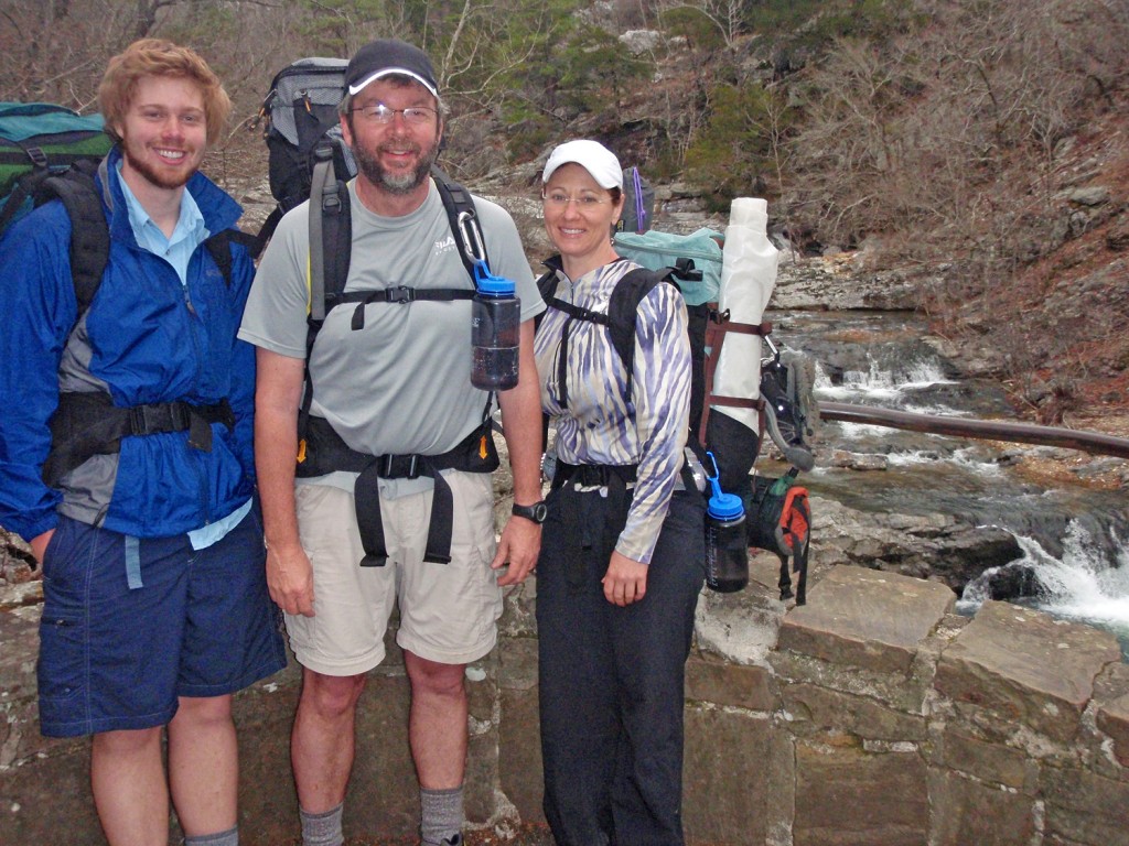
A quick breakfast and pack up and we were on our way. I was curious to see if there really had been a campsite down the river. Within minutes, we walked into the Little Missouri Falls Recreation Area. This is really a beautiful area. Although no one else was there I figured someone had spent the night there, that would explain the campfire. We stayed around long enough to get a few photos and enjoy the falls. The sky was overcast and so far Lisa’s boots were holding out so we decided to head on down the river. We had about 6 miles to get back to the car.
We hiked quickly enjoying the views of the river. Several more river crossings brought us to what looked like the toughest crossing of the trip. Another couple was there looking like they were on a day hike. After finally getting across we talked with the other hikers for a bit and found out they were on their first backpacking trip. They left from the parking lot the day before in the opposite direction as us. After hiking to Little Missouri Falls where they camped for the night (yes, it was their campfire), they decided to hike without packs back to the car and then drive around and pick up their gear. Luckily they weren’t beaten by backpacking and spoke as if they would try it again starting off with shorter easier hikes.
We moved on quickly and soon the sun came back out. We got within a mile of the car and decided that we were done with the boot-off water crossings. Lisa’s boots were still hanging on and we just walked through all that were left. It was a grand finish. We had gotten back in time to drive as far as Benton before we decided to stop for a late lunch at Brown’s Buffet. A great trip that had been long overdue.

This loop hike is wonderful. Be prepared for lots of stream, river and creek crossings. Be ready to make several tough climbs. There are a lot of campsites along the trail, usually near water. Although I usually prefer to camp farther from the water it seems best to utilize the sites that are there instead of creating new ones. Be prepared and have a great time.





2 Responses
Nice report! Different type of terrain than we see in the Pacific Northwest, but it definitely looks like a great trip!
Very nice !! We did the ridges first and got that over with going counter-clockwise.
Pretty rough on the feet with all the crossings and rocks, but great feeling when done and beautiful on the way.
Did you get your patch?
You can email the Ranger District and they will send you an awesome patch.