
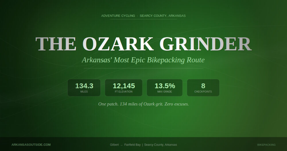


Adventure Cycling · Searcy County, Arkansas
One patch. 134 miles of Ozark grit. Zero excuses.
GILBERT, Ark. — Finishing a long bicycle route is its own reward. But sometimes a little extra motivation is in order, and Searcy County has come up with a compelling one: a completer patch for anyone tough enough to ride the Ozark Grinder Trail from start to finish.

“You will be hard-pressed to find a more epic route in Arkansas.”
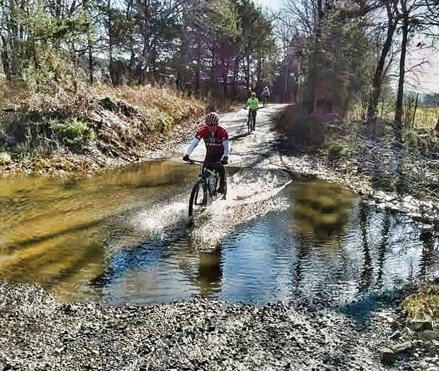
With 12,145 feet of total elevation gain and a maximum grade of 13.5%, this is not a Sunday afternoon cruise. The route crosses multiple surfaces, paved roads, gravel, U.S. Forest Service roads and river beds, and includes a number of water crossings that demand scouting before any attempt. Think of it as the Ozarks’ version of a one-day suffer-fest, offered up on a rolling platter of limestone ridges and hardwood hollers.
How to Earn Your Patch
To receive an official completer patch, riders must document their journey with mandatory selfies at eight checkpoints along the route. Upon finishing, GPS data from Strava or a similar app must be emailed to route certifier Dirk Merle at d.merle@hotmail.com. Merle will verify completion and officially record each rider’s time.
The eight mandatory photo checkpoints, in route order, are:
- Gilbert General Store — the starting-line landmark at the Buffalo River
- Richland Creek Bridge — a favorite scenic pause on the route
- Richland Waterfalls Welcome Center in Witts Springs
- Wades Convenience Store in Leslie — stock up while you can
- Oxley General Store — a classic crossroads stop
- Red River low-water bridge at Lydalisk
- Shirley Railroad Bridge — one of the route’s most photogenic moments
- Fairfield Bay Cobblestone Hotel — the finish line
The Rules of the Road
Official Participant Rules
- Get the selfies. All eight checkpoint photos are required for official completion.
- Follow the route and submit your GPS data to Dirk Merle for official review.
- Self-supported effort. Riders may accept trail hospitality and random acts of kindness, but may not solicit outside assistance. Shopping at any business open to the public is permitted.
- Safety first. If a rider needs help, asking for it is always the right call — the finish simply won’t be recorded as official. No patch is worth a medical emergency.
- GPS must run continuously. Start the GPS at the beginning and do not pause it during the attempt. Stop it only upon reaching the finish, then submit the uninterrupted file.
Fastest Known Times
For competitors chasing more than a patch, the Ozark Grinder maintains official Fastest Known Times across six categories. Overnight lodging is permitted for all FKT attempts.
| Age Group | E-Bike | Non-E-Bike | Single-Speed |
|---|---|---|---|
| Male & Female (Under 60) | ✓ Tracked | ✓ Tracked | ✓ Tracked |
| 60+ Seniors | ✓ Tracked | ✓ Tracked | ✓ Tracked |
Know Before You Go
The Ozark Grinder is not a race with a start gun and aid stations. It is an individual time trial through some of the most remote and visually stunning terrain in the central United States. Riders should carry everything they need for repairs, to both themselves and their bikes, and plan resupply stops carefully around the limited services available along the route.
The multi-surface nature of the route demands a versatile setup. Most riders opt for a gravel or hardtail mountain bike capable of handling loose gravel, rutted forest roads and, yes, the occasional rocky riverbed. Bikepacking bags rather than a traditional rack-and-pannier system are strongly recommended for the terrain involved.
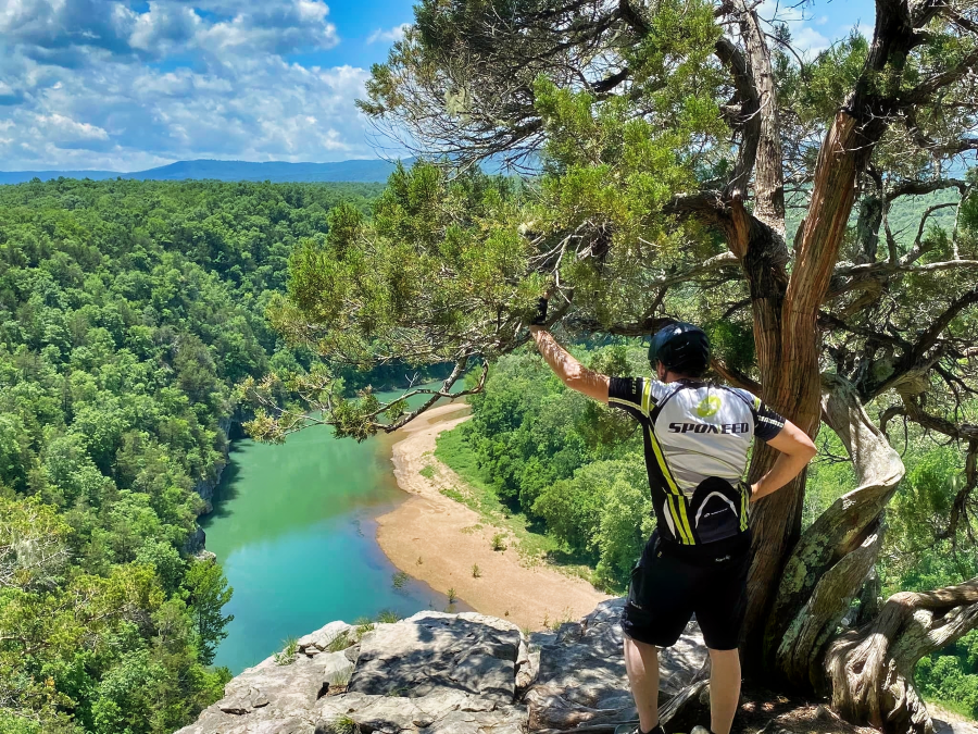
The scenery, however, more than compensates for the suffering. The Ozark Grinder threads through some of the least-traveled corners of Searcy County — a part of Arkansas that still feels genuinely wild. Expect towering hardwood ridges, clear Ozark streams, century-old general stores and the kind of quiet that only exists far from an interstate highway.
Plan Your Ride
Ready to Grind?
View the full route map on RideWithGPS, then check Searcy County’s bikepacking page for the latest conditions and information.
To submit a completed ride or ask questions about the route, contact certifier Dirk Merle at d.merle@hotmail.com. Include GPS file, checkpoint selfies and your category when submitting.
The Ozark Grinder Trail is open year-round, though spring and fall offer the most favorable conditions. Summer heat in the Ozarks can be punishing, and winter cold requires serious preparation. Whenever a rider chooses to go, the patch is waiting — and the Ozarks will make sure they earn it.
