

Estimated reading time: 9 minutes
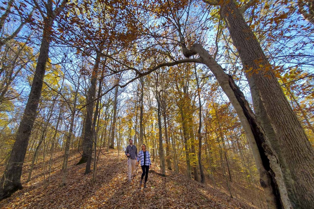
Fall hiking season is almost here in Arkansas, but leaf-peepers may want to adjust their expectations this year.
Arkansas enters fall 2026 after an exceptionally dry stretch. According to the National Integrated Drought Information System, January through August was the 10th driest such period in Arkansas since recordkeeping began in 1895. August alone finished 1.55 inches below normal precipitation.
The dry weather has already affected Arkansas forests. University of Arkansas System Division of Agriculture forestry experts reported early leaf drop during the summer as trees responded to drought stress. Some hardwoods have simply turned brown and dropped leaves rather than waiting for fall.
That doesn’t mean Arkansas won’t have fall color. It does mean the show could be more unpredictable than usual.
What to Expect From Arkansas Fall Color in 2026
Moisture, temperature, sunlight and tree species all play a role in fall color. Shorter days trigger the seasonal process, while cool nights and sunny days can help produce brighter colors.
Drought complicates things. Severely stressed trees may drop leaves early or go directly from green to brown. University of Arkansas Extension has previously noted that locations with more available moisture, including protected slopes, can fare better during dry years.
There is another wrinkle this year: timing.
One current 2026 foliage model forecasts Arkansas running about six days later than normal, with much of the state reaching peak color around the first week of November. The model puts some northern and higher-elevation areas ahead of the rest of the state. As always, these dates are estimates, and weather during October could change the schedule considerably.
The best strategy may be to stay flexible. Instead of planning one weekend weeks in advance, watch conditions and be prepared to head toward the part of the state showing the best color.
Here are seven Arkansas trails and hiking destinations worth keeping on your list.
Flatside Pinnacle
Located in the Ouachita Mountains west of Little Rock, Flatside Pinnacle provides one of the state’s great big-landscape views.
A short hike from Forest Service Road 94 leads to an overlook across the Flatside Wilderness. From the top, the view stretches across an almost uninterrupted forest toward Forked Mountain and the surrounding Ouachitas.
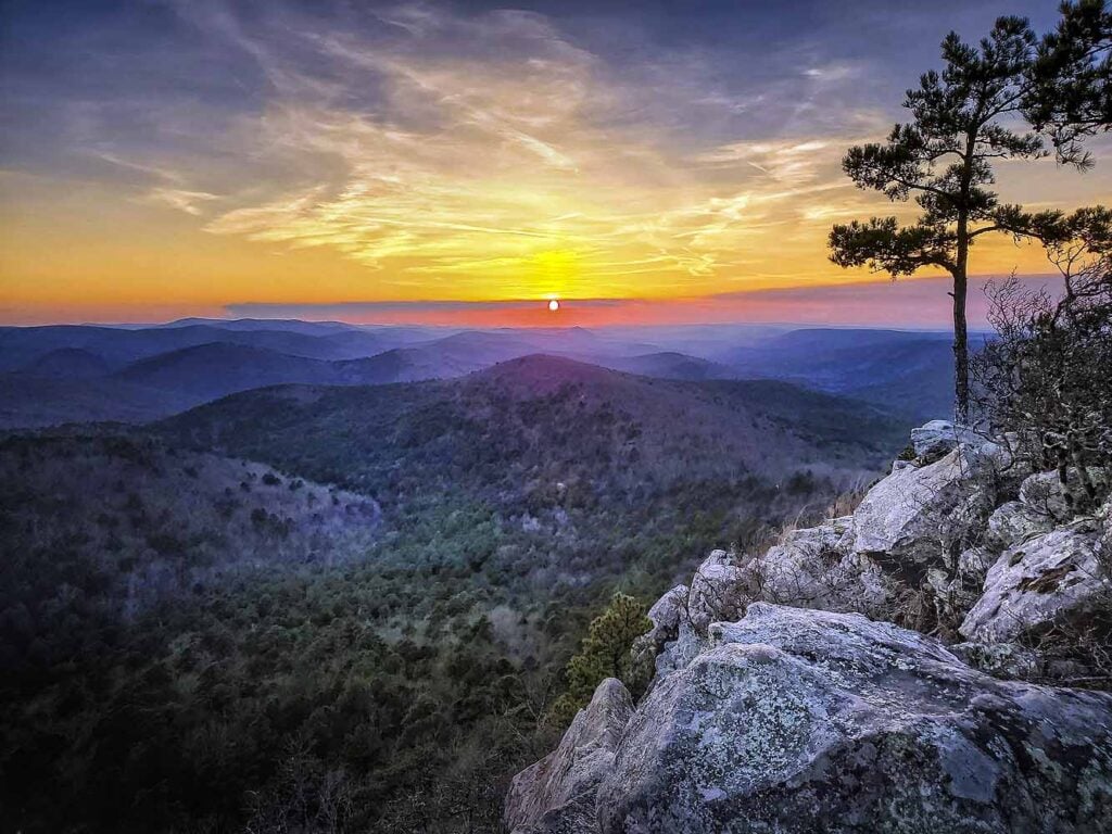
That broad view makes Flatside particularly useful in an unpredictable color year. Even if individual trees aren’t putting on their best show, the mixture of hardwoods spread across the mountains can provide plenty of autumn texture.
The Ouachita National Recreation Trail crosses Forest Service Road 94 just below the mountain.
Pro tip: Time your hike for late afternoon and stick around for sunset, but bring a headlamp for the hike back to your vehicle.
Cossatot River State Park-Natural Area
For a combination of fall color, rugged terrain and moving water, it’s difficult to beat the Cossatot River.
The Cossatot River Corridor Trail follows the river through approximately 13 miles of Cossatot River State Park-Natural Area in southwest Arkansas. Hikers can choose shorter sections or arrange a shuttle for a longer point-to-point adventure.
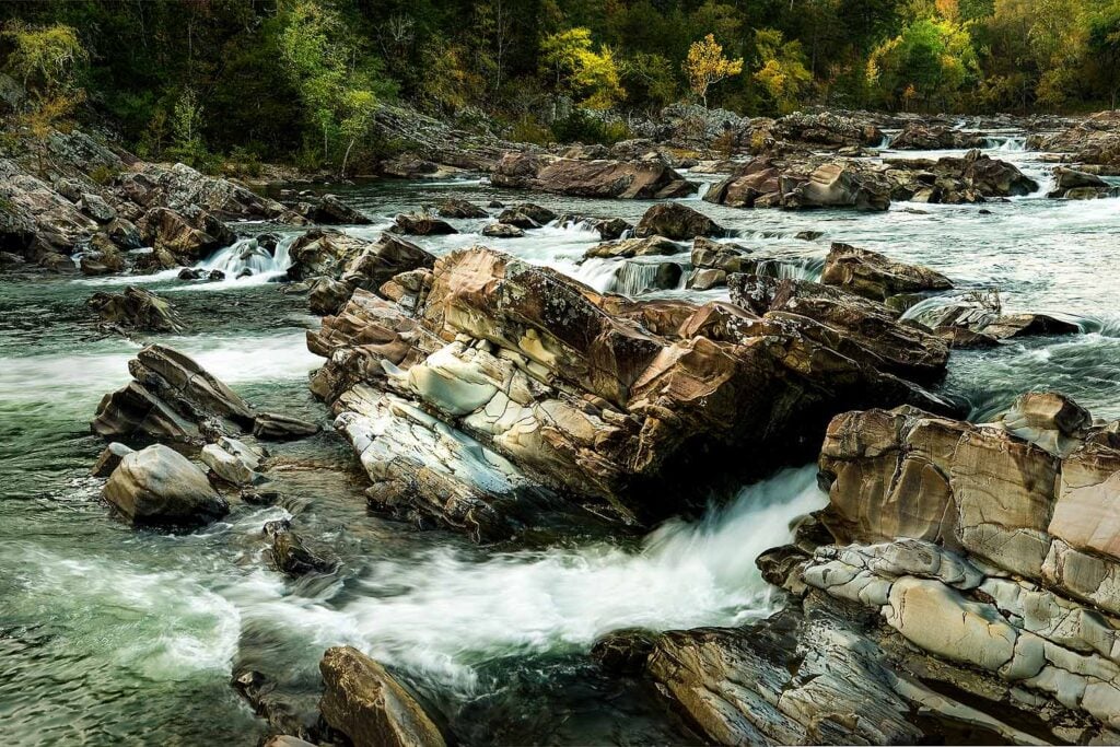
In a dry year, river corridors are especially worth watching. Trees growing near waterways and in areas with better soil moisture may experience less drought stress than trees on exposed ridges.
The combination of hardwood forest, exposed rock and the Cossatot River makes this a good destination even if 2026 foliage turns out to be less brilliant than usual.
Pro tip: Make time for Cossatot Falls. You can reach the area by trail or road, and the exposed rock and river provide one of the most distinctive landscapes in Arkansas.
Lake Ouachita Vista Trail
The Lake Ouachita Vista Trail, better known as the LOViT, follows the southern shore of Lake Ouachita through the Ouachita Mountains.
Several sections offer overlooks across the lake toward miles of forested mountains. One of our favorites can be reached from the Brady Mountain or Crystal Springs sections of the trail.
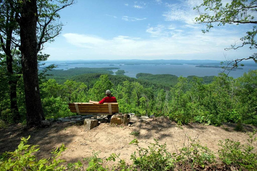
The combination of lake, mountains and hardwood forest makes this an especially interesting option during a dry fall. Lakeshores and drainages may retain more moisture than surrounding exposed slopes, potentially helping some trees hold their leaves longer.
The trail is open to hiking and mountain biking, so remember to share the trail.
Pro tip: If you want the view without the hike, drive to the Hickory Nut Mountain overlook off Highway 270 east of Mount Ida.
Cane Creek State Park
If drought limits the fall color in Arkansas’ mountains, Cane Creek State Park could be one of the places to watch later in the season.
Located near Star City, the park sits where the West Gulf Coastal Plain meets the Mississippi Alluvial Plain. The 15-mile Cane Creek Lake Trail winds through forests and wetlands, crossing more than 50 bridges, including three suspension bridges.
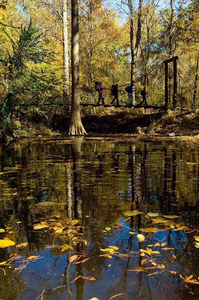
The lake and wetlands make this landscape very different from the rocky ridges of the Ozarks and Ouachitas. They also provide access to moisture that could become particularly important during a dry fall.
Because Cane Creek is in southern Arkansas, color generally arrives later here, extending the leaf-peeping season after northern Arkansas begins losing its leaves.
Pro tip: Unless you’re looking for the full 15-mile experience, consider turning around after crossing the third suspension bridge. The long levee section can feel a little repetitive on foot.
Village Creek State Park
Crowley’s Ridge offers one of Arkansas’ most distinctive fall landscapes.
Village Creek State Park near Wynne protects nearly 7,000 acres and offers an extensive network of hiking, mountain biking and equestrian trails through hardwood forest.
The ridge rises sharply above the surrounding Delta, creating an environment dramatically different from the flat agricultural landscape around it. Trail options make it easy to put together anything from a short walk to a longer day hike.
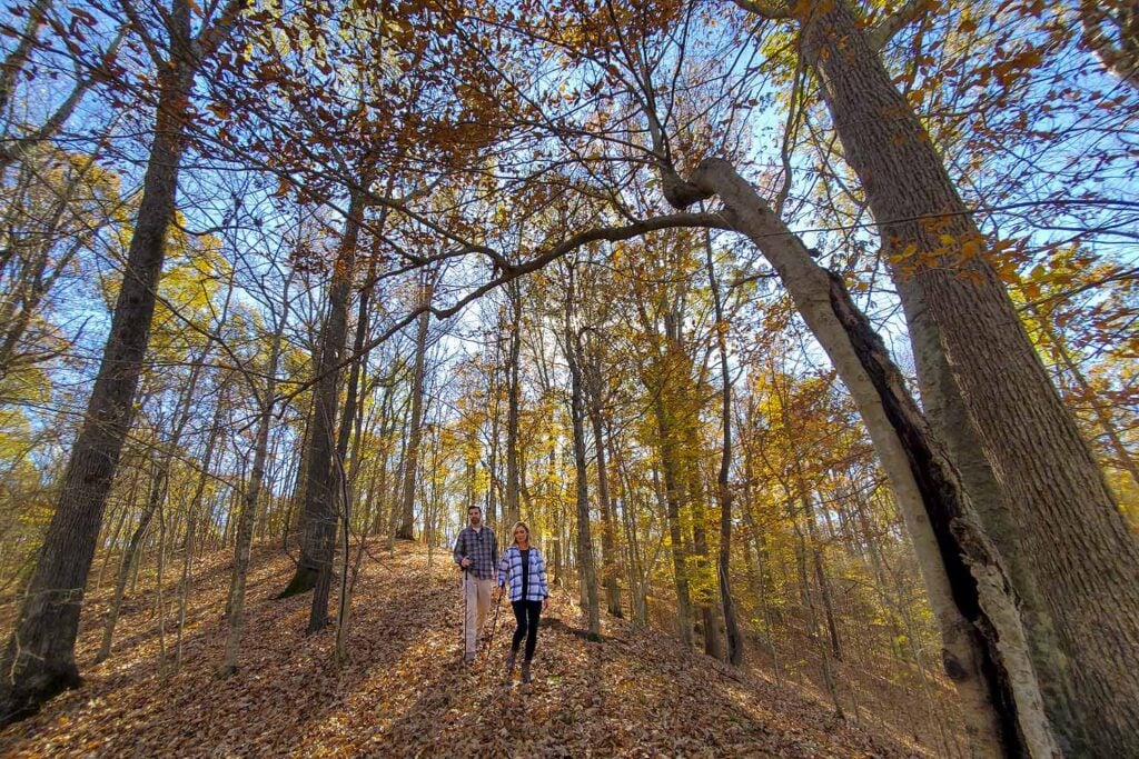
Look for sections of the historic Military Road, part of the route traveled by Native Americans during forced removals in the 1830s.
Pro tip: Check current trail conditions with the park before your trip and ask which sections are showing the best color.
Lover’s Leap Trail at Queen Wilhelmina State Park
Elevation can make a difference during Arkansas’ fall color season, which puts Queen Wilhelmina State Park high on our list.
The park sits atop Rich Mountain in the western Ouachitas. Lover’s Leap Trail begins near the lodge and provides expansive views across the surrounding mountains.
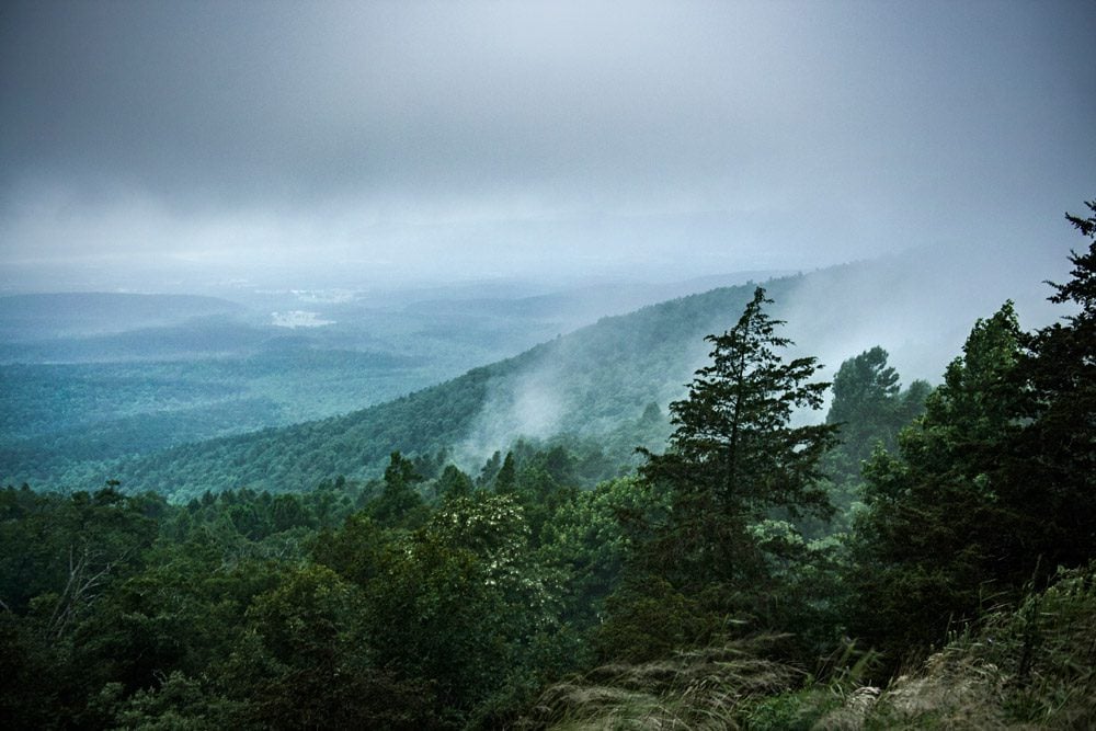
Because of the elevation, temperatures can be noticeably cooler than in lower parts of western Arkansas. That can make Rich Mountain one of the places to watch as the first significant fall color begins appearing in the Ouachitas.
The park is also located along the Ouachita National Recreation Trail, providing plenty of opportunities for hikers looking for a longer outing.
Pro tip: Even if you don’t hike far, the overlooks around the lodge and along the Talimena Scenic Drive make this an easy place to spend a full fall day.
Sam’s Throne
We couldn’t put together a list of Arkansas fall hikes without including at least one classic Ozark destination.
Sam’s Throne, located off Highway 123 in the Ozark National Forest, combines dramatic sandstone formations, hardwood forests and sweeping views of the surrounding mountains.
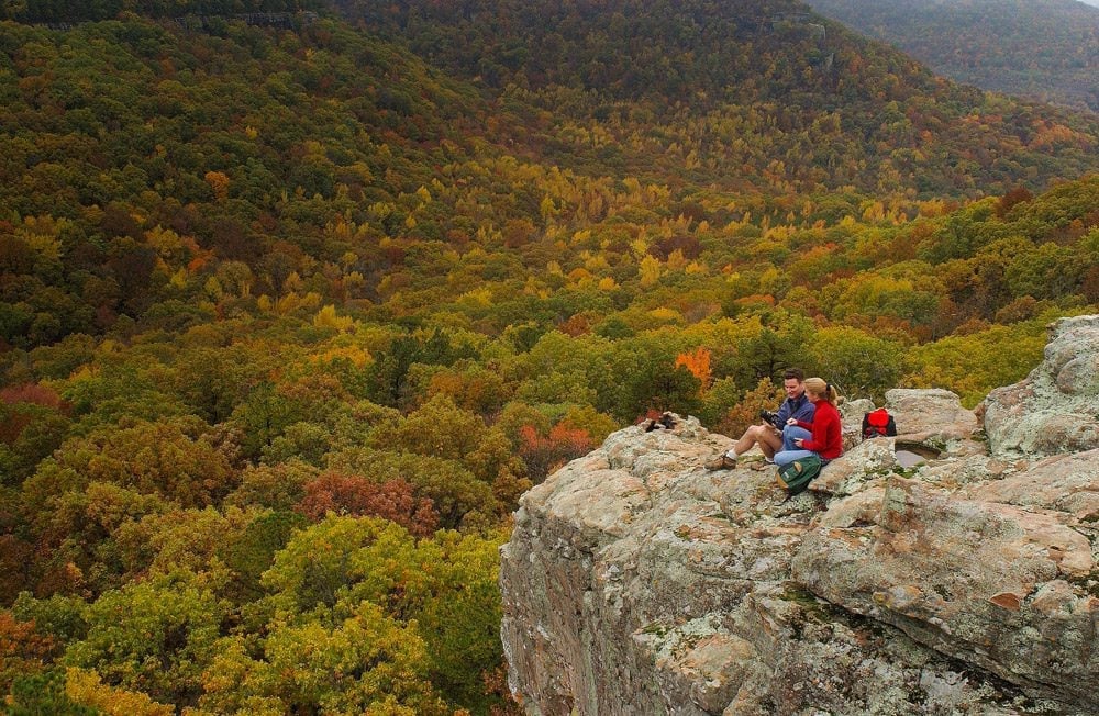
A relatively short hike provides access to overlooks where you can see across a broad section of the Ozarks. The area is also well known among rock climbers.
Because drought conditions have been significant across northern Arkansas this year, color could be less consistent than in a wetter fall. That makes the panoramic views at Sam’s Throne useful. You can see across different slopes, elevations and drainages rather than relying on one small patch of forest.
Pro tip: Add nearby Pedestal Rocks Scenic Area to your trip. It’s about a 30-minute drive away and offers another completely different Ozark hiking experience.
Be Flexible This Fall
Fall color is never an exact science in Arkansas, and 2026 may be particularly unpredictable.
The state’s long-running drought has stressed trees and contributed to early leaf drop in some areas. Arkansas also recorded its 21st driest August on record, and exceptionally dry soils remained a concern heading into fall.
That makes this a good year to follow the color rather than the calendar.
Northern Arkansas and higher elevations will generally be the first places to watch, followed by the Ouachitas and central Arkansas, with southern Arkansas extending the season later. Current foliage modeling suggests much of Arkansas could peak around early November, but rain, cold fronts, wind and frost during October could change that quickly.
And don’t automatically write off a dry year. Look toward lakes, rivers, creek valleys, north-facing slopes and wetlands, where trees may have had better access to moisture.
Most importantly, get outside. Even when the leaves don’t cooperate, cooler temperatures, fewer insects and Arkansas’ varied landscapes make fall one of the best times of year to explore the state’s trails.
Please practice Leave No Trace principles, stay on designated trails and check current trail, fire and weather conditions before heading out.
Photos courtesy of the Arkansas Department of Parks, Heritage and Tourism.
This article was originally published on ArkansasOutside.com, your trusted source for outdoor news and updates in The Natural State. Unless otherwise credited, all photos included in this piece are the property of Arkansas Outside, LLC. We take pride in sharing the beauty and adventures of Arkansas through our lens, thank you for supporting our work!