


Estimated reading time: 8 minutes
There are hikes with great views, and then there are hikes where the trail itself becomes part of the view.
The Goat Trail to Big Bluff, tucked into the rugged Ponca Wilderness along the Buffalo National River, belongs firmly in the second category. Reached by hiking the Centerpoint Trail, this roughly six-mile round trip takes hikers deep into the Upper Buffalo country before delivering them to a narrow pathway carved across the face of one of Arkansas’s most imposing bluffs.
It is spectacular. It is strenuous. And for anyone uncomfortable with heights, it can be downright intimidating.
That combination makes the Goat Trail our Arkansas Outside Trail of the Month.
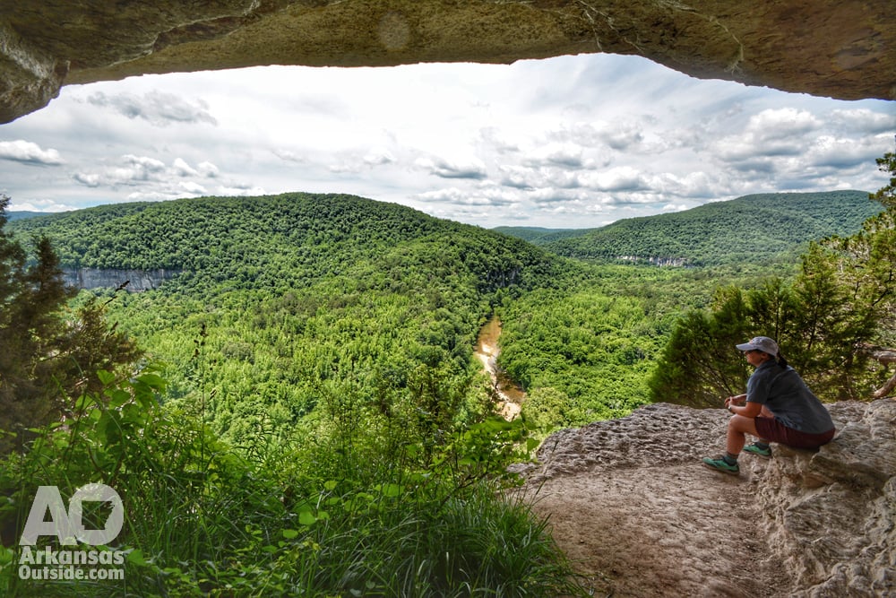
Trail at a Glance
Trail: Centerpoint Trail to Goat Trail and Big Bluff
Location: Ponca Wilderness, Buffalo National River
Trailhead: Centerpoint Trailhead on Arkansas Highway 43
Distance: Approximately 6 miles round trip
Route: Out and back
Time: 4 to 6 hours
Difficulty: Strenuous
Elevation gain on return: Approximately 1,000 feet
Dogs: Not permitted
Best for: Experienced hikers comfortable with heights
Facilities: No restroom at the trailhead
The National Park Service recommends carrying at least two liters of water per person, salty snacks, a detailed trail map, and wearing sturdy footwear.
The Hike Starts by Going Down
One of the things that makes the Goat Trail deceptive is that the beginning feels relatively easy.
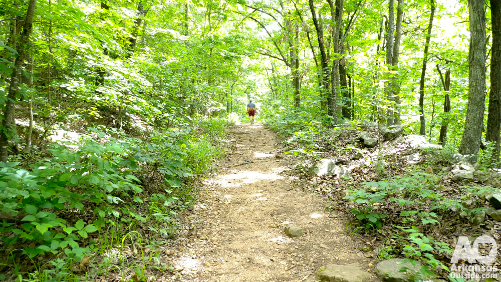
From the Centerpoint Trailhead, about three miles north of Ponca on Highway 43, hikers follow the Centerpoint Trail down an old wagon road into the Ponca Wilderness. The route descends steadily through the hardwood forests and rugged terrain that define the Upper Buffalo River country.
For approximately 2.5 miles, you are mostly heading downhill.
That is worth remembering.
Every foot of elevation lost on the way toward Big Bluff has to be regained on the return trip. The National Park Service estimates that hikers face about 1,000 feet of elevation gain coming back from Big Bluff.
The Centerpoint Trail is marked with yellow rectangular blazes labeled “CPT,” something hikers should watch carefully. Several other wilderness trails intersect the route, including connections to Chimney Rock, Sneeds Creek, Compton Loop and Hemmed-in Hollow.
Eventually, the route reaches the junction that changes the entire character of the hike.
Turn right, and you’re headed for the Goat Trail.
Then Things Get Interesting
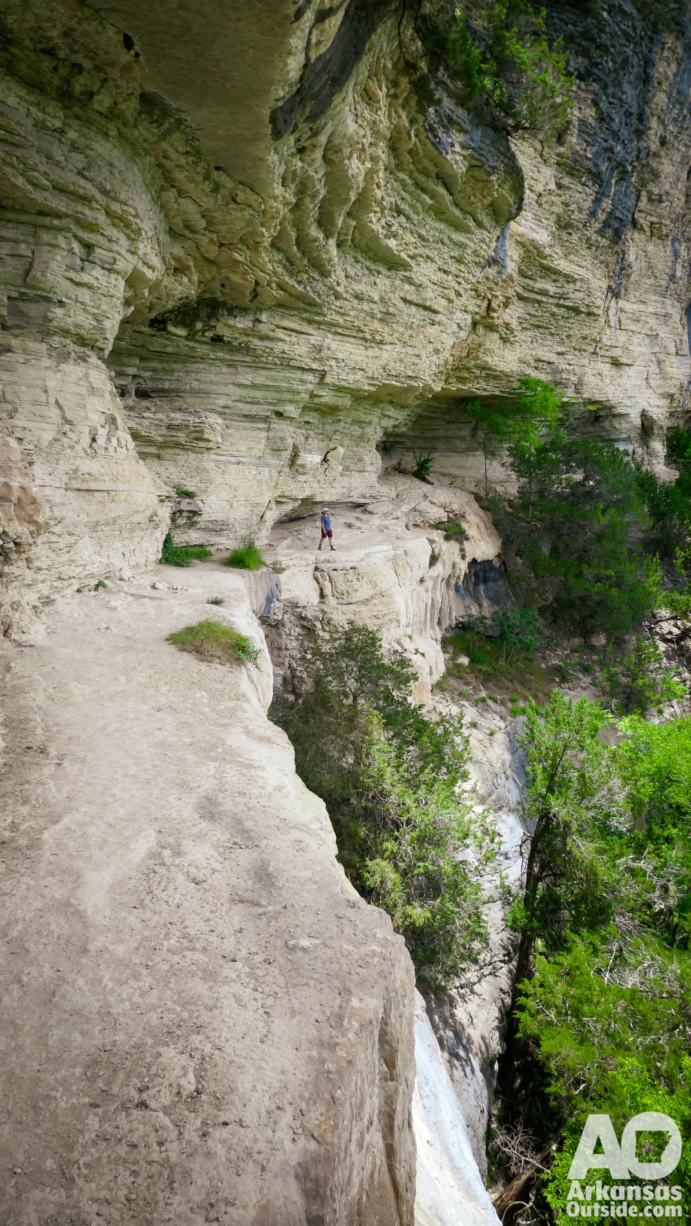
The Goat Trail is a spur off the Centerpoint Trail that works its way onto Big Bluff. As you approach the bluff, the wooded Ozark hike begins transforming into something considerably more dramatic.
Trees give way to exposed rock. The Buffalo River appears far below. And the trail narrows.
Very quickly, you understand why this hike has developed such a reputation.
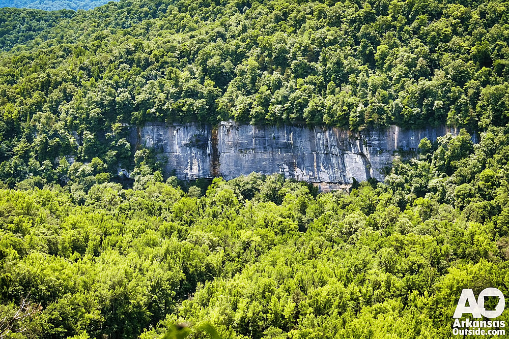
The National Park Service describes the Goat Trail as extremely narrow and running along the edge of a roughly 350-foot sheer cliff. It specifically does not recommend the hike for young children or people with a fear of heights.
This isn’t a place to rush.
The trail crosses exposed sections of Big Bluff where a mistake could have serious consequences. Hikers need to pay attention to every step, give others room to pass, and resist the temptation to take unnecessary chances for a photograph.
But the exposure is also what makes the Goat Trail unlike almost anything else in Arkansas.
A Front-Row Seat Above the Buffalo
Once you’re on Big Bluff, the scale of the Upper Buffalo becomes apparent.
Far below, the Buffalo National River curves through the valley. Across the river, forested ridges stack one behind another into the Ozarks. The bluff itself becomes part of the scenery, with massive layers of exposed rock extending above and below the trail.
It is the kind of place where you naturally stop walking.
On our previous Arkansas Outside hike to Big Bluff, we described the view as a panorama of the Buffalo River winding through a seemingly endless landscape of rolling hills and forest. The combination of height, exposed rock and wilderness gives the overlook a sense of scale that photographs have a difficult time capturing.
There is plenty to see closer to your feet, too.
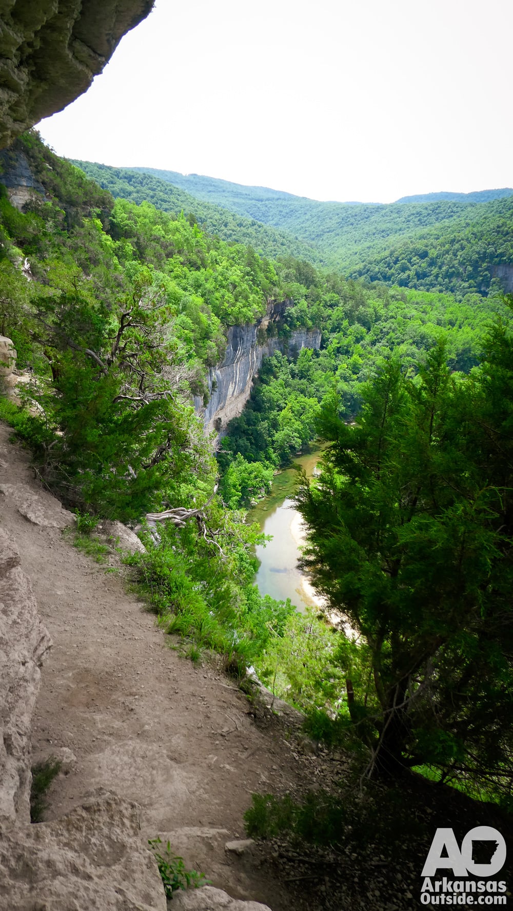
Buffalo Outdoor Center notes that old junipers cling to the rocky bluff, with some reportedly dated by the National Park Service at more than 800 years old. The Goat Trail name also has a bit of local history behind it. According to Buffalo Outdoor Center, the name comes from feral descendants of domestic goats brought into the area by early settlers. A few feral goats reportedly still roam the Upper Buffalo wilderness, although hikers are far more likely to encounter turkey vultures soaring around the bluff.
It’s a landscape that rewards slowing down.
The Hard Part Comes After the View
Eventually, you have to leave.
And that is when the Goat Trail presents its second challenge.
The trip from the trailhead to Big Bluff is largely downhill. The trip back isn’t.
After leaving the bluff and rejoining the Centerpoint Trail, hikers begin the long climb toward Highway 43. It is roughly 2.5 miles of sustained uphill hiking, much of it over rocky and uneven wilderness terrain.
This is where preparation matters.
A pleasant morning hike can become a difficult afternoon if you’ve consumed most of your water, eaten all your food, or burned through your energy getting to the overlook.
The National Park Service recommends allowing four to six hours for the approximately six-mile round trip and advises hikers starting later in the day to carry a light source in case they are still on the trail after dark.
Take the Warnings Seriously
Big Bluff is beautiful, but this isn’t a hike where warnings should be treated as boilerplate.
The National Park Service identifies the Centerpoint Trail and Big Bluff as one of the most frequent search-and-rescue locations within Buffalo National River. Dehydration, exhaustion, heat-related illness, steep terrain and inadequate preparation can all turn the hike into a problem.
The Goat Trail adds significant exposure to those challenges.
Hikers should wear footwear with good traction, carry plenty of water, bring food, check the weather before leaving, and carry a map. Because this is wilderness, don’t count on having reliable cell service.
The NPS recommends the hike for ages 12 and older, and pets are prohibited on trails within the Ponca Wilderness, with the exception of documented service animals.
Most importantly, know your comfort level around heights. There is nothing wrong with deciding that the Goat Trail isn’t for you.
Getting to the Centerpoint Trailhead
The Centerpoint Trailhead is approximately three miles north of Ponca on Arkansas Highway 43, directly across the highway from the Fire Tower Road intersection.
The gravel parking area accommodates roughly 20 to 25 vehicles, according to the National Park Service, and there are no restroom facilities at the trailhead.
The trail’s popularity means arriving early is a good idea, particularly on pleasant weekends during the prime hiking seasons.
When to Hike the Goat Trail
The route is open year-round, but conditions can dramatically change the experience.
Spring brings green forests, wildflowers and potentially better water levels on the Buffalo below. Fall turns the surrounding mountains into one of the best places in Arkansas for viewing autumn color. Winter removes much of the foliage, opening longer views through the forest and across the surrounding terrain.
Summer deserves more caution. Heat and humidity can make the long climb back to the trailhead considerably harder, and the National Park Service specifically lists heat-related illness among the problems that have led to rescues along the route.
Whatever the season, wet, icy, or stormy conditions should factor heavily into any decision to venture onto the exposed bluff.
Why the Goat Trail Belongs on Your Arkansas Hiking List
Arkansas has plenty of beautiful overlooks, but Big Bluff asks you to work for this one.
You have to descend into the wilderness, hike onto the bluff, carefully negotiate the exposed Goat Trail, and then climb all the way back out.
That effort is part of the experience.
The Goat Trail doesn’t need elaborate trail features or manufactured viewpoints. Its appeal comes from the landscape itself: rock, river, forest, elevation and a narrow footpath across one of the most dramatic places along the Buffalo National River.
Treat Big Bluff with respect, prepare for the hike instead of just the photograph, and take your time.
The reward is one of those distinctly Arkansas outdoor experiences that sticks with you long after you’ve made the climb back to the trailhead.
For official trail information and current Buffalo National River conditions, visit the National Park Service Big Bluff hiking guide. Additional trail information is available from Buffalo Outdoor Center’s Goat Trail guide.
This article was originally published on ArkansasOutside.com, your trusted source for outdoor news and updates in The Natural State. Unless otherwise credited, all photos included in this piece are the property of Arkansas Outside, LLC. We take pride in sharing the beauty and adventures of Arkansas through our lens, thank you for supporting our work!