
From the Ozarks to the Ouachitas, these four Arkansas rivers deliver unforgettable paddling for every skill level this holiday weekend.
Memorial Day weekend marks the unofficial middle of float season across Arkansas. The rivers are running, the bluffs are green, and outfitters from the Ozarks to the Ouachita Mountains are gearing up for one of the busiest weekends of the year. Whether you want a mellow family float, a challenging whitewater run, or a multi-day backcountry adventure, Arkansas has a river for you.
Here is a detailed look at four of the state’s best rivers for a Memorial Day float trip: the Buffalo National River, the Caddo River, the Mulberry River, and the Spring River. Each offers something different, and each is worth planning around.
Pro Tip: Book Early for Memorial Day Weekend
Outfitters on every river listed here strongly recommend making reservations well in advance of Memorial Day weekend. Canoes, kayaks, and rafts sell out fast. Shuttle services also face high demand and delays. Call ahead, confirm water levels the morning of your trip, and arrive early.
Buffalo National River: America’s First National River
Location: Newton and surrounding counties, north-central Arkansas
Difficulty: Class I to Class II (water-level dependent)
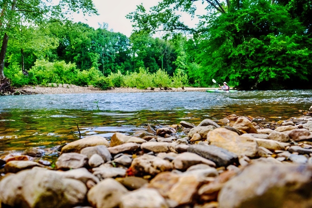
If there is one float trip that defines Arkansas paddling, it is the upper Buffalo National River. Designated as America’s first national river by Congress in 1972 and managed by the National Park Service, the Buffalo flows freely for 135 miles through the Ozark Mountains without a single dam, making it one of the last undammed rivers in the lower 48 states.
The crown jewel of the entire river is the Ponca-to-Pruitt section, covering approximately 23.9 miles through the Ponca Wilderness Area. This stretch features towering limestone bluffs, the historic Parker-Hickman Homestead at Erbie, and access to Hemmed-In Hollow, home to a stunning 225-foot waterfall — the tallest in the Interior Highlands. For Memorial Day weekend, this section is ideal as a two-day, one-night trip: Day 1 from Ponca to Kyle’s Landing covers about 10.7 miles, and Day 2 from Kyle’s Landing to Pruitt adds roughly 13.2 more.
For paddlers looking for a one-day float, the Ponca to Kyle’s Landing stretch takes four to six hours under average conditions. Outfitters typically calculate a pace of about 2 miles per hour, not including stops for swimming, hiking, or photography. The National Park Service rates most of the river as Class I, though high spring water can push sections into Class II territory.
Water level is critical to know before launching. The upper Buffalo is rainfall-dependent, meaning launch sites shift based on daily conditions. Outfitters such as Buffalo Outdoor Center (BOC) in Ponca and Buffalo River Canoes monitor levels daily and confirm launch sites each morning during the March-through-June float season. On Saturdays in May, outfitters are required to launch from the Steel Creek access rather than Ponca.
Primitive camping is available throughout the corridor. Paddlers can pull over on gravel bars and set up camp anywhere at least a half-mile from designated NPS campgrounds. The Buffalo National River is also a designated Dark Sky Park, meaning stargazing from a riverside gravel bar on a clear May night is an experience not easily forgotten.
Children as young as 6 are generally considered ready to float with proper supervision. Arkansas law requires children 12 and under to wear a U.S. Coast Guard-approved personal flotation device at all times while on the water. Dogs are welcome in canoes, though they must remain leashed in all campgrounds and are not permitted on the national park’s trails.
Buffalo National River: Quick Reference
- Best section for Memorial Day: Ponca to Pruitt (23.9 miles, two days) or Ponca to Kyle’s Landing (10.7 miles, one day)
- Best for: Families, intermediate paddlers, overnight trips, hikers and nature lovers
- Outfitters: Buffalo Outdoor Center (Ponca), Buffalo River Canoes (Ponca), Buffalo River Float Service (Yellville)
- Float season: March through June (sometimes into July depending on water)
- Water level resources: buffaloriver.com/float-the-buffalo (BOC river level page)
Caddo River: Southwest Arkansas’s Most Consistent Float
Location: Montgomery and Pike counties, southwest Arkansas
Difficulty: Class I to Class II
The Caddo River is one of the most accessible and beginner-friendly float rivers in the state, making it an excellent pick for Memorial Day weekend groups that include first-timers, families, or anyone looking for a low-stress float with enough excitement to keep things interesting.
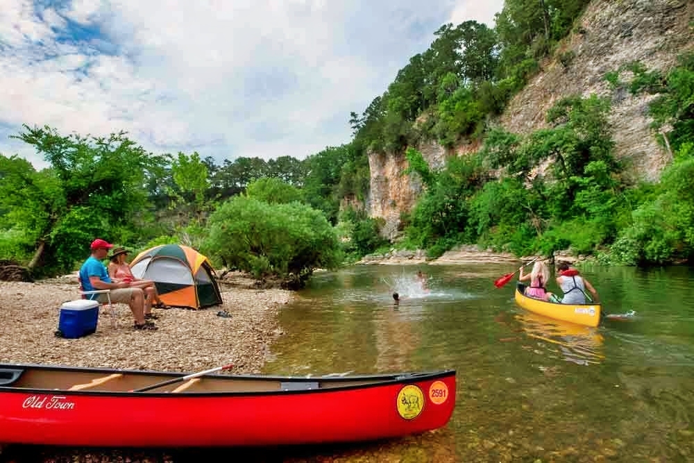
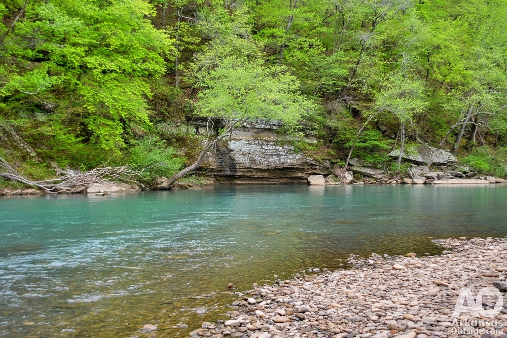
Originating high in the Ouachita Mountains near Mena, the Caddo flows 82 miles before joining the Ouachita River near Arkadelphia. The upper portion of the river, above DeGray Lake, is the section most popular for floating. The classic route runs 7.5 miles from Caddo Gap south to Glenwood, offering a mix of calm pools and Class I-II rapids through the scenic Ouachita Mountain foothills. The water is notably clear, with a rocky riverbed visible for much of the float.
This pool-and-drop river is gentle enough for novice paddlers but delivers enough rapids to keep experienced boaters engaged. The Glenwood area outfitters describe it as one of the most consistent floating rivers in Arkansas, with a season that typically spans March through September. When water levels drop below 5.2 feet at the Caddo Gap gauge, outfitters switch to a lower, deeper route that stays floatable through the summer months.
For those seeking a more challenging and remote experience, the Norman-to-Caddo Gap stretch covers about 8 miles through some of the most isolated terrain on the river. Cell phone service is nearly nonexistent on this section, and it requires a gauge reading of at least 5.5 feet to float well. Outfitters do not recommend this section for children or inexperienced boaters.
The lower Caddo, from Glenwood toward Amity, runs slower and wider, making it a prime spot for fishing. Smallmouth bass, spotted bass, and sunfish are abundant throughout the upper 40 miles of river above DeGray Lake. Outfitters including Arrowhead Cabin and Canoe, Lucky’s Canoe Rental, and Caddo River Camping and Canoe Rental offer rentals and shuttle services. Several campground options are available between Glenwood and Caddo Gap, and Arrowhead also has cabin and bunkhouse accommodations.
The Caddo’s proximity to central and southwest Arkansas makes it a convenient day trip. Most paddlers can complete the Caddo Gap-to-Glenwood section and drive home the same day, though spending the night extends the fun and reduces the post-float rush.
Caddo River: Quick Reference
- Best section for Memorial Day: Caddo Gap to Glenwood (7.5 miles, half to full day)
- Best for: Beginners, families, day-trippers, anglers, central and southwest Arkansas visitors
- Outfitters: Caddo River Camping and Canoe Rental (Glenwood), Arrowhead Cabin and Canoe, Lucky’s Canoe Rental
- Float season: March through September
- Water level resources: caddoriver.com (current river level and route recommendations)
Mulberry River: Arkansas’s Wild and Scenic Whitewater Run
Location: Franklin and Johnson counties, northwest Arkansas (Ozark National Forest)
Difficulty: Class I to Class III (highly water-level dependent)
If your group wants whitewater and big scenery, the Mulberry River should be at the top of your Memorial Day list. One of the most celebrated paddling rivers in Arkansas, the Mulberry begins near the mountain community of Fallsville in the upper Ozarks and descends roughly 60 miles through forested hills, sandstone outcrops, and house-sized boulders on its way to the Arkansas River.
The Arkansas General Assembly officially designated the Mulberry a scenic river of the state in 1985. The U.S. Congress added it to the National Wild and Scenic Rivers system in 1992. Both designations reflect the pristine, undeveloped nature of the river corridor, which runs almost entirely through the Ozark National Forest.
The Mulberry’s character changes dramatically with water levels. Early spring brings Class II and III whitewater that draws experienced paddlers from across the region. As Memorial Day approaches and water levels stabilize, the river typically settles into a more manageable Class I-II range that remains exciting without being overwhelming for intermediate paddlers. At a gauge reading between 2.5 and 3.5 feet at the Turner Bend gauge, the river is considered prime whitewater; at 1.5 to 1.9 feet, it becomes suitable for beginners with some rock dodging required.
The most popular float for Memorial Day weekend is the Byrd’s Adventure Center to Turner Bend stretch, covering about 7.25 to 8 miles depending on the exact put-in. This section features consistent Class I-II rapids and one notable technical spot: Sacroiliac Rapid, rated Class II-III at higher flows, located roughly 5.8 miles into the float just below the Fain Creek confluence. Paddlers should approach it from center-left through the main chute. The shorter High Bank to Byrd’s float (4.7 miles) is loaded with fast water and is best suited for intermediate to advanced paddlers.
The Mulberry is not a summer river. Because it is not spring-fed, water levels typically drop too low for floating by mid-June. Memorial Day weekend falls right at the sweet spot of the season, when flow is usually strong and the surrounding forest is at its greenest. Plan this float sooner rather than later.
Access to the Mulberry is straightforward. All major put-in and take-out points run along Cass Oark Road (Highway 215), which parallels the river from the Highway 23 Pig Trail Scenic Byway community of Cass. Wolf Pen Recreation Area, Byrd’s Adventure Center, Redding Campground, and Turner Bend Outfitters all serve as access points. Cell service is limited throughout the corridor, so coordinate logistics before leaving the highway.
Mulberry River: Quick Reference
- Best section for Memorial Day: Byrd’s Adventure Center to Turner Bend (7.25-8 miles, moderate to challenging)
- Best for: Intermediate to advanced paddlers, whitewater enthusiasts, nature lovers seeking solitude
- Outfitters: Byrd’s Adventure Center (Cass), Turner Bend Outfitters (Ozark)
- Float season: Late October through mid-June (rainfall and water-level dependent)
- Water level resources: American Whitewater (americanwhitewater.org), RiverApp, or call Byrd’s or Turner Bend directly
Spring River: Arkansas’s Year-Round Cold-Water Float
Location: Fulton and Sharp counties, north-central Arkansas
Difficulty: Class I to Class III
The Spring River is unlike any other float stream in Arkansas. While most rivers in the state rise and fall with the rain, the Spring River runs at a steady, dependable pace year-round, fed almost entirely by Mammoth Spring, one of the largest springs in the United States. Mammoth Spring pumps approximately nine million gallons of 58-degree water into the river every hour, keeping water levels consistent regardless of drought or rainfall.
That constant 58-degree water temperature makes the Spring River a natural trout fishery. The Arkansas Game and Fish Commission regularly stocks rainbow trout throughout the upper river, and the cold, clear water supports healthy populations of brown trout as well. The river is among the best trout fishing destinations in the state, and floating and fishing often go hand in hand here.
The most popular float section runs 17 miles from Mammoth Spring State Park south to Hardy, a historic town in northern Sharp County. Most canoeists divide this into two segments: the 9-mile stretch from Dam 3 to Many Islands Camp, and the 8-mile leg from Many Islands to Hardy Beach. The full 17-mile float takes a full day, roughly 8 hours at a relaxed pace. Sections range from Class I to Class III, with the upper half featuring more frequent rapids and a couple of small waterfalls. High Falls, a 6-foot drop about halfway through the lower section, is a notable landmark that can look considerably taller from a canoe approaching the brink.
The Hardy area is well set up for Memorial Day weekend visitors. River Wilderness Sports, located right in Hardy, offers canoe and kayak rentals, tube rentals, and shuttle service that drops paddlers upriver and allows them to float back to their vehicle. Several campgrounds line the river corridor, including Spring River Oak, which offers tent and RV sites directly along the bank.
Because the Spring River is spring-fed and temperature-stable, it is technically floatable year-round, making it a reliable choice even if spring weather brings conditions that knock other rivers out of shape. If storms push the Buffalo too high or the Mulberry too low, the Spring River is almost always open and runnable.
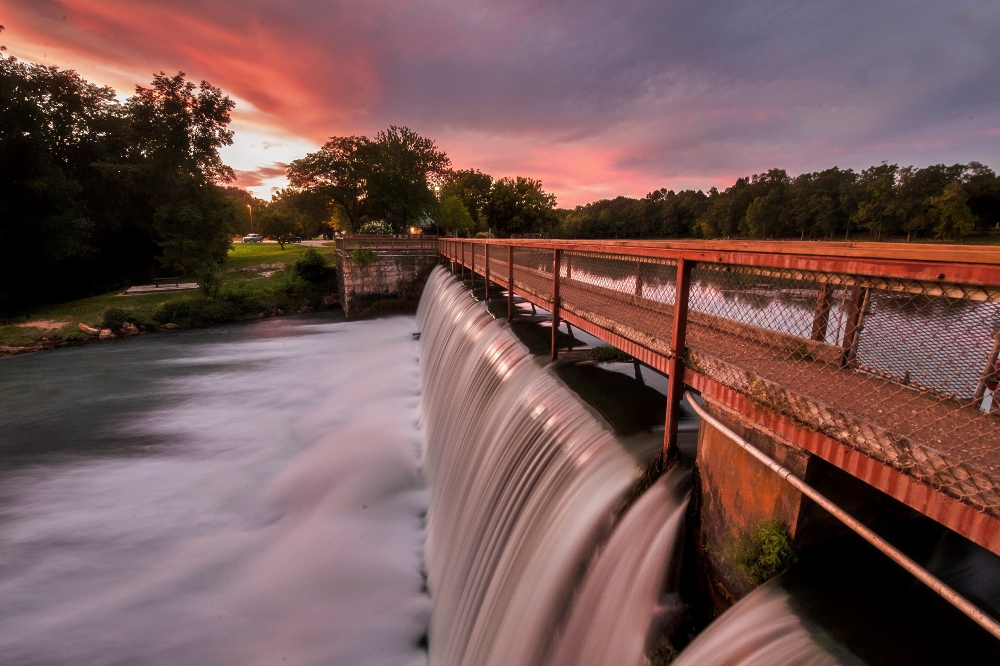
The Mammoth Spring town itself is worth exploring. Mammoth Spring State Park includes a restored hydroelectric plant, a former train depot that now serves as a free museum, and direct river access. The town sits just across the Missouri state line and offers restaurants, shops, and lodging options within minutes of the water.
Spring River: Quick Reference
- Best section for Memorial Day: Dam 3 to Hardy (17 miles, full day) or Dam 3 to Many Islands (9 miles, half day)
- Best for: Families, anglers, beginners to intermediate paddlers, year-round floaters
- Outfitters: River Wilderness Sports (Hardy), Spring River Camp and Canoe
- Float season: Year-round (spring-fed and consistently floatable)
- Water level resources: Hardy, Ark., city website (visithardyarkansas.com) tracks current Spring River water levels
General Memorial Day Float Trip Tips for Arkansas
- Check water levels the morning of your float. Every river listed here is subject to rapid changes from upstream rainfall. What reads as perfect one morning can turn dangerous by afternoon. Use the American Whitewater app, the RiverApp, or check directly with your outfitter before launching.
- Reserve gear in advance. Memorial Day weekend is one of the two or three busiest float weekends of the year across Arkansas. Canoes, kayaks, and rafts at every outfitter on every river in this guide can be reserved and paid for ahead of time. Do not plan to show up and rent on the day of your float.
- Pack accordingly. Essentials include sunscreen, a hat, water shoes or sandals that strap securely, a dry bag or waterproof case for electronics, plenty of drinking water, snacks, a small first aid kit, and a change of clothes at the take-out vehicle. No glass bottles are permitted on Arkansas waterways.
- Life jackets save lives. Arkansas law requires children 12 and younger to wear a properly fitted, U.S. Coast Guard-approved personal flotation device at all times while on the water. Adults should also wear one, particularly on higher-water spring floats.
- Leave no trace. Arkansas rivers are treasured public resources. Pack out all trash, do not feed wildlife, stay on established trails when hiking, and respect other paddlers and landowners. The beauty of places like the Buffalo National River depends on everyone treating it with care.
Make the Most of the Long Weekend
Memorial Day weekend on an Arkansas river is one of those experiences that stays with you. The limestone bluffs of the Buffalo, the emerald water of the Mulberry, the clear pools of the Caddo, the steady, cold flow of the Spring River — each river offers something the others do not.
The best float for your group depends on where you are in the state, how much time you have, your skill level, and what you want out of the weekend. Families and first-timers will find the Caddo and Spring River most approachable. Paddlers looking for scenery and a true wilderness experience will not find anything better in Arkansas than the upper Buffalo. And anyone who wants whitewater with their long weekend should plan around the Mulberry before mid-June closes the season.

Whatever river you choose, book your reservations now, check water levels the morning of your float, and take your time on the water. That is what you came for.
This article was originally published on ArkansasOutside.com, your trusted source for outdoor news and updates in The Natural State. Unless otherwise credited, all photos included in this piece are the property of Arkansas Outside, LLC. We take pride in sharing the beauty and adventures of Arkansas through our lens—thank you for supporting our work!