

(Note: This article was written before the 2025 U.S. Government shutdown. Please check with the U.S. Army Corps of Engineers offices for the current status of campgrounds, day-use areas, and boat ramps. If you are concerned about your current reservations, we recommend contacting Recreation.gov. )
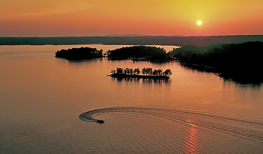
Arkansas campers might be surprised to learn that the U.S. Army Corps of Engineers (USACE) manages the largest number of campsites in the state. In fact, some estimates say the Corps controls nearly 70% of all campsites across Arkansas. This makes the USACE the dominant public land manager for camping in the Natural State, surpassing even Arkansas State Parks and the U.S. Forest Service in campsite count. While the Corps’ primary missions include flood control, navigation, and hydropower, its many lake and river projects in Arkansas have evolved into a vast network of recreation areas. Three different USACE districts oversee these sites in Arkansas: the Little Rock, Vicksburg, and Memphis districts. Each district’s territory offers unique camping experiences, from the Ozark Mountains to the Ouachita foothills to the Mississippi Delta. Below, we highlight a few notable campgrounds in each district as examples of the outdoor experiences available to enthusiasts.
Little Rock District: Highland Lakes and Ozark Camping
The Little Rock District of the Corps of Engineers covers much of Arkansas’s highland region, from the Ozark Mountains through the Arkansas River Valley and parts of southwestern Arkansas. This district alone operates 146 public parks and access areas, encompassing 25 multi-purpose lakes and navigation pools in Arkansas and southern Missouri. With nearly 500,000 acres of public land and water under its care, the Little Rock District is among the most visited in the nation. Its recreation sites range from large mountain reservoirs to smaller flood-control lakes, offering camping, boating, fishing, hiking and more.

One prime example is Beaver Lake in northwest Arkansas, a 28,000-acre reservoir nestled in the Ozark Mountains. Beaver Lake’s Dam Site campground near Eureka Springs is representative of the area’s appeal. Towering limestone bluffs and natural caves line the lakeshore, and the surrounding forest of oak and cedar provides seasonal color and wildlife habitat. Modern campgrounds at Beaver Lake offer electricity, water, hot showers and other amenities, making it a popular destination for families and anglers. Boating and water sports are major draws as well, with the lake’s marinas supporting everything from fishing trips to scuba diving. Visitors can also explore nearby hiking trails and scenic drives in the Ozarks. With multiple campground parks such as Dam Site, Horseshoe Bend and Prairie Creek, Beaver Lake exemplifies how the Corps has opened the Ozark waterways for outdoor recreation.
Another hallmark Little Rock District project is Greers Ferry Lake, located in north-central Arkansas near Heber Springs. Greers Ferry Lake spans over 30,000 surface acres of deep, clean water, formed by a dam on the Little Red River in the 1960s. Eighteen Corps parks ring the lake’s lengthy shoreline, providing campgrounds, swim beaches, boat ramps and marinas for visitors. Heber Springs Park, for example, features more than 100 campsites (many with full hookups) along the lake’s wooded shore. Greers Ferry is renowned for its crystal-clear water, so clear that scuba diving is a popular pastime here. Anglers come for record-size trout below the dam and healthy populations of bass and crappie in the lake itself. Extensive hiking opportunities also exist, including several National Nature Trails around the lake. Greers Ferry’s blend of water sports, fishing and trail recreation makes it an outdoor enthusiast’s dream. The lake’s visitor center even commemorates President John F. Kennedy’s dedication of the dam, underlining Greers Ferry’s historical significance in addition to its recreation value.
The Little Rock District also manages smaller lakes that have been beloved by hunters and fishermen for generations. Nimrod Lake in west-central Arkansas is one such gem. Completed in 1942 on the Fourche La Fave River, Nimrod was the very first Corps of Engineers lake in Arkansas. Eight decades later, Nimrod Lake remains a popular destination for angling and waterfowl hunting, surrounded by the Ouachita National Forest on one side and a wildlife management area on the other. Despite its modest size, Nimrod boasts five campgrounds on project lands to accommodate visitors. Campers at Nimrod Lake enjoy a tranquil, wooded setting and ample opportunities to catch crappie, bass and catfish or to hunt ducks in season. Similarly, nearby Blue Mountain Lake (completed in 1947 on the Petit Jean River) offers quiet campsites and is known for fishing and birdwatching against the backdrop of the Ouachita Mountains. These older flood-control lakes may lack the size of Beaver or Greers Ferry, but they illustrate the breadth of the Little Rock District’s recreation offerings, from large multi-use reservoirs to smaller, secluded camps perfect for a weekend retreat.
Reservations and Recreation Information for the Little Rock District.
Vicksburg District: Ouachita Basin Lakes and Campgrounds
Moving southward, the Corps of Engineers’ Vicksburg District oversees the Ouachita River basin in Arkansas, which includes some of the state’s most popular lake recreation destinations. Three major Corps lakes in the Ouachita Mountains, Lake Ouachita, DeGray Lake and Lake Greeson, are managed by the Vicksburg District. Each of these projects was built for flood control and hydropower, but they are equally treasured for the outdoor recreation opportunities they provide today.
Lake Ouachita, located just west of Hot Springs, is the largest lake entirely in Arkansas and a crown jewel of the Vicksburg District. Created by Blakely Mountain Dam on the Ouachita River, Lake Ouachita spans roughly 40,000 acres of water surrounded by the pine-covered Ouachita National Forest. The Corps maintains over 1,100 campsites around Lake Ouachita’s extensive 975-mile shoreline. These are spread across dozens of campgrounds and parks, from Denby Point and Twin Creek on the south shore to Crystal Springs, Tompkins Bend and many others along the lake’s fingers. Boating is a prime activity, with 200-plus islands dotting the lake. Houseboating, sailing and paddling are especially popular on Ouachita’s clear waters. Scuba divers also flock to Ouachita for its clarity and underwater attractions, including noted dive sites. Anglers come seeking trophy striped bass and walleye. Despite its vast size, Lake Ouachita retains a wilderness feel due to the undeveloped National Forest lands bordering it. It consistently ranks among the cleanest lakes in the nation and draws about 4 million visits each year. For campers, this lake offers both primitive island camping and developed campgrounds with modern facilities. A stay at one of Lake Ouachita’s campsites might include waking up to a misty mountain view, spending the day water-skiing or fishing, and ending with a sunset over the Ouachita hills.
Just to the south, DeGray Lake provides another standout camping destination under Corps management. DeGray Lake was formed by a 1970s-era dam on the Caddo River, and it now features 13,800 acres of water with 208 miles of shoreline winding through the foothills of the Ouachitas. The lake is easily accessed via Scenic Highway 7 north of Arkadelphia, making it popular for weekend getaways. The Corps operates several campgrounds at DeGray, which complement the amenities of DeGray Lake Resort State Park (located on an island in the lake). For example, Caddo Drive and Arlie Moore are Corps park areas with campgrounds that offer electrical hookups, picnic shelters and swim beaches. Shouse Ford and Point Cedar are other favored camping sites along the lake’s fingers. Visitors to DeGray can enjoy fishing for hybrid striped bass and crappie, or take advantage of marinas for boating and water sports. The lake’s clear water and scenic coves are also great for swimming and kayaking. Notably, DeGray Lake includes a unique hydropower system – it was the first Corps lake to feature pump-back hydropower capability, using a small lower re-regulation lake to recycle water for electricity generation. But recreation remains at the forefront: DeGray offers five designated swim beaches and multiple boat ramps, along with hiking trails and even an 18-hole disc golf course in development. Campers often cite the balance at DeGray Lake between peaceful natural surroundings and convenient facilities. Whether you pitch a tent under the pines at Arlie Moore or park an RV at a lakeside pad in Caddo Drive, DeGray provides a relaxing outdoor experience just a short drive from central Arkansas.
Farther down the Ouachita River system is Lake Greeson, another Vicksburg District project that serves as a more tucked-away retreat. Lake Greeson (formed by Narrows Dam on the Little Missouri River) lies near Murfreesboro in southwest Arkansas. Smaller than Ouachita and DeGray, Greeson covers about 7,000 acres, but it is prized for its quiet atmosphere and excellent fishing. The Corps’ Kirby Landing and Daisy State Park (operated in partnership with Arkansas State Parks) are popular spots on Greeson’s shores. Kirby Landing Campground offers over 100 sites with full hookups, making it an RV-friendly destination. Anglers at Lake Greeson seek out striped bass, largemouth bass and crappie in the lake’s clear waters; the tailwaters below Narrows Dam are also stocked with trout. The surrounding hills provide habitat for deer and turkey, attracting hunters in season. For campers, Lake Greeson’s appeal is the combination of well-kept facilities and a smaller, less crowded lake where you can truly unwind. Hiking trails like the Bear Creek Trail give visitors a chance to explore the Ouachita foothills on foot. And if you want a bit of local color, the Crater of Diamonds State Park (the only diamond-bearing public site in the world) is just a short drive from Lake Greeson. Together, Lake Ouachita, DeGray Lake and Lake Greeson showcase the Vicksburg District’s contribution to Arkansas recreation, these lakes not only support flood control and hydropower, but also offer thousands of campsites where people can connect with the Natural State’s mountains and waters.
Reservations and Recreation Information for the Vicksburg District.
Memphis District: Delta Rivers Camping and Recreation
In eastern Arkansas, the Memphis District of the Corps of Engineers manages the waterways of the Mississippi Delta region, including parts of the White River and the lower Arkansas River. Unlike the upland districts, the Memphis District does not have large Corps reservoirs in Arkansas. However, it maintains several river-based recreation sites and campgrounds that allow the public to enjoy the big rivers. These sites are often adjacent to navigation locks and levees, blending recreation with the working river landscape.
One prime example is the Pendleton Bend and Wilbur D. Mills parks along the Arkansas River in Desha and Arkansas counties. This area is where the Arkansas River meets the White River, not far above their confluence with the Mississippi. The Corps’ Wilbur D. Mills Dam (Lock & Dam No. 2 on the Arkansas River) creates a navigable pool and also a rich habitat for fish and wildlife. Just downstream of the dam is Wilbur D. Mills Campground, a small and tranquil camping area with 21 campsites on the river’s wooded bank. Each site has water and electric hookups available, and the campground provides hot showers and a boat launch for easy river access. Campers here are treated to an authentic Delta experience. The Arkansas River below the dam winds for 26 miles through bottomland habitat on its way to the Mississippi, creating prime feeding grounds for shorebirds and migratory waterfowl. Sightings of egrets, herons and even the endangered least tern are common on the sandbars and shallows nearby. Anglers are drawn to the dam’s tailwaters, which offer excellent catfishing for blue, channel and flathead catfish, as well as seasonal runs of white bass and crappie. In fact, local fishermen know this stretch as a hotspot when the Corps is releasing water through the dam’s gates.
A short distance upriver from the dam is Pendleton Bend Park, another Corps-managed campground and day-use area. Pendleton Bend sits on the bank of the Arkansas River and features about 32 campsites, many of them spacious and well-shaded by mature trees. This park is conveniently located off Highway 212 near Dumas/Gillett and serves as the check-in point for campers headed to Wilbur D. Mills Campground. At Pendleton Bend, visitors can launch boats into the river or simply relax at their riverfront campsite watching barges and fishing boats pass by. The site’s history is notable too – it lies along the route of the Trail of Tears, and the National Park Service has identified Pendleton Bend as a historical stop on that trail in the 1830s. Modern campers at Pendleton Bend enjoy not only the recreation but also proximity to significant heritage sites.
Staying at either Pendleton Bend or Wilbur D. Mills puts you in the heart of Arkansas’s Delta ecosystem. From these campgrounds, it’s an easy trip to Arkansas Post National Memorial, where Arkansas’s first European settlement was established in 1686. That park, just a few miles away, interprets colonial history and Civil War action in the area. Nature enthusiasts can venture into the adjacent Trusten Holder Wildlife Management Area or the vast Dale Bumpers White River National Wildlife Refuge, which together protect tens of thousands of acres of bottomland hardwood forest and wetlands. The White River refuge alone spans 160,000 acres of prime duck hunting and birding territory. Campers often use Pendleton Bend as a base for autumn hunting trips or for spring birdwatching in these public lands. Even if you never leave the campground, the setting offers plenty: you might fish for dinner during the day, then grill your catch under a Delta sunset, listening to owls and frogs once night falls. The Memphis District’s river parks give a reminder that outdoor recreation in Arkansas isn’t limited to mountains – the big rivers and bayous of the eastern plains have their own appeal and serenity.
The Memphis District does not maintain recreation or camping information on their website.

Lead photo courtesy of the Arkansas Department of Parks, Heritage and Tourism.
This article was originally published on ArkansasOutside.com, your trusted source for outdoor news and updates in The Natural State. Unless otherwise credited, all photos included in this piece are the property of Arkansas Outside, LLC. We take pride in sharing the beauty and adventures of Arkansas through our lens—thank you for supporting our work!