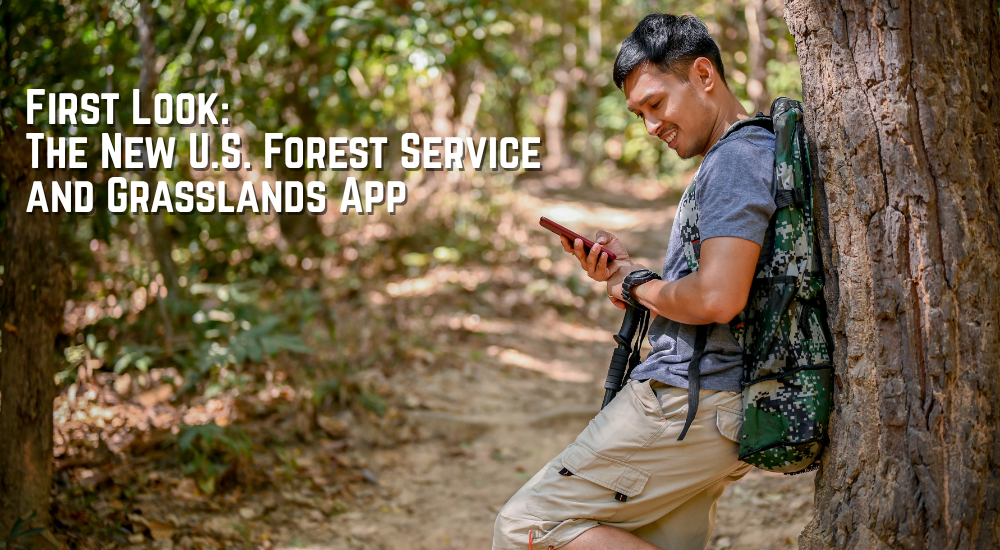


The U.S. Forest Service has launched its new National Forests and Grasslands mobile app, now available for both iOS and Android devices. The app is designed to serve as a one-stop resource for visitors to the nation’s forests and grasslands, providing access to recreation information, trail data, campground details, safety alerts, fire information, weather alerts, and downloadable offline maps. It also marks the retirement of nearly 30 separate Forest Service apps, consolidating recreation information into a single platform.
A Long-Awaited Digital Upgrade
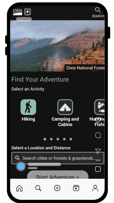
On paper, the app checks a lot of boxes. Offline maps are particularly valuable for visitors traveling into remote areas where cell service is unreliable. The ability to view closures, fire information, and weather alerts from within the app could help users make safer decisions before heading into the backcountry. The app also includes new interactive Motor Vehicle Use Maps (MVUMs), which appear to be a major focus of the platform.
For years, Forest Service visitors have relied on a patchwork of websites, PDF maps, and separate mobile applications to plan trips. Bringing those resources together into a single app is a welcome move and one that many public lands users have been hoping to see.
Built Around Maps, Sometimes Too Much
In practice, however, the experience is a bit more mixed.
The app feels heavily centered around its map interface. While that may work well for users who already know exactly where they are headed, finding recreation sites through the search function can be frustrating. The interactive MVUM layers are impressive and likely to be especially useful for motorized users, but they also seem to drive much of the app’s overall design.
For visitors who simply want to locate a campground, trailhead, or recreation area, the map-first approach can sometimes feel less intuitive than expected.
Finding Recreation Sites Can Be Frustrating
During testing in Arkansas, searching for well known destinations did not always produce useful results. For example, entering “Lake Sylvia Recreation Area” into the search bar returned no results, despite it being one of the most popular recreation areas in the Ouachita National Forest.
Finding nearby trailheads proved equally challenging. Rather than using intuitive place names, the most reliable method was often to manually zoom into a map and locate a known area. For users unfamiliar with a forest or planning a trip to a new destination, that approach can feel cumbersome.
Navigation within the app is also not always intuitive. Information is available, but it sometimes takes more taps and exploration than expected to find it. Recreation sites, trailheads, and other points of interest can feel buried beneath the map interface, making the learning curve steeper than many users may prefer.
A Promising Start With Room to Grow
That said, there is real potential here. The map layers are useful, the offline functionality is a major improvement over carrying multiple PDFs, and bringing recreation information from across the National Forest System into a single application is a worthwhile goal. For off highway vehicle users and others who regularly rely on MVUM data, the app may quickly become an essential tool.
It is also worth remembering that this is a brand new platform. The Forest Service has already released updates aimed at improving search performance and map functionality, suggesting that user feedback is being incorporated quickly.
For now, the National Forests and Grasslands app is a promising first step. It may not yet be the pocket guide many outdoor enthusiasts hoped for, but it provides a solid foundation. With continued refinement, improved search capabilities, and easier recreation discovery, it has the potential to become one of the most useful digital tools available for exploring America’s public lands.

Download the app and tell us what you think. It’s free.
This article was originally published on ArkansasOutside.com, your trusted source for outdoor news and updates in The Natural State. Unless otherwise credited, all photos included in this piece are the property of Arkansas Outside, LLC. We take pride in sharing the beauty and adventures of Arkansas through our lens—thank you for supporting our work!